South Fork Eel River
At a glance
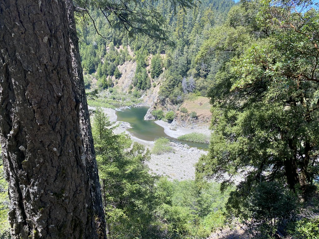
South Fork Eel River is a paddling route in California, about 4 miles from the town of Branscomb. It is a canoeing destination, and the river makes a natural corridor for time on the water. The most comfortable paddling weather falls in late spring and early fall. Typical averages from a nearby weather station in Covelo show May highs around 75°F with only about six wet days, and October highs near 76°F with about five. Midsummer is hot, with July and August highs in the low 90s. Winter brings more frequent rain, with around 12 to 14 wet days a month from December through January. Several trails sit close to the river. Conger Trail is under a mile away, and Walker Meadow Loop and Black Oak Mountain Trail are both about 1.5 miles off. For more paddling, Rattlesnake Creek lies about 8 miles away.
- distance
- 23.1 mi
- high point
- 1,789 ft
- best months
- Late Feb–early Jul, early Sep–mid-Nov
Near: Fort Bragg
Best weeks to go
Late February to early July and early September to mid-November are usually best for paddling here.
Typical highs of 60–88°F and lows of 35°F or warmer in those weeks. Rain falls on about 40% of days at the wettest of them, so plan around showers.
Typical weather: NOAA 1991–2020 normals at Covelo, CA, 22 mi away. Not a forecast.
Typical weather by monthBest time to visit South Fork Eel River
Best months: March–June and September–October. Best months are the ones mostly made of the best weeks for paddling: typical temperatures in its comfortable range, few snowy days and not usually wet, judged with the same limits as our good-day forecasts.
Jan
52°
33°
13 wet
Feb
57°
34°
12 wet
Mar
62°
36°
11 wet
Apr
67°
38°
9 wet
May
75°
43°
6 wet
Jun
84°
48°
2 wet
Jul
92°
53°
1 wet
Aug
91°
51°
0 wet
Sep
88°
45°
1 wet
Oct
76°
39°
5 wet
Nov
58°
35°
11 wet
Dec
50°
32°
14 wet
Typical high / low (°F) and days with rain or snow, 1991–2020. Measured at Covelo, CA, 22 mi away at 1,413 ft. Source: NOAA NCEI U.S. Climate Normals 1991–2020.
Been here? Tell people how it was.
 Ten Mile RiverCanoeingPhoto: David Eppstein, CC BY-SA 3.0 (via Wikimedia Commons)~19 min drive
- Shelter Cove Boat LaunchBoat launch~54 min drive
 Usal CreekCanoeingPhoto: Thewellman, CC0 (via Wikimedia Commons)~27 min drive
 Noyo RiverCanoeingPhoto: W Nowicki, CC BY-SA 3.0 (via Wikimedia Commons)~33 min drive
 Outlet CreekCanoeingPhoto: Thewellman, CC0 (via Wikimedia Commons)~34 min drive
 Albion RiverCanoeingPhoto: David Eppstein, CC BY-SA 3.0 (via Wikimedia Commons)~53 min drive
- Rattlesnake CreekCanoeing~14 min drive
- Hollow Tree CreekCanoeing~14 min drive
- Woodman CreekCanoeing~19 min drive
- Burger CreekCanoeing~22 min drive
Conditions and forecast
Clear at last checkDetails in the tracked factors belowusgs_nwis · checked 17 h agoDaily highs and lows, wind and the chance of precipitation at Start for the next 7 days, from the Open-Meteo model.
Ask about this place
Questions about South Fork Eel River: conditions, access, timing. Answers say when something isn't known.
