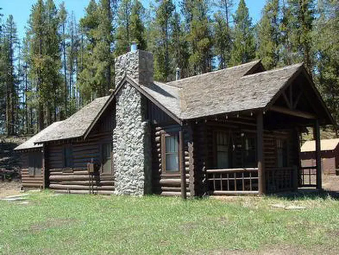
Gold Park Campground
Campground
Campground · 2.0 mi from the trail
Alert in the area
The Forest Service lists 6 alerts for White River National Forest.
FSR 286, Radical Hill, is closed due to washouts and unsafe conditions
Agency alert covering White River National Forest · USFS · White River National Forest
Limited parking at Snowmass Creek Trailhead
Agency alert covering White River National Forest · USFS · White River National Forest
Grizzly Creek Trail Closure
Agency alert covering White River National Forest · Order 2026-02 · USFS · White River National Forest
Ruedi Marina Day Use area Dump Station is CLOSED
Agency alert covering White River National Forest · USFS · White River National Forest
Asbestos safety closure - Camp Hale
Agency alert covering White River National Forest · USFS · White River National Forest
As of · Source: USFS · White River National Forest. Agencies don't list every closure — check before you go.
The Missouri Lakes trail is 4.4 miles long. It begins at Missouri Creek Road #704 and ends at Cross Creek Trail and Fancy Pass Trail #2006: The first mile of the trail passes diversion dams and water pipelines. Just past mile 1, the trail crosses the creek at the mouth of a miniature canyon, creating a breath taking view. The trail winds through stands of conifers and crosses the creek several more times before emerging into a large lush meadow. The trail climbs a short, steep distance to the basin that holds the Missouri Lakes. At about 2.7 miles you will see a side trail left that leads to the first of the lakes, a short climb of 100 feet gain in 0.3 miles. Savage Peak dominates the view to the south above this first lake. The main trail traverses the basin past several other lakes before reaching the last lake at about 3.5 miles. To get a bird’s eye view of the lakes, continue up switchbacks to the 11,986-foot Missouri Pass and back down the other side to join the Fancy Pass and Cross Creek trails at 4.4 miles. * There is a printable Recreation Quicksheet for this trail which is complete with directions, a map, details, and other information about this trail. Or to see quicksheets for other recreation areas across the Forest, click on the "Recreation Quicksheets" link in the right column and select the appropriate Ranger District.
Gold Park Campground
Campground
Hot Heads Chicken
Fast food
 If it rainsCraig Talbert, CC BY 3.0 · Wikimedia Commons
Places © OpenStreetMap contributors · Photos: Craig Talbert, CC BY 3.0 (commons)
More in LeadvilleNot on Roamze yet. Their page has how to reach them.
 Tiger CliffRock climbingPhoto: foto3116, CC BY 2.0 (via Flickr)6.5 miMain WallRock climbingPhoto: foto3116, CC BY 2.0 (via Flickr)6.5 mi
Source: Roamze catalog (indexable pages within 10 miles, PostGIS distance)
Best months: June–August. Best months have typical highs of 55–85 °F, lows of 30 °F or warmer (32 °F where the station doesn't record snow), at most one snowy day and no more than 12 wet days.
Jan
31° / 3°
8 wet
Feb
33° / 3°
8 wet
Mar
39° / 9°
8 wet
Apr
44° / 18°
8 wet
May
55° / 27°
9 wet
Jun
68° / 34°
9 wet
Jul
73° / 39°
12 wet
Aug
70° / 38°
12 wet
Sep
62° / 31°
8 wet
Oct
51° / 23°
6 wet
Nov
39° / 14°
7 wet
Dec
31° / 6°
7 wet
Typical high / low (°F) and days with rain or snow, 1991–2020. Measured at Sugarloaf Rsvr, CO, 11.4 mi away at 9,738 ft. This station doesn't record snowfall. Source: NOAA NCEI U.S. Climate Normals 1991–2020.