
Mt. Lowe
Campground
0.9 mi from the trail
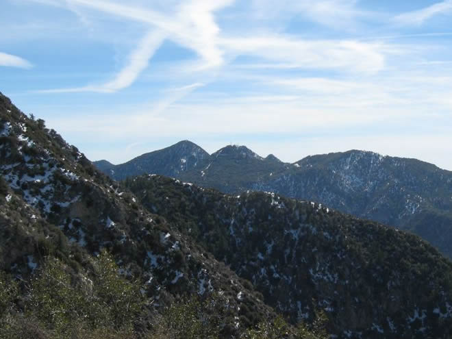
Muir Peak is a summit of 4,687 feet in the Los Angeles Gateway Ranger District of Angeles National Forest, about 2.5 miles from Altadena, California. It sits among a cluster of trails and campgrounds, making it an easy addition to a day spent exploring the forest's lower reaches. Spring and fall are the most comfortable times to go. Typical averages from a nearby weather station at Mt Wilson, which sits about 1,000 feet higher, show May highs around 70°F and October highs around 72°F, with only a few wet days in each month. That station's figures run cooler than conditions at the peak's elevation, so expect slightly warmer temperatures on the summit. Lone Tree Trail and One Man & Mule Trail both start within a mile, and Mt. Lowe and Idlehour campgrounds are each about a mile away.
Where it is: Los Angeles Gateway Ranger District · Angeles National Forest
Near: Pasadena
Best months: Year-round. Best months have typical highs of 55–85 °F, lows of 30 °F or warmer (32 °F where the station doesn't record snow), at most one snowy day and no more than 12 wet days.
Jan
56°
38°
7 wet
Feb
55°
37°
8 wet
Mar
59°
39°
7 wet
Apr
63°
42°
4 wet
May
70°
48°
3 wet
Jun
79°
58°
1 wet
Jul
84°
64°
1 wet
Aug
85°
64°
1 wet
Sep
81°
59°
1 wet
Oct
72°
51°
3 wet
Nov
63°
43°
4 wet
Dec
55°
37°
7 wet
Typical high / low (°F) and days with rain or snow, 1991–2020. Measured at Mt Wilson Cbs, CA, 2.1 mi away at 5,710 ft. The station sits about 1,000 ft higher than this place, so expect it a little warmer here. This station doesn't record snowfall. Source: NOAA NCEI U.S. Climate Normals 1991–2020.
Been here? Tell people how it was.



 Lone Tree TrailHikingPhoto: mjhbower, CC BY-SA 2.0 (via Flickr)0.5 mi
 One Man & Mule TrailHikingPhoto: mjhbower, CC BY-SA 2.0 (via Flickr)0.6 mi
 West Fork San Gabriel RiverCanoeingPhoto: Eeekster, CC BY 3.0 (via Wikimedia Commons)8.1 mi
 Big Tujunga CreekCanoeingPhoto: MajaTrochimczyk, CC BY 3.0 us (via Wikimedia Commons)8.5 miEcho MountainSummitPhoto: Mike Manning, CC BY-SA 3.0 (via Wikimedia Commons)~2 min driveMount LoweSummitPhoto: The original uploader was Magi Media at English Wikipedia., CC BY-SA 3.0 (via Wikimedia Commons)~2 min driveMount DisappointmentSummitPhoto: Justin, CC BY-SA 2.0 (via Wikimedia Commons)~4 min drive
 Mount LukensSummitPhoto: Doc Searls from Santa Barbara, USA, CC BY 2.0 (via Wikimedia Commons)~15 min drive
 Mount HollywoodSummitPhoto: Dipsey, CC BY-SA 3.0 (via Wikimedia Commons)~22 min drive
 Mount LeeSummitPhoto: Downtowngal, CC BY-SA 3.0 (via Wikimedia Commons)~23 min drive
 Cahuenga PeakSummitPhoto: Junkyardsparkle, CC0 (via Wikimedia Commons)~24 min drive
 Workman HillSummitPhoto: Sergei Gussev, CC BY 2.0 (via Wikimedia Commons)~28 min drive
 Throop PeakSummitPhoto: Eeekster, CC BY 3.0 (via Wikimedia Commons)~34 min drive
 Mount BurnhamSummitPhoto: Ctatkinson, Public domain (via Wikimedia Commons)~36 min drive
Daily highs and lows, wind and the chance of precipitation at the summit and route start for the next 7 days, from the Open-Meteo model.
4,687 ft (1,429 m).
One: One Man & Mule Trail.
Questions about Muir Peak: conditions, access, timing. Answers say when something isn't known.
Mt. Lowe
Campground
 If it rainsBoothsift, CC BY-SA 4.0 · Wikimedia Commons
Places © OpenStreetMap contributors, Places © Overture Maps Foundation · Photos: Boothsift, CC BY-SA 4.0 (commons)
More in Acton