Cahuenga Peak
 Photo: Junkyardsparkle, CC0 (via Wikimedia Commons)
- 1,818 ft
- summit
- 1
- way up
- City Land
- managed by
- Oct–Jun
- best months
Cahuenga Peak is a summit of 1,818 feet in California, sitting within the Cahuenga Peak Phase 1 land unit on city-managed land about 3.7 miles from Burbank. It makes an easy anchor for a short outing in the hills just beyond the city, with several trails starting within a mile of the top. Spring and fall are the most comfortable times to go. Typical averages from a nearby weather station in Burbank show May highs around 75°F and October highs around 81°F, while July and August climb into the mid-80s. That station sits well below the peak, so temperatures on top run cooler. The Aileen Getty Ridge Trail passes just 0.1 mile away, and the Burbank Peak Trail and Powerline Trail are within half a mile. For climbing, Bee Rock in Griffith Park is about 1.9 miles off.
Conditions and forecast
Daily highs and lows, wind and the chance of precipitation at the summit and route start for the next 7 days, from the Open-Meteo model.
- Summit elevation
- 1,818 ft
- Land manager
- City Land
Elevation from USGS 3D Elevation Program terrain data (about 10 m resolution).
Map © Mapbox © OpenStreetMap contributors Questions about Cahuenga Peak
How tall is Cahuenga Peak?
1,818 ft (554 m).
How many routes go to the summit of Cahuenga Peak?
One: Aileen Getty Ridge Trail.
 Mount Hollywood1,615 ft · California3 routes1.6 mi awayPhoto: Dipsey, CC BY-SA 3.0 (via Wikimedia Commons)
 San Vicente Mountain1,936 ft · California1 route11 mi awayPhoto: Clyde Charles Brown, CC BY-SA 4.0 (via Wikimedia Commons)
- Limerock Peak2,987 ft · California1 route13 mi away
 Echo Mountain3,212 ft · California2 routes13 mi awayPhoto: Mike Manning, CC BY-SA 3.0 (via Wikimedia Commons)
- Inspiration Point4,706 ft · California3 routes14 mi away
- Muir Peak4,687 ft · California1 route14 mi away
- Aileen Getty Ridge TrailHiking0.1 mi
- Burbank Peak TrailHiking0.3 mi
- Powerline TrailHiking0.5 mi
- Innsdale TrailHiking0.6 mi
 Bee Rock (Griffith Park)Rock climbingPhoto: Thad Zajdowicz, CC BY-SA 2.0 (via Flickr)1.9 mi
 Eagle RockRock climbingPhoto: Vahe Martirosyan, CC BY 2.0 (via Flickr)8.2 mi
- UclaRock climbing8.3 mi
- Gould MesaCamping8.3 mi
Source: Roamze catalog (indexable pages within 10 miles, PostGIS distance)
 Mount LeeSummit · Next doorPhoto: Downtowngal, CC BY-SA 3.0 (via Wikimedia Commons)
- Mount HollywoodSummit · ~3 min drivePhoto: Dipsey, CC BY-SA 3.0 (via Wikimedia Commons)
 Mount LukensSummit · ~18 min drivePhoto: Doc Searls from Santa Barbara, USA, CC BY 2.0 (via Wikimedia Commons)
- San Vicente MountainSummit · ~18 min drivePhoto: Clyde Charles Brown, CC BY-SA 4.0 (via Wikimedia Commons)
- Echo MountainSummit · ~22 min drivePhoto: Mike Manning, CC BY-SA 3.0 (via Wikimedia Commons)
 Mount LoweSummit · ~24 min drivePhoto: The original uploader was Magi Media at English Wikipedia., CC BY-SA 3.0 (via Wikimedia Commons)
 Mount DisappointmentSummit · ~25 min drivePhoto: Justin, CC BY-SA 2.0 (via Wikimedia Commons)
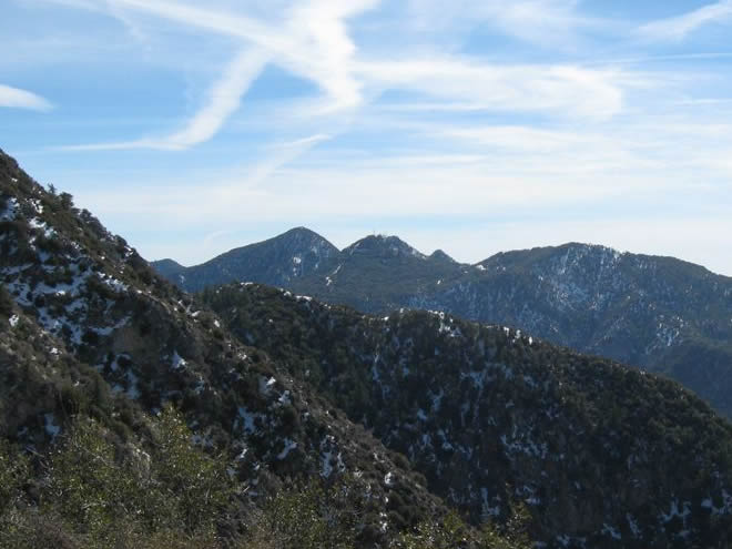 San Gabriel PeakSummit · ~26 min drivePhoto: Justin.Johnsen, CC BY 3.0 (via Wikimedia Commons)
 Strawberry PeakSummit · ~27 min drivePhoto: Justin, CC BY-SA 2.0 (via Wikimedia Commons)
 Mount WilsonSummit · ~28 min drivePhoto: The original uploader was Geographer at English Wikipedia., CC BY 1.0 (via Wikimedia Commons)
Best time to visit Cahuenga Peak
Best months: October–June. Best months have typical highs of 55–85 °F, lows of 30 °F or warmer (32 °F where the station doesn't record snow), at most one snowy day and no more than 12 wet days.
Jan
69° / 43°
6 wet
Feb
68° / 44°
6 wet
Mar
71° / 47°
6 wet
Apr
74° / 50°
3 wet
May
75° / 55°
2 wet
Jun
80° / 59°
1 wet
Jul
86° / 63°
0 wet
Aug
88° / 63°
0 wet
Sep
87° / 61°
1 wet
Oct
81° / 54°
2 wet
Nov
75° / 46°
3 wet
Dec
68° / 42°
5 wet
Typical high / low (°F) and days with rain or snow, 1991–2020. Measured at Burbank Valley Pump Plt, CA, 3.6 mi away at 655 ft. The station sits about 1,200 ft lower than this place, so expect it a little cooler here. Source: NOAA NCEI U.S. Climate Normals 1991–2020.

