
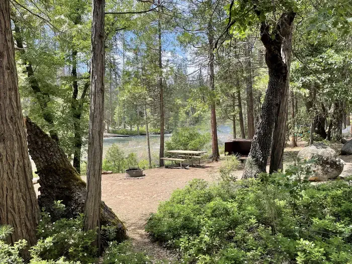
Summerdale Campground
Campground
1.7 mi from the trail
Mount Savage is a climbing area in Yosemite National Park in California, managed by the National Park Service. It sits within the park's boundaries, and a fee is charged for visits. The climbing here is a mix of styles, with six routes in total. Three are mixed, one is bouldering, and one each is sport and trad. The grades run from 5.5 to 5.10a/b, with the hardest being 30-06 at 5.10a/b. Boy Meets World is the easiest at 5.5, and Topanga! is 5.7. Summer is the most comfortable time to go. Typical averages from a nearby weather station show July and August highs around 80°F with lows near 50°F and only about one wet day a month. That station sits roughly 700 feet lower than the climbing area, so temperatures at the crag run cooler. Wawona Meadow Loop Trail is about 1.2 miles away, and Summerdale Campground is 1.7 miles off. Powerline Rock, another climbing area, is 2.7 miles away, and Big Creek offers canoeing about 2.8 miles from the crag.
6 routes · 5.5 – 5.10a/b · Mixed · Sport · Trad
Where it is: Yosemite National Park
Near: Fish Camp
Best months: May–October. Best months have typical highs of 55–85 °F, lows of 30 °F or warmer (32 °F where the station doesn't record snow), at most one snowy day and no more than 12 wet days.
Jan
45°
27°
9 wet
Feb
46°
27°
9 wet
Mar
50°
28°
10 wet
Apr
55°
31°
7 wet
May
63°
37°
5 wet
Jun
73°
44°
2 wet
Jul
80°
51°
1 wet
Aug
80°
49°
1 wet
Sep
75°
45°
2 wet
Oct
64°
37°
4 wet
Nov
53°
30°
6 wet
Dec
44°
26°
9 wet
Typical high / low (°F) and days with rain or snow, 1991–2020. Measured at So Entrance Yosemite Np, CA, 0.9 mi away at 5,047 ft. The station sits about 700 ft lower than this place, so expect it a little cooler here. This station doesn't record snowfall. Source: NOAA NCEI U.S. Climate Normals 1991–2020.
Been here? Tell people how it was.
 Summerdale CampgroundCampingPhoto: Recreation.gov (RIDB) / public domain1.7 mi
 Wawona TrailHikingPhoto: RuggyBearLA, CC BY 2.0 (via Flickr)2 mi
 Wawona CampgroundCampingPhoto: Recreation.gov (RIDB) / public domain4.5 mi
 j. Hawk DomeRock climbingPhoto: Guywelch2000, CC BY-SA 4.0 (via Wikimedia Commons)~12 min driveFresno DomeRock climbingPhoto: Guywelch2000, CC BY-SA 4.0 (via Wikimedia Commons)~12 min drive
 The Widow's Tears AreaRock climbingPhoto: Richard Wood, CC BY-SA 3.0 (via Wikimedia Commons)~24 min drive
 Leaning Tower AreaRock climbingPhoto: Daniel Gillaspia, CC BY 2.0 (via Flickr)~24 min driveFifi ButtressRock climbingPhoto: Daniel Gillaspia, CC BY 2.0 (via Flickr)~24 min drive
 Leaning TowerRock climbingPhoto: dconvertini, CC BY-SA 2.0 (via Flickr)~24 min drive
 Higher Cathedral SpireRock climbingPhoto: Capt' Gorgeous, CC BY 2.0 (via Flickr)~24 min drive
 Higher Cathedral RockRock climbingPhoto: Capt' Gorgeous, CC BY 2.0 (via Flickr)~24 min driveEnchanted RockRock climbingPhoto: Guywelch2000, CC BY-SA 4.0 (via Wikimedia Commons)~13 min drive
 Road Closure CragRock climbingPhoto: btwashburn, CC BY 2.0 (via Flickr)~23 min drive
Daily highs and lows, wind and the chance of precipitation at Mount Savage for the next 7 days, from the Open-Meteo model.
Questions about Mount Savage: conditions, access, timing. Answers say when something isn't known.
Summerdale Campground
Campground
Wawona Hotel Dining Room
Restaurant
 If it rainsWearsunscreen, CC BY-SA 3.0 · Wikimedia Commons
Open air museum in California
Places © OpenStreetMap contributors · Photos: Wearsunscreen, CC BY-SA 3.0 (commons)
More in Yosemite Valley