Camp Wawona
Campground
Campground · 0.8 mi from the trail
 Photo: RuggyBearLA, CC BY 2.0 (via Flickr)
Closure in the area
There's a closure order in Yosemite National Park. It doesn't name Wawona Trail, so check the source for the area it covers (3 listed).
Big Oak Flat Road (continuation of Hwy 120 from the west) is closed
Park closure covering Yosemite National Park · NPS · Yosemite National Park
Campgrounds and Curry Village tent cabins are closed due to a winter storm
Park closure covering Yosemite National Park · NPS · Yosemite National Park
Tioga and Glacier Point Roads are closed due snow
Park closure covering Yosemite National Park · NPS · Yosemite National Park
As of · Source: NPS · Yosemite National Park. Agencies don't list every closure — check before you go.
The Wawona Trail is a 5.7-mile out-and-back hike in Yosemite National Park, California, set within the Yosemite Wilderness. The National Park Service manages the land, and the trail starts about 1.4 miles from South Wawona, the nearest town. The route climbs from 4,619 feet to 5,960 feet, with a total gain of 2,697 feet, and the steepest stretch comes at about 1.3 miles in, where the grade reaches 24%. Summer is the most comfortable time to go. Typical averages from a nearby weather station show July and August highs around 80°F with lows near 50°F and only about one wet day a month. That station sits roughly 900 feet lower than the trail's high point, so temperatures on the ridge run cooler. The trip takes about three hours. The Wawona Meadow Loop Trail and the Wawona Swinging Bridge Trail both lie within a mile, and climbers can head to Oldsquaw Boulder about 1.1 miles away. Summerdale Campground, about 2.8 miles off, offers a place to stay.
Camp Wawona
Campground
Wawona Hotel Dining Room
Restaurant
 If it rainsWearsunscreen, CC BY-SA 3.0 · Wikimedia Commons
Open air museum in California
Places © OpenStreetMap contributors · Photos: Wearsunscreen, CC BY-SA 3.0 (commons)
More in Yosemite ValleyNot on Roamze yet. Their page has how to reach them.
 Wawona Swinging Bridge TrailHikingPhoto: Bmdavll (talk · contribs), CC BY-SA 3.0 (via Wikimedia Commons)1 mi
 Summerdale CampgroundCampingPhoto: Recreation.gov (RIDB) / public domain2.8 mi
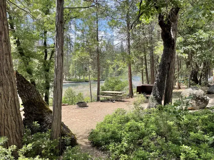 Wawona CampgroundCampingPhoto: Recreation.gov (RIDB) / public domain3.7 mi
Source: Roamze catalog (indexable pages within 10 miles, PostGIS distance)
Wawona Swinging Bridge TrailHiking · ~2 min drivePhoto: Bmdavll (talk · contribs), CC BY-SA 3.0 (via Wikimedia Commons) Buena Vista TrailHiking · ~13 min drivePhoto: aballant38, CC BY 2.0 (via Flickr)
 Guardians of the Grove Loop TrailHiking · ~4 min drivePhoto: A.Poulos (Iya) from USA, CC BY 2.0 (via Wikimedia Commons)Biledo Meadow TrailHiking · ~4 min drivePhoto: A.Poulos (Iya) from USA, CC BY 2.0 (via Wikimedia Commons)
 Grizzly Giant Loop TrailHiking · ~4 min drivePhoto: Capt' Gorgeous, CC BY 2.0 (via Flickr)
 Perimeter TrailHiking · ~4 min drivePhoto: Capt' Gorgeous, CC BY 2.0 (via Flickr)
Also worth it near here
 Camp WawonaCamping · ~1 min drivePhoto: nakamuraphotography — CC BY-SA 2.0 (via Flickr)
 Chilnualna FallWaterfall · ~4 min drivePhoto: Ben Lane, CC BY-SA 2.5 (via Wikimedia Commons)
 j. Hawk DomeRock climbing · ~12 min drivePhoto: Guywelch2000, CC BY-SA 4.0 (via Wikimedia Commons)
Best months: May–October. Best months have typical highs of 55–85 °F, lows of 30 °F or warmer (32 °F where the station doesn't record snow), at most one snowy day and no more than 12 wet days.
Jan
45° / 27°
9 wet
Feb
46° / 27°
9 wet
Mar
50° / 28°
10 wet
Apr
55° / 31°
7 wet
May
63° / 37°
5 wet
Jun
73° / 44°
2 wet
Jul
80° / 51°
1 wet
Aug
80° / 49°
1 wet
Sep
75° / 45°
2 wet
Oct
64° / 37°
4 wet
Nov
53° / 30°
6 wet
Dec
44° / 26°
9 wet
Typical high / low (°F) and days with rain or snow, 1991–2020. Measured at So Entrance Yosemite Np, CA, 1.3 mi away at 5,047 ft. The station sits about 900 ft lower than this place, so expect it a little cooler here. This station doesn't record snowfall. Source: NOAA NCEI U.S. Climate Normals 1991–2020.
Map and trail data © OpenStreetMap contributors
