Marble Mountain
At a glance
Marble Mountain is a summit in New York, about 2 miles from the town of Wilmington. Summer is the most comfortable time to visit. Typical July averages at a nearby weather station in Lake Placid run to highs around 74°F and lows near 54°F. That station sits well below the summit, so temperatures up high run cooler. The Marble Mountain Trail starts just 0.1 mile away, and the Flume Knob Trail is under a mile off. Within a few miles you'll also find the Bear Den Trail and the rock climbing at Cloudspin Cliff.
- summit
- 2,744 ft
- way up
- 1
Near: Wilmington · 2.2 mi
Best time to visit Marble Mountain
No month here meets our mild-weather rule. Best months have typical highs of 55–85 °F, lows of 30 °F or warmer (32 °F where the station doesn't record snow), at most one snowy day and no more than 12 wet days.
Jan
23°
6°
18 wet
Feb
27°
8°
14 wet
Mar
36°
16°
14 wet
Apr
49°
29°
14 wet
May
62°
40°
15 wet
Jun
70°
49°
14 wet
Jul
74°
54°
14 wet
Aug
73°
52°
13 wet
Sep
66°
45°
13 wet
Oct
52°
35°
15 wet
Nov
40°
25°
16 wet
Dec
28°
14°
18 wet
Typical high / low (°F) and days with rain or snow, 1991–2020. Measured at Lake Placid 2 S, NY, 8.2 mi away at 1,888 ft. The station sits about 900 ft lower than this place, so expect it a little cooler here. This station doesn't record snowfall. Source: NOAA NCEI U.S. Climate Normals 1991–2020.
Been here? Tell people how it was.
Map © Mapbox © OpenStreetMap contributors - Lookout Mountain4,089 ft · New York1 route1.4 mi away
- Esther Mountain4,244 ft · New York1 route1.4 mi away
 Whiteface Mountain4,862 ft · New York2 routes2.4 mi awayPhoto: Mwanner, CC BY-SA 3.0 (via Wikimedia Commons)
- Catamount Mountain3,168 ft · New York1 route5.2 mi away
- Oak Hill1,242 ft · New York1 route6.6 mi away
- Moose Mountain3,903 ft · New York1 route7.4 mi away
- Marble Mountain TrailHiking0.1 mi
 Flume Knob TrailHikingPhoto: Idawriter, CC BY-SA 3.0 (via Wikimedia Commons)0.8 mi
 Bear Den TrailHikingPhoto: Apuch, CC BY-SA 2.0 (via Flickr)1.4 mi
- Rock Garden TrailHikingPhoto: Idawriter, CC BY-SA 3.0 (via Wikimedia Commons)1.4 mi
- Cloudspin CliffRock climbing2.7 mi
- D: Wilmington RegionRock climbing3.3 mi
 Moss CliffRock climbingPhoto: Apuch, CC BY-SA 2.0 (via Flickr)3.6 mi
- West Branch Ausable RiverRiver fishing8.9 mi
- Whiteface MountainSummitPhoto: Mwanner, CC BY-SA 3.0 (via Wikimedia Commons)~4 min drive
 McKenzie MountainSummitPhoto: Mwanner, CC BY-SA 3.0 (via Wikimedia Commons)~16 min drive
 Pitchoff MountainSummitPhoto: Mwanner, CC BY-SA 3.0 (via Wikimedia Commons)~17 min drive
 Cascade MountainSummitPhoto: Laurent Gélinas, CC BY-SA 3.0 (via Wikimedia Commons)~20 min drive
 Porter MountainSummitPhoto: Mwanner, CC BY-SA 3.0 (via Wikimedia Commons)~20 min drive
 Hurricane MountainSummitPhoto: Mwanner, CC BY-SA 3.0 (via Wikimedia Commons)~22 min drive
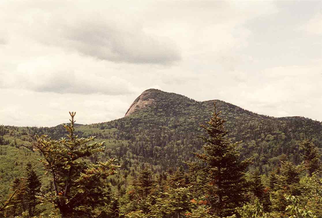 Big Slide MountainSummitPhoto: petersent, Public domain (via Wikimedia Commons)~24 min drive
 Phelps MountainSummitPhoto: Pepper, CC BY-SA 3.0 (via Wikimedia Commons)~27 min drive
 Street MountainSummitPhoto: Edmund Rozell, CC BY-SA 4.0 (via Wikimedia Commons)~28 min drive
 Upper Wolfjaw MountainSummitPhoto: Mwanner
Uploaded by Mwanner at en.wikipedia, CC BY-SA 3.0 (via Wikimedia Commons)~29 min drive
Also worth it near here
- Flume Knob TrailHikingPhoto: Idawriter, CC BY-SA 3.0 (via Wikimedia Commons)~1 min drive
- Lake Placid / Whiteface Mtn. KOA HolidayCamping~2 min drive
 Whiteface Mountain Ski CenterDownhill skiingPhoto: Dr. John Kelley, NOAA/NOS/COOPS., Public domain (via Wikimedia Commons)~3 min drive
- The Flume FallWaterfall~3 min drive
Conditions and forecast
Daily highs and lows, wind and the chance of precipitation at the summit and route start for the next 7 days, from the Open-Meteo model.
Questions about Marble Mountain
How tall is Marble Mountain?
2,744 ft (836 m).
How many routes go to the summit of Marble Mountain?
One: Marble Mountain Trail.
Ask about this place
Questions about Marble Mountain: conditions, access, timing. Answers say when something isn't known.
