Jessieville Winona Fourche Ranger District
- Mar–Jun, Sep–Nov
- best months
Is Jessieville Winona Fourche Ranger District open right now?
Closure in the area
There's a closure order in Ouachita National Forest. It doesn't name Jessieville Winona Fourche Ranger District, so check the source for the area it covers (4 listed).
Forest Service Road 6035 Closed for Construction
Agency closure covering Ouachita National Forest · USFS · Ouachita National Forest
Forest Service Road Closures on the Caddo-Womble Ranger District
Agency closure covering Ouachita National Forest · USFS · Ouachita National Forest
Wildfire Risk Increases in Arkansas and Oklahoma
Agency closure covering Ouachita National Forest · USFS · Ouachita National Forest
Hole in the Ground Hiking Trail Closed due to Logging Operations
Agency closure covering Ouachita National Forest · USFS · Ouachita National Forest
Sugar Creek Multi-Use Trail Partially Closed Due to Logging Operations
Agency alert covering Ouachita National Forest · USFS · Ouachita National Forest
As of · Source: USFS · Ouachita National Forest. Agencies don't list every closure — check before you go.
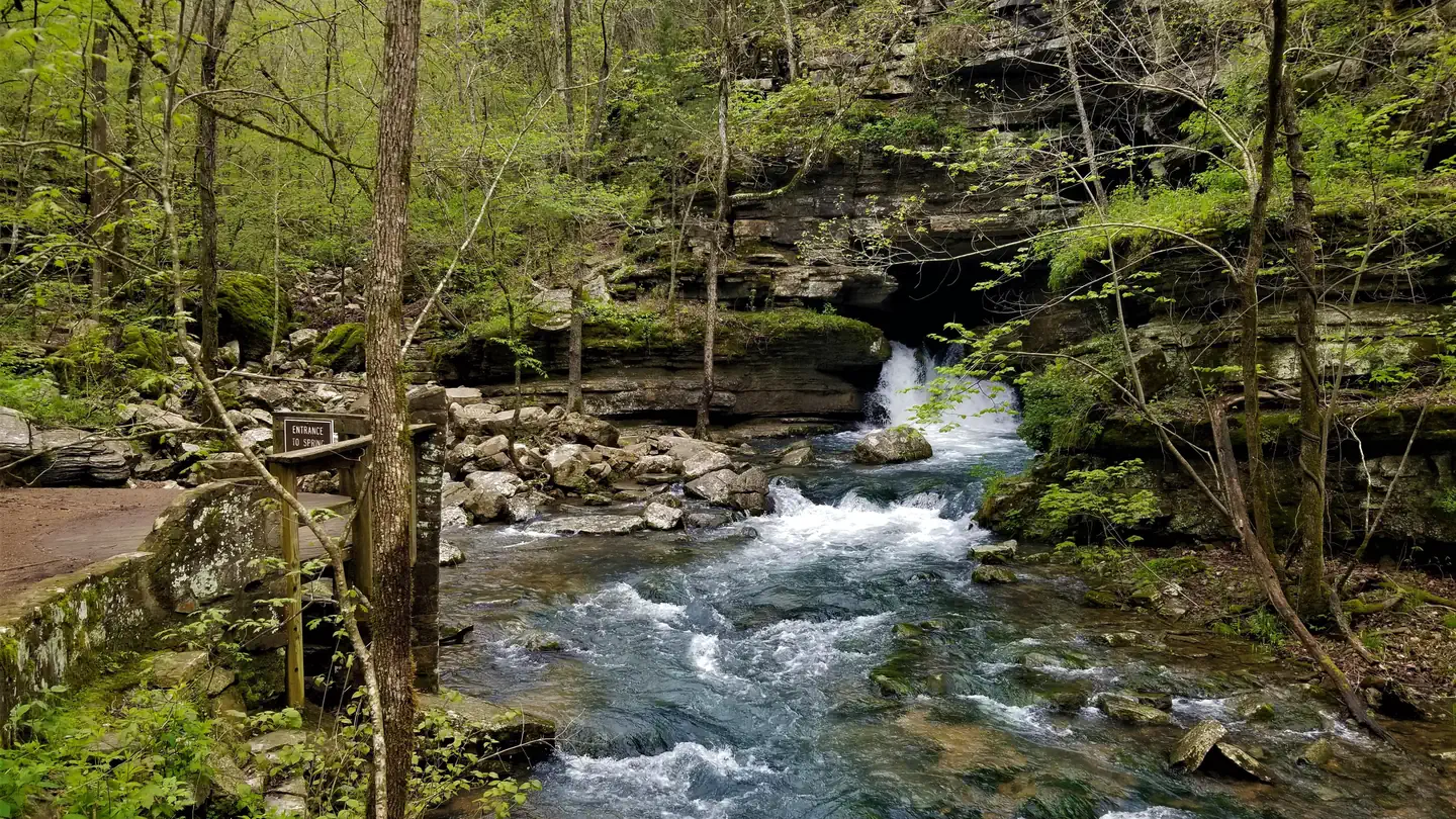
Jessieville/Winona/Fourche Office8607 N Hwy 7PO Box 189Jessieville AR 71949(501) 984-5313Jessieville-Winona-Fourche Ranger District covers approximately 406 thousand acres on the north and east end of the Ouachita National Forest. The district is blessed with 11 lakes and numerous creeks and rivers for public fishing and water activities. Recreation opportunities abound. This district has a portion of the Scenic 7 Byway running through it with three Civilian Conservation Corp Camp interpretive sites. It has Richardson Bottoms Wildlife Viewing Area, Winona Scenic Drive, the 9,507 acre Flatside Wilderness area, three walk- in-turkey hunting areas, three designated scenic areas, three developed campgrounds including Lake Sylvia, two public rifle ranges, and 183 miles of trail for hiking, biking, and horseback riding. The Ouachita National Recreation Trail spans 71 miles across the district and has nine trail shelters dispersed along its length for hiker use. The district is also home to Camp Ouachita, a historic Girl Scouts Inc. camp built between 1936 and 1940 by the Works Progress Administration (WPA) and the Civilian Conservation Corp (CCC). The camp is listed on the National Register of Historic Places and is the only surviving WPA and CCC constructed Girl Scouts Inc. camp in the United States.
Local outfitters
- River View Cabins & Canoes41 mi away
Not on Roamze yet. Their page has how to reach them.
- Friendship TrailHiking0.2 mi
 Hunts LoopHikingPhoto: SlapTheWorld, Public Domain Dedication (CC0) (via Flickr)4.2 mi
- BEAR CREEK EQUESTRIAN TRAILHiking5.6 mi
- Bear Creek - Middle LoopHiking8.8 mi
- Middle Fork Saline RiverCanoeing8.8 mi
- Bear Creek - East LoopHiking9.4 mi
- Caddo Bend TrailHiking9.8 mi
Source: Roamze catalog (indexable pages within 10 miles, PostGIS distance)
- Nimrod LakeLake fishing · ~32 min drive
- Little Fir Recreation AreaLake fishing · ~48 min drive
- Little Fir LandingLake fishing · ~49 min drive
- Caddo/Womble Ranger DistrictLake fishing · ~57 min drive
- Russellville State ParkLake fishing · ~1h 10m drive
- Lake ConwayLake fishing · ~1h 14m drive
- CherokeeRiver fishing · ~56 min drive
- Highway 27 Fishing VillageLake fishing · ~48 min drive
Best time to visit Jessieville Winona Fourche Ranger District
Best months: March–June and September–November. Best months have typical highs of 55–85 °F, lows of 30 °F or warmer (32 °F where the station doesn't record snow), at most one snowy day and no more than 12 wet days.
Jan
49° / 29°
10 wet
Feb
54° / 32°
9 wet
Mar
62° / 40°
11 wet
Apr
71° / 48°
10 wet
May
78° / 58°
11 wet
Jun
85° / 66°
9 wet
Jul
89° / 70°
10 wet
Aug
89° / 69°
9 wet
Sep
83° / 62°
7 wet
Oct
73° / 50°
8 wet
Nov
61° / 39°
9 wet
Dec
51° / 32°
10 wet
Typical high / low (°F) and days with rain or snow, 1991–2020. Measured at Alum Fk, AR, 13.9 mi away at 698 ft. Source: NOAA NCEI U.S. Climate Normals 1991–2020.
Similar waters
Like this spot? Try: