Flowers Camp
At a glance
Flowers Camp is a campground in Nevada.
- best months
- Apr–Jun, Sep–Oct
Where it is: Alta Toquima Wilderness · Austin-Tonopah Ranger District
Near: Tonopah
Best time to visit Flowers Camp
Best months: April–June and September–October. Best months have typical highs of 55–85 °F, lows of 30 °F or warmer (32 °F where the station doesn't record snow), at most one snowy day and no more than 12 wet days.
Jan
42°
17°
4 wet
Feb
48°
21°
4 wet
Mar
56°
27°
4 wet
Apr
63°
32°
4 wet
May
72°
40°
4 wet
Jun
84°
47°
3 wet
Jul
91°
55°
3 wet
Aug
90°
53°
2 wet
Sep
81°
44°
2 wet
Oct
68°
33°
3 wet
Nov
54°
23°
3 wet
Dec
42°
16°
4 wet
Typical high / low (°F) and days with rain or snow, 1991–2020. Measured at Smoky Valley - Carvers, NV, 14.5 mi away at 5,647 ft. We don't have this place's elevation, so higher spots nearby can run cooler. This station doesn't record snowfall. Source: NOAA NCEI U.S. Climate Normals 1991–2020.
Been here? Tell people how it was.
- Middle Summit Mt JeffersonHiking0.6 mi
- North Summit Mt JeffersonHiking1.8 mi
- Middle Summit Mount JeffersonSummit1.8 mi
- Windy Pass TrailHiking2.3 mi
- Bucks CanyonHiking2.5 mi
- Trail Canyon CreekHiking2.8 mi
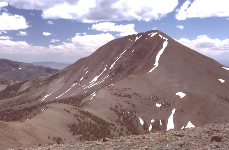
 Mount JeffersonHikingPhoto: Famartin — Wikimedia Commons (CC BY-SA 4.0)3.2 mi
- Pine Creek CampgroundCamping3.2 mi
- Pine Creek CampgroundCamping~6 min drive
- Kingston Guard Station RentalHut camping~1h 2m drive
- Peavine Creek CampgroundCamping~42 min drive
- Toquima Cave CampgroundCamping~50 min drive
- San Juan CuaCamping~53 min drive
- San Juan CampgroundCamping~53 min drive
- Kingston CampgroundCamping~57 min drive
- Berlin Ichthyosaur CampgroundCamping~1h 5m drive
- Big Creek CampgroundCamping~1h 11m drive
- Bob Scott CampgroundCamping~1h 21m drive
Conditions and forecast
Daily highs and lows, wind and the chance of precipitation at Flowers Camp for the next 7 days, from the Open-Meteo model.
Ask about this place
Questions about Flowers Camp: conditions, access, timing. Answers say when something isn't known.
- Alta Toquima WildernessAustin-Tonopah Ranger District · Humboldt-Toiyabe National Forest
Map and trail data © OpenStreetMap contributors
