Signal Peak
About
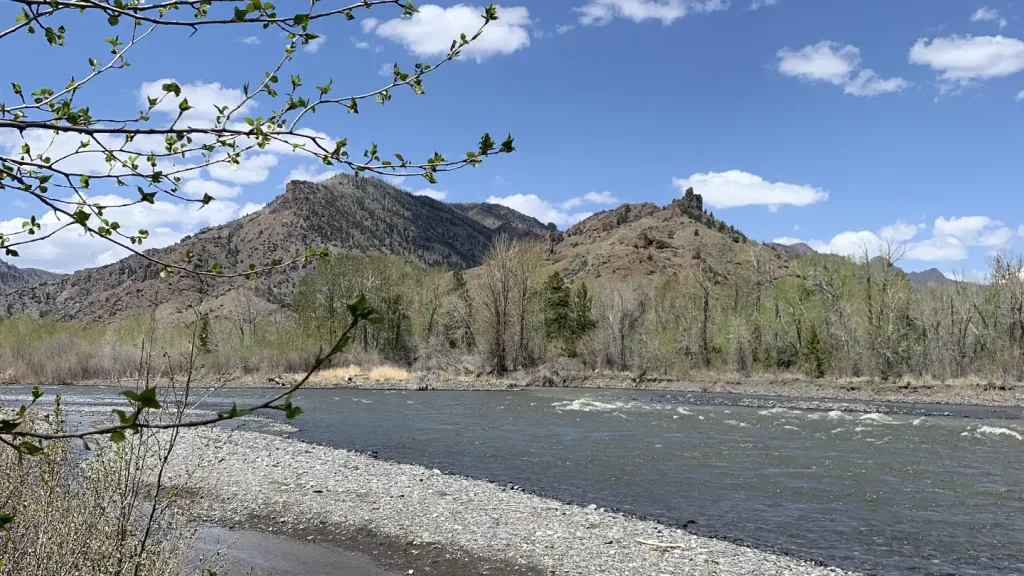
Signal Peak is a summit of 6,990 feet in the Wapiti Ranger District of Shoshone National Forest in Wyoming, managed by the Forest Service. The nearest town is Cody, about 24 miles away. Summer is the most comfortable time to go. Typical averages from a nearby weather station show July highs around 83°F with lows near 51°F, and September highs around 71°F. That station sits well below the summit, so temperatures up top run cooler. Several trails start close by. Nameit Cr Trail is about a mile away and Grizzly Ridge Trail about 1.5 miles. For an overnight base, Big Game Campground is about 3.6 miles off and Wapiti Campground about 4.5 miles.
Summit Facts
Summit elevation
6,990 ft
Land manager
Forest Service
Elevation from USGS 3D Elevation Program terrain data (about 10 m resolution).
Location
Signal Peak
Wyoming
Name and location: U.S. Geological Survey, Geographic Names Information System (GNIS). Elevation: USGS 3D Elevation Program. View the GNIS record.
Facts about this place
When to go
Best time to go: May–Sep. The mildest months here, with typical highs of 62–83°F and lows of 37–51°F.
Typical monthly averages (not a forecast) from the Wapiti 1wsw, WY weather station, 5.8 mi away. High / low in °F.
- Jan39° high19° low
- Feb39° high17° low
- Mar47° high24° low
- Apr53° high29° low
- May62° high37° low
- Jun72° high44° low
- Jul83° high51° low
- Aug81° high49° low
- Sep71° high42° low
- Oct57° high33° low
- Nov45° high25° low
- Dec37° high19° low
The station sits about 1,400 ft lower than this spot, so expect it to run cooler up here.
Where it is
- Wapiti Ranger District · Ranger district
- Shoshone National Forest · National forest
- Nearest town
- Cody, Wyoming · 24 mi
- Managed by
- Forest Service
Source: USFS EDW boundaries; USGS PAD-US 4.1; USGS GNIS populated places
Conditions
Active alerts for Shoshone National Forest as of Oct 9, 2026:
caution · posted Sep 14, 2026
Prohibits Camping in Areas that are Posted or Signed as Closed to Camping
information · posted Aug 24, 2026
Acts Prohibited in Wilderness Areas
information · posted Aug 24, 2026
Single Location Occupancy Limited to Sixteen (16) Days; Boat Launching Limited to Boat Ramps
information · posted Aug 24, 2026
Restrictions to Activities in the Sleeping Giant Ski Area and Pahaska Nordic Ski Area
information · posted Aug 24, 2026
Restrictions to Activities on Roads, Trails, and Other Areas
information · posted Aug 24, 2026
Over-Snow Vehicle Area, Road, and Trail Prohibitions
information · posted Aug 24, 2026
Over-Snow Vehicle Area, Road, and Trail Prohibitions
information · posted Aug 24, 2026
Over-Snow Vehicle Area, Road, and Trail Prohibitions
information · posted Aug 24, 2026
Occupancy and Use Restrictions
information · posted Aug 24, 2026
Source: USFS forest alerts
Nearby
- Nameit Cr TrailHiking1.2 mi
- Grizzly Ridge TrailHiking1.5 mi
- Clocktower Cr TrailHiking2.3 mi
- Big Game CampgroundCamping3.6 mi
 Wapiti CampgroundCampingPhoto: Recreation.gov (RIDB) / public domain4.5 mi
 Elk Fork CampgroundCampingPhoto: George Bannister from Woodville, MS, USA, CC BY 2.0 (via Wikimedia Commons)4.8 mi
- Wapiti BridgeRiver fishing5.1 mi
- North Fork Shoshone R AccessRiver fishing5.5 mi
Source: Roamze catalog (indexable pages within 10 miles, PostGIS distance)
Is Signal Peak open right now?
Alert in the area
The Forest Service lists an alert for Shoshone National Forest.
Morrison Jeep Trail
Agency alert covering Shoshone National Forest · USFS · Shoshone National Forest
As of · Source: USFS · Shoshone National Forest. Agencies don't list every closure — check before you go.
Best time to visit Signal Peak
Best months: May–October. Best months have typical highs of 55–85 °F, lows of 30 °F or warmer (32 °F where the station doesn't record snow), at most one snowy day and no more than 12 wet days.
Jan
39° / 19°
3 wet
Feb
39° / 17°
3 wet
Mar
47° / 24°
4 wet
Apr
53° / 29°
6 wet
May
62° / 37°
7 wet
Jun
72° / 44°
7 wet
Jul
83° / 51°
6 wet
Aug
81° / 49°
6 wet
Sep
71° / 42°
5 wet
Oct
57° / 33°
4 wet
Nov
45° / 25°
4 wet
Dec
37° / 19°
4 wet
Typical high / low (°F) and days with rain or snow, 1991–2020. Measured at Wapiti 1wsw, WY, 5.8 mi away at 5,558 ft. The station sits about 1,400 ft lower than this place, so expect it a little cooler here. This station doesn't record snowfall. Source: NOAA NCEI U.S. Climate Normals 1991–2020.
