Hidden Valley Group Site
Campground
Campground · 2.6 mi from the trail
Alert in the area
The Forest Service lists 3 alerts for Medicine Bow-Routt National Forest.
Access Impact: Big Creek Lakes Dam Project
Agency alert covering Medicine Bow-Routt National Forest · USFS · Medicine Bow-Routt National Forest
Trail & Access Impact: Stillwater Reservoir Project
Agency alert covering Medicine Bow-Routt National Forest · USFS · Medicine Bow-Routt National Forest
Snowy Range - 2026 Active Vegetation Operations
Agency alert covering Medicine Bow-Routt National Forest · USFS · Medicine Bow-Routt National Forest
As of · Source: USFS · Medicine Bow-Routt National Forest. Agencies don't list every closure — check before you go.
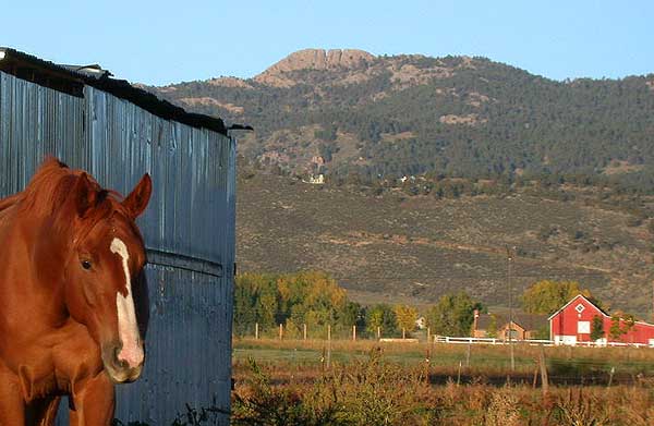
Point Crawford is a summit of 8,870 feet in the Laramie Ranger District of the Medicine Bow-Routt National Forest in Wyoming, about 13 miles from the town of Laramie. Summer is the most comfortable time to visit. Typical averages from a nearby weather station in Laramie show July highs around 81°F with lows near 52°F, and September still runs in the low 70s by day. That station sits roughly 1,500 feet below the summit, so temperatures up high run cooler. The Wallis hike starts just 0.3 miles away, and the Double Black Diamond Trail for mountain biking is 0.4 miles off. Climbers can find Little John's Meditation Boulder about a mile away and John's Tower at 1.1 miles.
Hidden Valley Group Site
Campground
 If it rainsCogdogblog, CC BY 2.0 · Wikimedia Commons
Places © OpenStreetMap contributors, Places © Overture Maps Foundation · Photos: Cogdogblog, CC BY 2.0 (commons)
More in LaramieDaily highs and lows, wind and the chance of precipitation at the summit and route start for the next 7 days, from the Open-Meteo model.
Elevation from USGS 3D Elevation Program terrain data (about 10 m resolution).
8,870 ft (2,704 m).
One: Wallis.
Wallis starts at HEADQUARTERS NRT (about 8,559 ft).
Year-round.

 Yellow Pine CampgroundCampingPhoto: Tony Webster — CC BY 2.0 (via Flickr)3.1 mi
Source: Roamze catalog (indexable pages within 10 miles, PostGIS distance)
Greyrock MountainSummit · ~59 min drivePhoto: Lvaughn7, CC BY-SA 4.0 (via Wikimedia Commons) Goat HillSummit · ~1h 10m drivePhoto: Jeffrey Beall, CC BY-SA 4.0 (via Wikimedia Commons)
 Horsetooth MountainSummit · ~1h 21m drivePhoto: Matthew Trump (talk) (Uploads)
Uploaded by Decumanus at en.wikipedia, CC BY-SA 3.0 (via Wikimedia Commons)
 Medicine Bow PeakSummit · ~1h 24m drivePhoto: Photomnt at English Wikipedia, Public domain (via Wikimedia Commons)
Best months: May–September. Best months have typical highs of 55–85 °F, lows of 30 °F or warmer (32 °F where the station doesn't record snow), at most one snowy day and no more than 12 wet days.
Jan
33° / 12°
7 wet
Feb
35° / 15°
7 wet
Mar
44° / 21°
8 wet
Apr
51° / 28°
11 wet
May
60° / 36°
12 wet
Jun
73° / 46°
10 wet
Jul
81° / 52°
11 wet
Aug
79° / 49°
10 wet
Sep
72° / 43°
8 wet
Oct
56° / 31°
8 wet
Nov
43° / 23°
7 wet
Dec
34° / 14°
7 wet
Typical high / low (°F) and days with rain or snow, 1991–2020. Measured at Laramie 4se, WY, 8.8 mi away at 7,390 ft. The station sits about 1,500 ft lower than this place, so expect it a little cooler here. This station doesn't record snowfall. Source: NOAA NCEI U.S. Climate Normals 1991–2020.


