The 1988 Fires
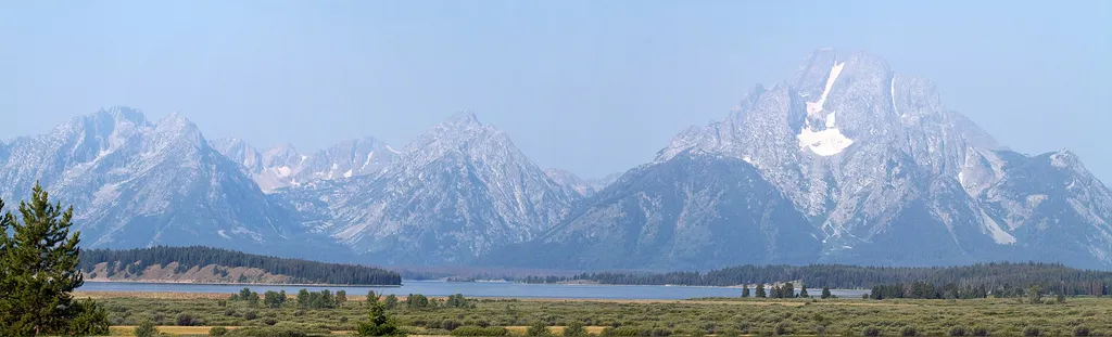 Photo: Brian Gratwicke — Wikimedia Commons (CC BY 2.0)
- Jun–Aug
- best months
Is The 1988 Fires open right now?
No closures listed
The National Park Service lists no closures for John D. Rockefeller, Jr., Memorial Parkway.
As of · Source: NPS · John D. Rockefeller, Jr., Memorial Parkway. Agencies don't list every closure — check before you go.
The 1988 Fires is a stop on the John D. Rockefeller, Jr., Memorial Parkway in Wyoming, managed by the National Park Service. It is Stop 5, the Huck Fire Turnout, and it serves as a place to learn about the 1988 fires in Yellowstone and their long-term impact on fire management in the West. The stop gives visitors a chance to hear about the scientific lessons the fires left behind. Summer is the most comfortable time to visit. Typical July averages at a nearby weather station run around 77°F for highs and 38°F for lows, and September cools to about 66°F by day. Several other stops sit close by. The Huck Fire Turnout is just 0.1 mile away, the John D. Rockefeller, Jr. Memorial Parkway South Turnout is 0.4 mile away, and the Grand Teton North Boundary Turnout is 0.6 mile away. Sheffield Campground is about 3.4 miles off.
Local outfitters
- Swift Creek Outfitters14 mi away
- The Virginian RV Park40 mi away
Not on Roamze yet. Their page has how to reach them.
Best time to go · Jun–Aug
Best time to visit The 1988 Fires
Best months: June–August. Best months have typical highs of 55–85 °F, lows of 30 °F or warmer (32 °F where the station doesn't record snow), at most one snowy day and no more than 12 wet days.
Jan
26° / 1°
18 wet
Feb
30° / 3°
15 wet
Mar
39° / 11°
15 wet
Apr
45° / 20°
14 wet
May
56° / 28°
13 wet
Jun
66° / 34°
12 wet
Jul
77° / 38°
10 wet
Aug
76° / 35°
9 wet
Sep
66° / 28°
9 wet
Oct
51° / 21°
10 wet
Nov
35° / 11°
15 wet
Dec
25° / 2°
19 wet
Typical high / low (°F) and days with rain or snow, 1991–2020. Measured at Snake Rvr, WY, 6 mi away at 6,882 ft. This station doesn't record snowfall. Source: NOAA NCEI U.S. Climate Normals 1991–2020.
Keep exploring — more trails worth the drive
HIKE
John D. Rockefeller, Jr. Memorial Parkway South Turnout
Next door
The top of Huckleberry Hill marks the boundary between Grand Teton National Park and the John D. Rockefeller, Jr. Memorial Parkway. The US Forest Service transferred the parkway land to the National Park Service in 1972 in honor of Rockefeller's many contributions. Today…
 Photo: Don Graham from Redlands, CA, USA - God bless it!, CC BY-SA 2.0 (via Wikimedia Commons)
Webb Canyon Trail
~7 min drive
Moderate 7.71-mile out-and-back canyon hike in Wyoming.
HIKE
Arizona Meadows Turnout
~10 min drive
This wet meadow turns blue violet in the early summer when blue camas blooms. Shoshone Indians harvested the bulbs once the flowers bloomed so that they did not confuse the plant with death camas that could be a very deadly mistake! The roasted bulbs formed an important part…
HIKE
Berry Creek Trail
~5 min drive
Out-and-back creek hike through Wyoming forest and meadow.
HIKE
Survey Peak Trail
~12 min drive
Moderate out-and-back summit hike with panoramic Wyoming views.
HIKE
Grand Teton North Boundary Turnout
Next door
The top of Huckleberry Hill marks the boundary between Grand Teton National Park and the John D. Rockefeller, Jr. Memorial Parkway. The US Forest Service transferred the parkway land to the National Park Service in 1972 in honor of Rockefeller's many contributions. Today…
 Photo: inkknife_2000 (7.5 million views +), CC BY-SA 2.0 (via Wikimedia Commons)
Bailey Creek
~10 min drive
6.66-mile out-and-back trail in Wyoming with 614 ft elevation gain.
Photo: inkknife_2000 (7.5 million views +), CC BY-SA 2.0 (via Wikimedia Commons)Bailey Creek Trail
~10 min drive
1.4-mile out-and-back trail in Wyoming with 432 ft elevation gain.
HIKE
Glade Creek Trail
~5 min drive
Moderate out-and-back creek hike through Wyoming forest and meadow.
HIKE
South Boundary Trail: Grassy Lake-South Entrance
~13 min drive
Moderate out-and-back hike along Wyoming's South Boundary Trail.
