Sizzling Basin
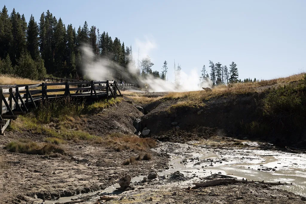 Photo: Clyde Charles Brown — Wikimedia Commons (CC BY-SA 4.0)
- Jul–Sep
- best months
Is Sizzling Basin open right now?
Closure in the area
There's a closure order in Yellowstone National Park. It doesn't name Sizzling Basin, so check the source for the area it covers (2 listed).
Most Park Roads Closed to All Vehicles
Park closure covering Yellowstone National Park · NPS · Yellowstone National Park
Biscuit Basin Closed Due to Hydrothermal Explosion
Park closure covering Yellowstone National Park · NPS · Yellowstone National Park
As of · Source: NPS · Yellowstone National Park. Agencies don't list every closure — check before you go.
Sizzling Basin is a hike in Yellowstone National Park in Wyoming, managed by the National Park Service. It sits among a cluster of short trails, with Black Dragon's Caldron, Cooking Hillside and Grizzly Fumarole all about 0.1 mile away. Summer is the most comfortable time to visit. Typical averages from the nearby Lake Yellowstone weather station show July and August highs around 71°F with lows in the low 40s, while winter highs stay in the 20s. A fee is charged for the visit. Plan on a short outing, since the closest trails are all within a few tenths of a mile. Lake Yellowstone Hotel and Cabins is about 5 miles away, and the Mud Volcano Trail is about 0.2 mile off.
Local outfitters
- Swift Creek Outfitters48 mi away
Not on Roamze yet. Their page has how to reach them.
Best time to go · Jul–Sep
Best time to visit Sizzling Basin
Best months: July–September. Best months have typical highs of 55–85 °F, lows of 30 °F or warmer (32 °F where the station doesn't record snow), at most one snowy day and no more than 12 wet days.
Jan
23° / 3°
17 wet
Feb
27° / 3°
15 wet
Mar
35° / 11°
14 wet
Apr
42° / 19°
12 wet
May
50° / 29°
12 wet
Jun
61° / 36°
13 wet
Jul
71° / 43°
10 wet
Aug
71° / 42°
10 wet
Sep
61° / 34°
10 wet
Oct
46° / 25°
9 wet
Nov
33° / 15°
12 wet
Dec
24° / 7°
16 wet
Typical high / low (°F) and days with rain or snow, 1991–2020. Measured at Lake Yellowstone, WY, 4.5 mi away at 7,892 ft. This station doesn't record snowfall. Source: NOAA NCEI U.S. Climate Normals 1991–2020.
Keep exploring — more trails worth the drive
HIKE
Black Dragon's Caldron
Next door
In 1948, Black Dragon’s Caldron burst through a crack in the earth. It uprooted and coated nearby trees with thick mud. Since then, this mudpot moved south 200 feet (60 m) along the crack. The spring feeding nearby Sour Lake was much more active before Black Dragon’s Caldron…
HIKE
Mud Caldron
Next door
A large mudpot located near the parking area.
 Photo: cchadek, CC BY 3.0 (via Wikimedia Commons)
Wapiti Lake Trail
~11 min drive
Scenic 16.32-mile out-and-back to alpine Wapiti Lake in Wyoming.
 Photo: inkknife_2000 (7.5 million views +), CC BY-SA 2.0 (via Wikimedia Commons)
Clear Lake-Ribbon Lake Trail
~11 min drive
Out-and-back alpine trail connecting Clear Lake and Ribbon Lake in Wyoming.
 Photo: Roger Sylvia, CC BY-SA 3.0 (via Wikimedia Commons)
Artist Point-Point Sublime Trail
~12 min drive
Scenic 1.3-mile out-and-back with dramatic viewpoints and natural formations.
HIKE
Cooking Hillside
Next door
The trees on this hillside are cooked by steam. In 1978, an earthquake swarm occurred at Mud Volcano. The intense swarm lasted about seven months. This hillside experienced increased heat, causing the vegetation to die. Researchers are able to study tree rings to learn about…
 Photo: Greg Willis from Denver, CO, usa, CC BY-SA 2.0 (via Wikimedia Commons)
Wrangler Lake Trail
~10 min drive
Short out-and-back hike to a scenic alpine lake in Wyoming's high country.
 Photo: R. Sieben, CC BY 3.0 (via Wikimedia Commons)
Howard Eaton Trail: Fishing Bridge-Canyon
~12 min drive
Moderate out-and-back hike from Fishing Bridge to Canyon through thermal landscapes.
 Photo: Don Graham from Redlands, CA, USA - God bless it!, CC BY-SA 2.0 (via Wikimedia Commons)
North Rim Trail
~13 min drive
Easy out-and-back rim hike with scenic views near North Rim.
HIKE
Grizzly Fumarole
Next door
While named a fumarole, this feature will change based on recent precipitation. When dry, it is a fumarole. When it has been rainy, this feature can be a mudpot.
Also worth it near here
 Photo: Yellowstone National Park from Yellowstone NP, USA, Public domain (via Wikimedia Commons)
Fishing Bridge RV Park
~9 min drive
SEE
Lake Yellowstone Hotel and Cabins
~9 min drive
SEE
Bridge Bay Boat Launch Ramp
~10 min drive
 Photo: G. Edward Johnson, CC BY 3.0 (via Wikimedia Commons)
Yellowstone Natural Bridge
~11 min drive
