Free — you'll pick up right here.
Watch this trail
Sign up to watch it — saving subscribes you to gate, closure and report changes.
Wyoming
Wrangler Lake Trail
2.4 mi
Distance
272 ft
Gain
56 min
Time
Conditions: Clear
for hike, todayWeather is good
1 factor · 1 source
Observed 13 h ago
clear: Weather
Clear, high 68°F / low 31°F, 0% precip — 99/100 for hike
OpenWeather13 h ago
Been out here in the last few days? One report keeps this current for everyone.
Why you'll love it
Here's your day, mapped
Wrangler Lake Trail
AI-suggested draft · review before you go
Meals
Gear for the day
Elevation & route
- Distance
- 2.4 mi
- Elevation gain
- 272 ft
- Elevation loss
- 272 ft
- Highest point
- 7,869 ft
- Lowest point
- 7,714 ft
Photos
Directions & GPX
Permits & access
- Managing agency
- National Park Service
About this trail
Wrangler Lake Trail is a scenic 2.42-mile out-and-back hike in Wyoming that leads to an alpine lake nestled in the high country. This relatively short trail offers hikers an accessible way to experience mountain lake scenery with moderate elevation gain through forested terrain.
Add to a trip & share
Keep exploring — more trails worth the drive
 Photo: Greg Willis from Denver, CO, usa, CC BY-SA 2.0 (via Wikimedia Commons)
Sour Creek Trail
~1 min drive
Short out-and-back creek-side hike in Wyoming.
 Photo: cchadek, CC BY 3.0 (via Wikimedia Commons)
Wapiti Lake Trail
~2 min drive
Scenic 16.32-mile out-and-back to alpine Wapiti Lake in Wyoming.
 Photo: Roger Sylvia, CC BY-SA 3.0 (via Wikimedia Commons)
Artist Point-Point Sublime Trail
~2 min drive
Scenic 1.3-mile out-and-back with dramatic viewpoints and natural formations.
 Photo: R. Sieben, CC BY 3.0 (via Wikimedia Commons)
Howard Eaton Trail: Fishing Bridge-Canyon
~2 min drive
Moderate out-and-back hike from Fishing Bridge to Canyon through thermal landscapes.
Grand Canyon of the Yellowstone - Lookout Point
~3 min drive
Scientists think the oldest Grand Canyon of the Yellowstone formed in rock and sediments about 160,000 to 140,000 years ago. This canyon was not as deep, wide, or long as today’s canyon. Past and current hydrothermal activity altered and weakened the rhyolite, making the…
 Photo: inkknife_2000 (7.5 million views +), CC BY-SA 2.0 (via Wikimedia Commons)
Clear Lake-Ribbon Lake Trail
~1 min drive
Out-and-back alpine trail connecting Clear Lake and Ribbon Lake in Wyoming.
 Photo: Don Graham from Redlands, CA, USA - God bless it!, CC BY-SA 2.0 (via Wikimedia Commons)
North Rim Trail
~3 min drive
Easy out-and-back rim hike with scenic views near North Rim.
 Photo: Don Graham from Redlands, CA, USA - God bless it!, CC BY-SA 2.0 (via Wikimedia Commons)
Mount Washburn Spur Trail
~3 min drive
16.89-mile out-and-back trail with 2,347 ft gain on Mount Washburn Spur Trail in Wyoming.
Hayden Valley at Alum Creek
~3 min drive
Hayden Valley, is one of the best places in the park to view a wide variety of large mammals. Grizzly bears and black bears are often seen in the spring and early summer. Large herds of bison may be seen in the spring, early summer, and during the rut in August. Coyotes can…
Photo: cchadek, CC BY 3.0 (via Wikimedia Commons)Clear Lake Trail
~2 min drive
Short out-and-back hike to a scenic Wyoming alpine lake.
Also worth it near here
 Photo: Tony Hisgett from Birmingham, UK, CC BY 2.0 (via Wikimedia Commons)
Upper Falls of the Yellowstone River
~3 min drive
 Photo: daveynin, CC BY 2.0 (via Flickr)
Glacial Boulder
~3 min drive
 Photo: Dirtsc, CC BY-SA 3.0 (via Wikimedia Commons)
Hedges Peak
~9 min drive
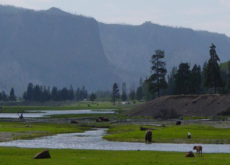 Photo: Daniel Mayer, CC BY-SA 3.0 (via Wikimedia Commons)
Gibbon River
~18 min drive
 Photo: Yellowstone National Park from Yellowstone NP, USA, Public domain (via Wikimedia Commons)
Fishing Bridge RV Park
~19 min drive
