Pelican Creek Nature Trail
- 1.3 mi
- round trip
- 7 ft
- climb
- 7,756 ft
- high point
- Out and back
- route
- Jul–Sep
- best months
Is Pelican Creek Nature Trail open right now?
Closure in the area
There's a closure order in Yellowstone National Park. It doesn't name Pelican Creek Nature Trail, so check the source for the area it covers (2 listed).
Most Park Roads Closed to All Vehicles
Park closure covering Yellowstone National Park · NPS · Yellowstone National Park
Biscuit Basin Closed Due to Hydrothermal Explosion
Park closure covering Yellowstone National Park · NPS · Yellowstone National Park
As of · Source: NPS · Yellowstone National Park. Agencies don't list every closure — check before you go.
Pelican Creek Nature Trail is a short, easy hike in Yellowstone National Park in Wyoming, managed by the National Park Service. The trail is about 1.3 miles long and rises only 7 feet from its low point of 7,745 feet to a high of 7,756 feet, making it a gentle out-and-back walk. Summer is the most comfortable time to go. Typical averages from the nearby Lake Yellowstone weather station show July and August highs around 71°F with lows in the low 40s, while winter highs stay in the 20s. A fee is charged for the visit. The trailhead is called Pelican Creek Nature Trailhead, and the route is part of the park's larger trail network. Fishing Bridge is about 0.8 miles away, and Storm Point Trail is about 1.6 miles off. Lake Yellowstone Hotel and Cabins and Elephant Back Mountain Trail are both about 2.1 miles away.
Local outfitters
- Swift Creek Outfitters43 mi away
Not on Roamze yet. Their page has how to reach them.
- Fishing BridgeHiking0.8 mi
- Storm Point TrailHiking1.6 mi
- Elephant Back Mountain TrailHiking2.1 mi
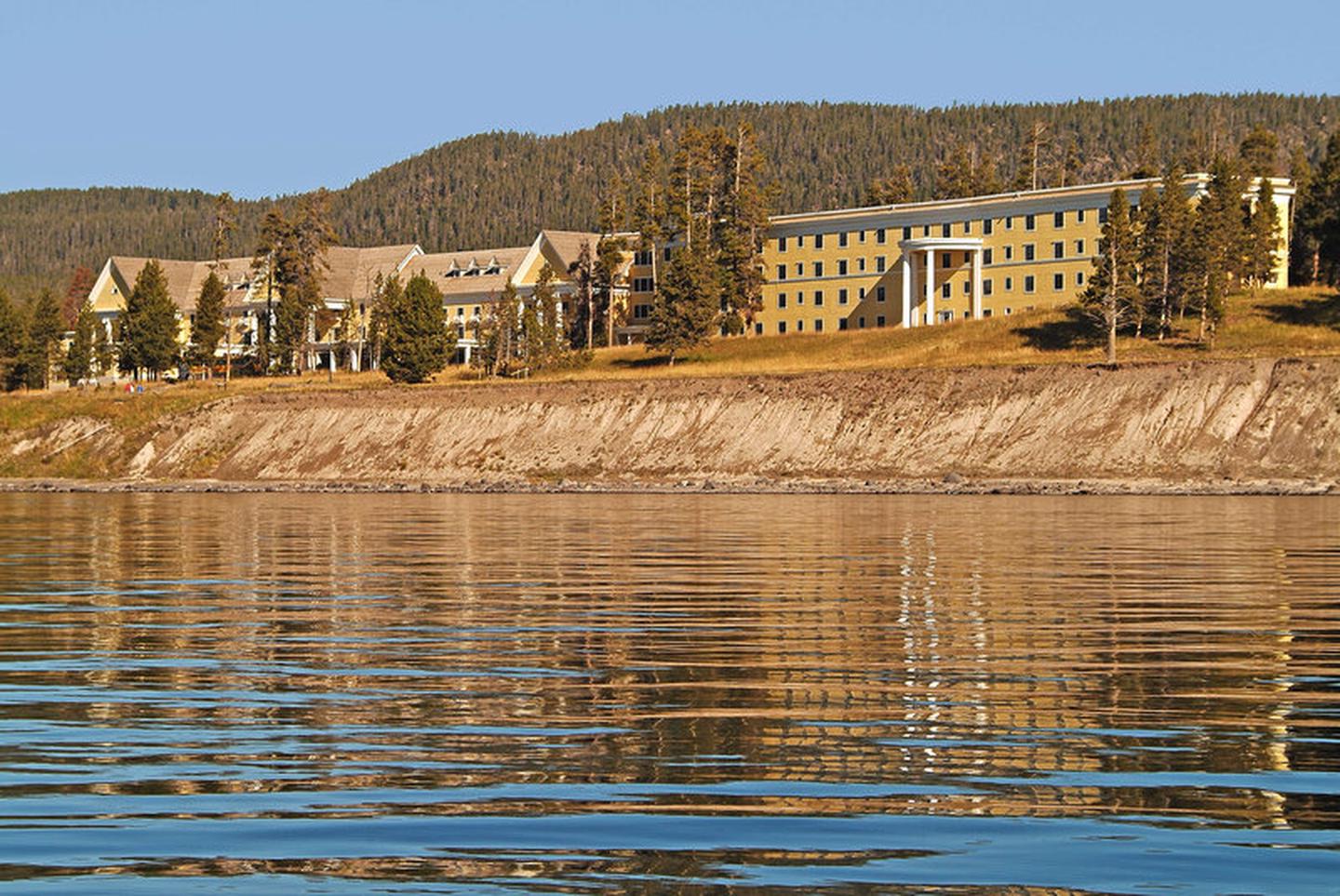 Lake Yellowstone Hotel and CabinsLake fishing2.1 mi
 LeHardys RapidsHikingPhoto: Christian Collins — Wikimedia Commons (CC BY-SA 2.0)3.5 mi
 Bridge Bay Campground-Natural Bridge TrailHikingPhoto: Greg Willis from Denver, CO, usa, CC BY-SA 2.0 (via Wikimedia Commons)4.2 mi
- Pelican Valley TrailHiking4.3 mi
- Natural Bridge TrailHikingPhoto: Greg Willis from Denver, CO, usa, CC BY-SA 2.0 (via Wikimedia Commons)5.1 mi
Source: Roamze catalog (indexable pages within 10 miles, PostGIS distance)
- LeHardys RapidsHiking · ~6 min drive
- Bridge Bay Campground-Natural Bridge TrailHiking · ~7 min drivePhoto: Greg Willis from Denver, CO, usa, CC BY-SA 2.0 (via Wikimedia Commons)
 Clear Lake-Ribbon Lake TrailHiking · ~21 min drivePhoto: inkknife_2000 (7.5 million views +), CC BY-SA 2.0 (via Wikimedia Commons)
 Wapiti Lake TrailHiking · ~21 min drivePhoto: cchadek, CC BY 3.0 (via Wikimedia Commons)
 Artist Point-Point Sublime TrailHiking · ~22 min drivePhoto: Roger Sylvia, CC BY-SA 3.0 (via Wikimedia Commons)
- Black Dragon's CaldronHiking · ~10 min drive
- Natural Bridge TrailHiking · ~9 min drivePhoto: Greg Willis from Denver, CO, usa, CC BY-SA 2.0 (via Wikimedia Commons)
 Howard Eaton Trail: Fishing Bridge-CanyonHiking · ~21 min drivePhoto: R. Sieben, CC BY 3.0 (via Wikimedia Commons)
- Pelican Valley TrailHiking · ~7 min drive
- Sizzling BasinHiking · ~10 min drive
Also worth it near here
- Lake Yellowstone Hotel and CabinsLake fishing · ~4 min drive
 Bridge Bay CampgroundCamping · ~6 min drivePhoto: Yellowstone National Park from Yellowstone NP, USA, Public domain (via Wikimedia Commons)
- Bridge Bay Boat Launch RampBoat launch · ~7 min drive
 Yellowstone Natural BridgeNatural arch · ~9 min drivePhoto: G. Edward Johnson, CC BY 3.0 (via Wikimedia Commons)
Best time to visit Pelican Creek Nature Trail
Best months: July–September. Best months have typical highs of 55–85 °F, lows of 30 °F or warmer (32 °F where the station doesn't record snow), at most one snowy day and no more than 12 wet days.
Jan
23° / 3°
17 wet
Feb
27° / 3°
15 wet
Mar
35° / 11°
14 wet
Apr
42° / 19°
12 wet
May
50° / 29°
12 wet
Jun
61° / 36°
13 wet
Jul
71° / 43°
10 wet
Aug
71° / 42°
10 wet
Sep
61° / 34°
10 wet
Oct
46° / 25°
9 wet
Nov
33° / 15°
12 wet
Dec
24° / 7°
16 wet
Typical high / low (°F) and days with rain or snow, 1991–2020. Measured at Lake Yellowstone, WY, 1.9 mi away at 7,892 ft. This station doesn't record snowfall. Source: NOAA NCEI U.S. Climate Normals 1991–2020.
Map and trail data © OpenStreetMap contributors
