Hobble Creek
- 13.3 mi
- round trip
- 795 ft
- climb
- 8,368 ft
- high point
- Out and back
- route
- Jun–Sep
- best months
Is Hobble Creek open right now?
No closures listed
The Forest Service lists no closures for Bridger-Teton National Forest.
As of · Source: USFS · Bridger-Teton National Forest. Agencies don't list every closure — check before you go.
Hobble Creek is a hard hike on natural-surface trail in the Kemmerer Ranger District of the Bridger-Teton National Forest in Wyoming. The route is an out-and-back of about 13.3 miles, with a one-way elevation gain of 795 feet. The trail rises from a low point of about 7,500 feet to a high of about 8,370 feet. The trailhead is called Hobble Creek Trailhead, and the Forest Service manages the surrounding land. Bikes and horses are both allowed on this route. Summer is the most comfortable time to go. Typical averages from a nearby weather station at Big Piney run to highs around 82°F in July and 80°F in August, with lows in the low 40s. That station sits well below the trail, so temperatures up high run cooler. Winter is harsh, with typical highs in the 20s and lows near zero. The hike sits in a cluster of trails and campgrounds. Coppermine-Labarge is about 0.3 miles away, Buckskin Knoll is about 1.2 miles away, and Lake Alice Campground is about 2.6 miles away. Paddlers can reach Smiths Fork, about 4.2 miles off.
- Coppermine-LabargeHiking0.3 mi
- Buckskin KnollHiking1.2 mi
- Lake Alice TrailHiking2.3 mi
- LAKE ALICEHiking2.3 mi
- Hobble Creek CampgroundCamping2.4 mi
- Lake Alice CampgroundCamping2.6 mi
- Smiths ForkCanoeing4.2 mi
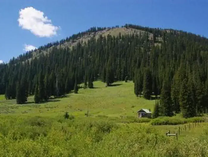 La Barge Guard StationCampingPhoto: Recreation.gov (RIDB) / public domain7.3 mi
Source: Roamze catalog (indexable pages within 10 miles, PostGIS distance)
- Coppermine-LabargeHiking · Next door
- Lake Alice OverlookHiking · ~4 min drive
- Wagner MT - Poker Hollow TrailHiking · ~10 min drive
- Buckskin KnollHiking · ~2 min drive
- MOUNT ISABEL CUTOFFHiking · ~8 min drive
- Ccc CampHiking · ~11 min drive
- Lake Alice TrailHiking · ~4 min drive
- Bull MountainHiking · ~9 min drive
- HAMS FORK CUTOFFHiking · ~12 min drive
- LAKE ALICEHiking · ~4 min drive
Best time to visit Hobble Creek
Best months: June–September. Best months have typical highs of 55–85 °F, lows of 30 °F or warmer (32 °F where the station doesn't record snow), at most one snowy day and no more than 12 wet days.
Jan
27° / -3°
4 wet
Feb
30° / 0°
4 wet
Mar
41° / 13°
6 wet
Apr
52° / 21°
7 wet
May
62° / 29°
8 wet
Jun
72° / 36°
6 wet
Jul
82° / 42°
6 wet
Aug
80° / 40°
6 wet
Sep
70° / 32°
6 wet
Oct
55° / 21°
5 wet
Nov
39° / 9°
4 wet
Dec
28° / -2°
4 wet
Typical high / low (°F) and days with rain or snow, 1991–2020. Measured at Big Piney Marbleton Ap, WY, 35.9 mi away at 6,970 ft. The station sits about 1,400 ft lower than this place, so expect it a little cooler here. This station doesn't record snowfall. Source: NOAA NCEI U.S. Climate Normals 1991–2020.
