Back Basin
 Photo: NPS / public domain
- Jul–Aug
- best months
Is Back Basin open right now?
Closure in the area
There's a closure order in Yellowstone National Park. It doesn't name Back Basin, so check the source for the area it covers (2 listed).
Most Park Roads Closed to All Vehicles
Park closure covering Yellowstone National Park · NPS · Yellowstone National Park
Biscuit Basin Closed Due to Hydrothermal Explosion
Park closure covering Yellowstone National Park · NPS · Yellowstone National Park
As of · Source: NPS · Yellowstone National Park. Agencies don't list every closure — check before you go.
In contrast to Porcelain Basin, Back Basin is more forested and its features are more scattered and isolated. Young lodgepole pines growing up among the remains a fire the burned through the area in 1988. Color and Heat Lovers Hydrothermal features are also habitats in which microscopic organisms survive and thrive. They are called thermophiles: "thermo" for heat and "phile" for lover. Although they are too small to be seen with the naked eye, trillions are grouped together and appear as masses of color. They are nourished by energy and chemical building blocks. Colorless and yellow thermophiles grow in the hottest water. Orange, brown, and green thermophiles grow in cooler waters. Imagine living in near-boiling temperatures, in hydrothermal features with the alkalinity of baking soda, or in water so acidic that it can burn holes in clothing. Microorganisms in Yellowstone need these extremes to survive. Norris Geyser Basin Norris Geyser Basin is one of the hottest and most acidic of Yellowstone’s hydrothermal areas. It is outside of the most recent Yellowstone caldera, but inside the first and largest caldera. It sits on the intersection of three major faults and is a very active earthquake area. Each year, new hot springs and geysers appear while others become dormant. Geologic events trigger many of these changes. Even small earthquakes can alter hydrothermal behavior. This sudden activity is known as a “thermal disturbance” and can last a few days, or more than a week. Gradually, most features return to “normal.” No one fully understands why this happens. Norris has the greatest water chemistry diversity among Yellowstone’s hydrothermal areas. The water chemistry changes as the water levels of underground hot water reservoirs fluctuates. Although Norris is known for its acid features, it also have alkaline hot springs and geysers. As underground water and chemistry shift suddenly, they could contribute to dramatic changes in minerals and pH. Use Caution in Hydrothermal Areas Stay on boardwalks and designated trails. Hydrothermal water can severely burn you. Never run, push, or shove. Supervise children at all times. Do not scratch hydrothermal mats. You are responsible for your safety. Think safety, act safely. Yellowstone is a dangerous place.
- Norris Geyser Basin TrailHiking0.3 mi
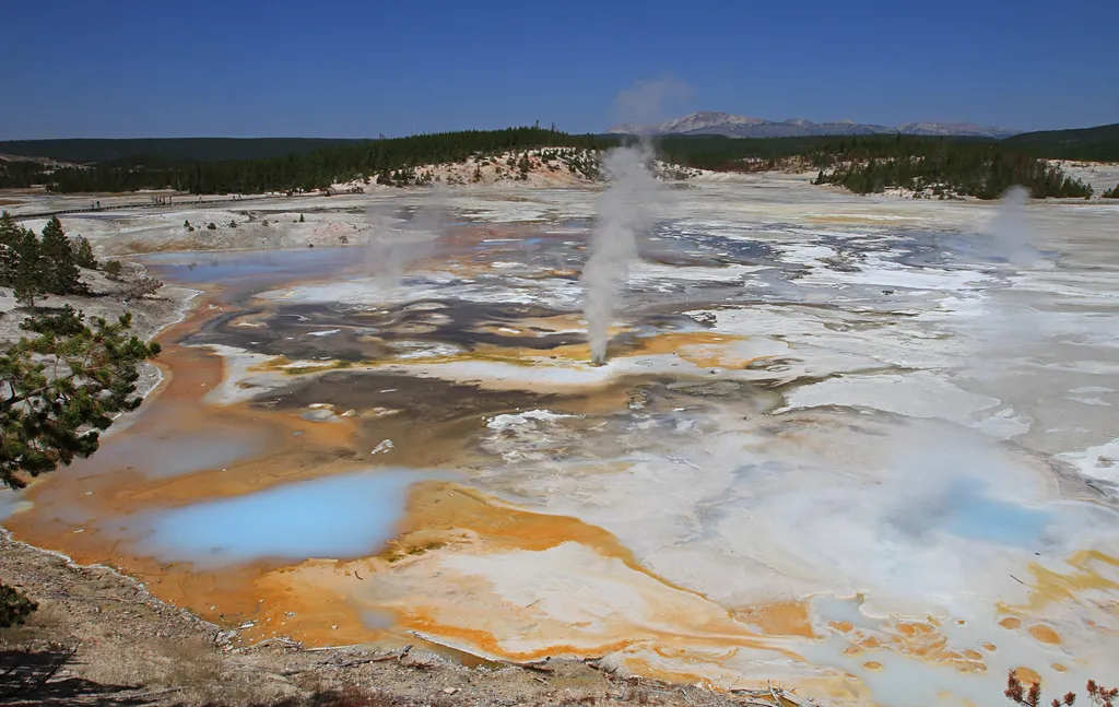 Fumaroles in Porcelain BasinHikingPhoto: NPS / public domain0.4 mi
 Norris Geyser Basin - Norris Campground TrailHikingPhoto: R. Sieben, CC BY 3.0 (via Wikimedia Commons)1.1 mi
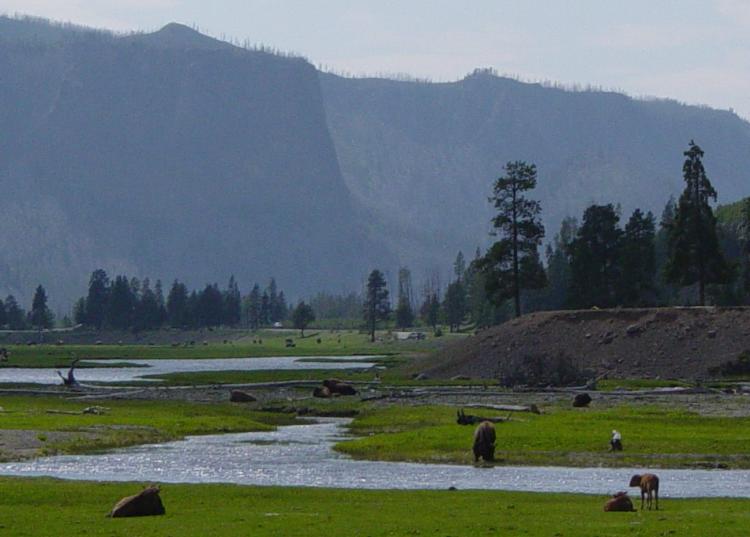 Gibbon RiverCanoeingPhoto: Daniel Mayer, CC BY-SA 3.0 (via Wikimedia Commons)1.4 mi
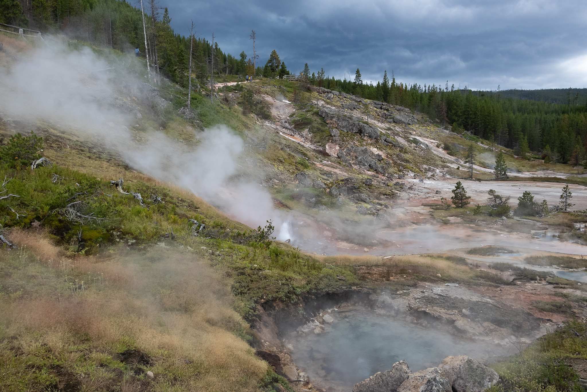 Artists Paintpots TrailHikingPhoto: NPS / public domain2.5 mi
- Monument Geyser Basin TrailHiking3.5 mi
- Howard Eaton TrailHiking3.5 mi
 Ice Lake TrailHikingPhoto: aoiaio, CC BY 3.0 (via Wikimedia Commons)3.6 mi
Source: Roamze catalog (indexable pages within 10 miles, PostGIS distance)
- Fumaroles in Porcelain BasinHiking · Next door
- Norris Geyser Basin - Norris Campground TrailHiking · ~2 min drivePhoto: R. Sieben, CC BY 3.0 (via Wikimedia Commons)
 Howard Eaton Trail:Cascade Lake-Norris CampgroundHiking · ~8 min drivePhoto: Chris Light, CC BY-SA 4.0 (via Wikimedia Commons)
 Solfatara Creek TrailHiking · ~8 min drivePhoto: Greg Willis from Denver, CO, usa, CC BY-SA 2.0 (via Wikimedia Commons)
 North Rim TrailHiking · ~18 min drivePhoto: Don Graham from Redlands, CA, USA - God bless it!, CC BY-SA 2.0 (via Wikimedia Commons)
- Lodgepole PinesHiking · ~6 min drive
- Artists Paintpots TrailHiking · ~4 min drive
 Howard Eaton Trail: Fishing Bridge-CanyonHiking · ~17 min drivePhoto: R. Sieben, CC BY 3.0 (via Wikimedia Commons)
 Wapiti Lake TrailHiking · ~18 min drivePhoto: cchadek, CC BY 3.0 (via Wikimedia Commons)
- Monument Geyser Basin TrailHiking · ~6 min drive
Also worth it near here
- Gibbon RiverCanoeing · ~2 min drivePhoto: Daniel Mayer, CC BY-SA 3.0 (via Wikimedia Commons)
 Virginia CascadeWaterfall · ~5 min drivePhoto: Rose Heil, Public domain (via Wikimedia Commons)
- Lemonade LakeLake fishing · ~8 min drive
 Purple MountainSummit · ~16 min drivePhoto: Mike Cline, Public domain (via Wikimedia Commons)
Best time to visit Back Basin
Best months: July–August. Best months have typical highs of 55–85 °F, lows of 30 °F or warmer (32 °F where the station doesn't record snow), at most one snowy day and no more than 12 wet days.
Jan
28° / 1°
14 wet
Feb
31° / 2°
12 wet
Mar
39° / 10°
13 wet
Apr
46° / 19°
12 wet
May
55° / 29°
13 wet
Jun
65° / 35°
13 wet
Jul
76° / 39°
10 wet
Aug
75° / 37°
9 wet
Sep
65° / 30°
9 wet
Oct
50° / 22°
10 wet
Nov
35° / 10°
12 wet
Dec
27° / 1°
15 wet
Typical high / low (°F) and days with rain or snow, 1991–2020. Measured at Old Faithful, WY, 19.4 mi away at 7,351 ft. This station doesn't record snowfall. Source: NOAA NCEI U.S. Climate Normals 1991–2020.
