Timm's Hill Trail
- 0.2 mi
- round trip
- 66 ft
- climb
- 1,676 ft
- high point
- Out and back
- route
- May–Oct
- best months
Timm's Hill Trail is a short, out-and-back cross-country ski route in northern Wisconsin, about 3.6 miles from the town of Rib Lake. The trail is only 0.34 miles long, with a total climb of 66 feet and a high point of 1676 feet. The route is back-loaded, with the steepest stretch at about 0.06 miles in, where the grade reaches 6 percent. Winter is the natural season for this trail. Typical averages from a nearby weather station show January highs around 21°F with lows near 0°F, while February is slightly milder at about 27°F. The station sits a few hundred feet lower than the trail, so temperatures on the hill run a little cooler. Several other ski routes lie close by. The Beginner Loop is 0.3 miles away, and the Nordic Trail and Die Promenade Trail are each about 0.4 miles off. The Ice Age Trail is roughly a mile away.
- Beginner LoopCross-country skiing0.3 mi
- Nordic TrailCross-country skiing0.4 mi
- Die Promenade TrailCross-country skiing0.4 mi
- Ice Age TrailCross-country skiing1 mi
- Old Tote Road TrailCross-country skiing1 mi
- Iat - Rib Lake SegmentHiking2 mi
- Iat - Rib Lake ConnectionHiking2 mi
- Big Rib RiverCanoeing6.1 mi
Source: Roamze catalog (indexable pages within 10 miles, PostGIS distance)
- Forest SpringsDownhill skiing · ~4 min drive
- Timm's Hill TrailCross-country skiing · Next door
- Beginner LoopCross-country skiing · Next door
- Roller CoasterCross-country skiing · ~4 min drive
- SidewinderCross-country skiing · ~4 min drive
- Timm's Hill TrailCross-country skiing · Next door
- Nordic TrailCross-country skiing · Next door
- SkidderCross-country skiing · ~4 min drive
- GaiterCross-country skiing · ~4 min drive
- Nordic TrailCross-country skiing · Next door
Also worth it near here
- James LakeLake fishing · ~5 min drive
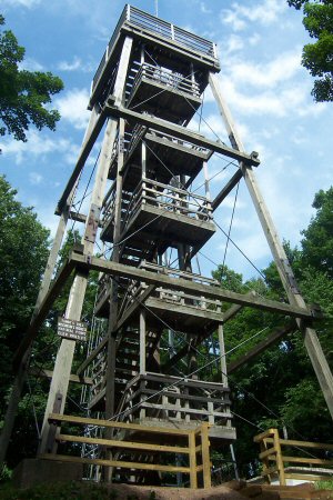 Timms HillSummit · ~11 min drivePhoto: Bmwenner at English Wikipedia, Public domain (via Wikimedia Commons)
 Black RiverCanoeing · ~22 min drivePhoto: Originally uploaded by Iulus Ascanius (Transferred by Royalbroil), Public domain (via Wikimedia Commons)
 Mondeaux River East HwtHiking · ~23 min drivePhoto: Aarongunnar, CC BY-SA 3.0 (via Wikimedia Commons)
Best time to visit Timm's Hill Trail
Best months: May–October. Best months have typical highs of 55–85 °F, lows of 30 °F or warmer (32 °F where the station doesn't record snow), at most one snowy day and no more than 12 wet days.
Jan
21° / 0°
8 wet
Feb
27° / 3°
6 wet
Mar
39° / 15°
7 wet
Apr
52° / 29°
9 wet
May
66° / 41°
10 wet
Jun
75° / 51°
11 wet
Jul
79° / 54°
10 wet
Aug
77° / 52°
9 wet
Sep
69° / 45°
9 wet
Oct
55° / 33°
9 wet
Nov
39° / 21°
7 wet
Dec
26° / 9°
8 wet
Typical high / low (°F) and days with rain or snow, 1991–2020. Measured at Prentice #2, WI, 14.1 mi away at 1,540 ft. This station doesn't record snowfall. Source: NOAA NCEI U.S. Climate Normals 1991–2020.
Map and trail data © OpenStreetMap contributors
