Ice Age Trail
- 0.2 mi
- round trip
- 30 ft
- climb
- 1,688 ft
- high point
- Out and back
- route
- May–Oct
- best months
The Ice Age Trail is a short, flat cross-country ski route in northern Wisconsin, about 2.7 miles from the town of Rib Lake. The trail is an out-and-back that covers roughly 0.4 miles, with a high point of 1,688 feet and a low of 1,663 feet. The climb is nearly flat, with a total gain and loss of about 30 feet each way, and the steepest stretch comes at about 0.08 miles in, with a grade of about 2%. Winter is the natural season for skiing here. Typical averages from a nearby weather station show January highs around 21°F with lows near 0°F, while February is slightly milder at about 27°F. Summer is warm, with July highs near 79°F. Several other trails sit close by. The Nordic Trail and Old Tote Road Trail are each about 0.2 miles away, and Die Promenade Trail is about 0.6 miles off. For a longer outing, the Iat - Rib Lake Segment hike is about 1.2 miles away.
- Nordic TrailCross-country skiing0.2 mi
- Old Tote Road TrailCross-country skiing0.2 mi
- Die Promenade TrailCross-country skiing0.6 mi
- Timm's Hill TrailCross-country skiing1 mi
- Iat - Rib Lake SegmentHiking1.2 mi
- Iat - Rib Lake ConnectionHiking1.2 mi
- Big Rib RiverCanoeing5.2 mi
- Iat - East Lake SegmentHiking5.9 mi
Source: Roamze catalog (indexable pages within 10 miles, PostGIS distance)
- Forest SpringsDownhill skiing · ~4 min drive
- Nordic TrailCross-country skiing · Next door
- Nordic TrailCross-country skiing · ~1 min drive
- GaiterCross-country skiing · ~3 min drive
- Roller CoasterCross-country skiing · ~4 min drive
- Old Tote Road TrailCross-country skiing · Next door
- KickerCross-country skiing · ~3 min drive
- SidewinderCross-country skiing · ~3 min drive
- SkidderCross-country skiing · ~4 min drive
- Nordic TrailCross-country skiing · Next door
Also worth it near here
- James LakeLake fishing · ~4 min drive
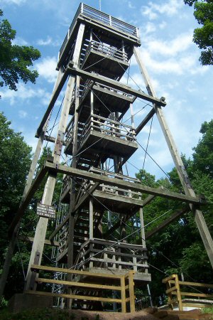 Timms HillSummit · ~12 min drivePhoto: Bmwenner at English Wikipedia, Public domain (via Wikimedia Commons)
 Black RiverCanoeing · ~20 min drivePhoto: Originally uploaded by Iulus Ascanius (Transferred by Royalbroil), Public domain (via Wikimedia Commons)
- EastwoodCamping · ~22 min drive
Best time to visit Ice Age Trail
Best months: May–October. Best months have typical highs of 55–85 °F, lows of 30 °F or warmer (32 °F where the station doesn't record snow), at most one snowy day and no more than 12 wet days.
Jan
21° / 0°
8 wet
Feb
27° / 3°
6 wet
Mar
39° / 15°
7 wet
Apr
52° / 29°
9 wet
May
66° / 41°
10 wet
Jun
75° / 51°
11 wet
Jul
79° / 54°
10 wet
Aug
77° / 52°
9 wet
Sep
69° / 45°
9 wet
Oct
55° / 33°
9 wet
Nov
39° / 21°
7 wet
Dec
26° / 9°
8 wet
Typical high / low (°F) and days with rain or snow, 1991–2020. Measured at Prentice #2, WI, 14.8 mi away at 1,540 ft. This station doesn't record snowfall. Source: NOAA NCEI U.S. Climate Normals 1991–2020.
Map and trail data © OpenStreetMap contributors
