Penokee Mountain Ski Trail
- 1.0 mi
- round trip
- 420 ft
- climb
- 1,446 ft
- high point
- Out and back
- route
- May–Sep
- best months
Is Penokee Mountain Ski Trail open right now?
Closure in the area
There's a closure order in Chequamegon-Nicolet National Forest. It doesn't name Penokee Mountain Ski Trail, so check the source for the area it covers (2 listed).
Trail work and picnic area improvements at Morgan Falls/St. Peter's Dome Recreation Area this fall
Agency closure covering Chequamegon-Nicolet National Forest · USFS · Chequamegon-Nicolet National Forest
Forest Order 09-13-25-02 General Occupancy and Use Restrictions
Agency closure covering Chequamegon-Nicolet National Forest · Order 09-13-25-02 · USFS · Chequamegon-Nicolet National Forest
As of · Source: USFS · Chequamegon-Nicolet National Forest. Agencies don't list every closure — check before you go.
The Penokee Mountain Ski Trail is a cross-country skiing route in Wisconsin's Chequamegon-Nicolet National Forest, within the Great Divide Ranger District. It is a short out-and-back that rises from about 1,350 feet to roughly 1,446 feet over a round trip of about 2 miles, with the steepest stretch around the 0.66-mile mark at about 8%. For a ski day, winter is the season to plan around. Typical averages from a nearby weather station in Mellen show January highs around 21°F with lows near 2°F and snow on about 13 days, while May runs about 64°F by day and has snow on only one day. Snow days drop to zero from June through September. Several other routes sit close by, including the North Country National 604-390 hike at about a tenth of a mile and the Penokee Mtn Ski Trail 5.1 KM at about half a mile. For camping, Mineral Lake is about 5 miles away, and Lake Three is about 6 miles away.
- North Country National 604-390Hiking0.1 mi
- PENOKEE MTN SKI TRAIL 3.2 KMHiking0.2 mi
- Penokee Moutain Ski TrailCross-country skiing0.3 mi
- PENOKEE MTN SKI TRAIL 5.1 KMHiking0.5 mi
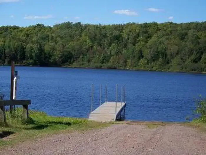 Mineral LakeCampingPhoto: Recreation.gov (RIDB) / public domain5.4 mi
 Lake ThreeCampingPhoto: Recreation.gov (RIDB) / public domain6.4 mi
 Beaver Lake (Chequamegon-Nicolet NF, WI)CampingPhoto: Recreation.gov (RIDB) / public domain7.5 mi
- Beaver LakeCamping8.4 mi
Source: Roamze catalog (indexable pages within 10 miles, PostGIS distance)
- Penokee Mtn Ski Trail 5.1 KmCross-country skiing · Next door
- Conservancy TrailCross-country skiing · ~34 min drive
- Whitecap MountainDownhill skiing · ~28 min drive
- Easy Way Out TrailCross-country skiing · ~8 min drive
- Rock Lake National RecreationCross-country skiing · ~37 min drive
- Forest Lodge Nature TrailCross-country skiing · ~35 min drive
- Takesson TrailCross-country skiing · ~8 min drive
- Rock Lake National Rec 7.1KmCross-country skiing · ~37 min drive
- Nglvc Boardwalk North Loop SnoCross-country skiing · ~37 min drive
- Pipeline TrailCross-country skiing · ~8 min drive
Best time to visit Penokee Mountain Ski Trail
Best months: May–September. Best months have typical highs of 55–85 °F, lows of 30 °F or warmer (32 °F where the station doesn't record snow), at most one snowy day and no more than 12 wet days.
Jan
21° / 2°
13 wet · 13 snow
Feb
26° / 5°
10 wet · 10 snow
Mar
37° / 15°
10 wet · 8 snow
Apr
50° / 28°
11 wet · 3 snow
May
64° / 40°
12 wet · 1 snow
Jun
73° / 50°
12 wet
Jul
77° / 55°
11 wet
Aug
76° / 54°
10 wet
Sep
68° / 46°
11 wet
Oct
54° / 34°
12 wet · 2 snow
Nov
38° / 22°
11 wet · 6 snow
Dec
26° / 10°
13 wet · 11 snow
Typical high / low (°F) and days with rain or snow, 1991–2020. Measured at Mellen 4 Ne, WI, 5.1 mi away at 1,300 ft. Source: NOAA NCEI U.S. Climate Normals 1991–2020.

Map and trail data © OpenStreetMap contributors
