Loading trail…

Free — you'll pick up right here.
Save this plan
Sign up to save your own editable copy — you'll pick up right here.
West Virginia
0.7 mi
Distance
896 ft
Gain
26 min
Time
No conditions check on file for this trail yet — always verify current conditions before you go.
Why you'll love it
Keeneys Creek Rail Trail
AI-suggested draft · review before you go
No permit or access details on file for this trail — check with the local land manager before you go.
<p><em>Labeled (3) on the Nuttallburg Area Trails map</em></p> <h4><br /> Length</h4> <p>3.3 miles/5.31 km (One-way)</p> <h4>Difficulty</h4> <p>Easy</p> <h4>Trail type</h4> <p>Hiking and biking</p> <h4>Trail Description</h4> <p>This former rail line once connected the mines and communities up Keeneys Creek to Nuttallburg and the Chesapeake & Ohio Railway mainline. Enjoy a leisurely stroll or bike ride on this wide trail that criss-crosses the rugged mountain landscape at a 4% grade. Here it is easy to see how the rugged terrain was a great challenge to those who constructed this railroad line over 100 years ago. This trail crosses under the conveyor, plus several trestle bridges offer spectacular views of scenic mountain streams, like Short Creek. Trail connections can be made from this trail to the Conveyor Trail and Town Loop Connector Trail.</p> <h4><span style="color:#e74c3c;">Note</span></h4> <p><span style="color:#e74c3c;">Keeneys Creek Rail Trail is currently closed due to a dangerous washout. Please check back for updates. </span><br /> <br /> Lansing-Edmond Road and Keeneys Creek Road are both very small, curvy roads, including some single lane sections. Use caution while driving and be prepared to cooperate with other drivers; this may include reversing!</p> <h4>To reach the trailhead</h4> <p>This trail has two small trailhead parking areas on Keeneys Creek Road. To get to these parking areas, turn onto Lansing-Edmond Road (CO 5/82) off US 19 in Lansing, just north of Canyon Rim Visitor Center. Travel 6.0 miles to Winona, then turn right onto Keeneys Creek Road (CO 85/2). Travel 2.0 miles to the first trailhead parking area, just past the second bridge. Travel an additional 1.5 miles down this road to the second trailhead parking area on the right. <br /> <br /> Winona can also be reached by traveling US 60 to Lansing-Edmond Road (CO 5/82) in Lookout. Travel 2.1 miles down Lansing-Edmond Road to Winona, then continue straight ahead 2.0 miles on Keeneys Creek Road (CO 85/2) to the first trailhead parking area or an additional 1.5 miles to the second parking area.</p>
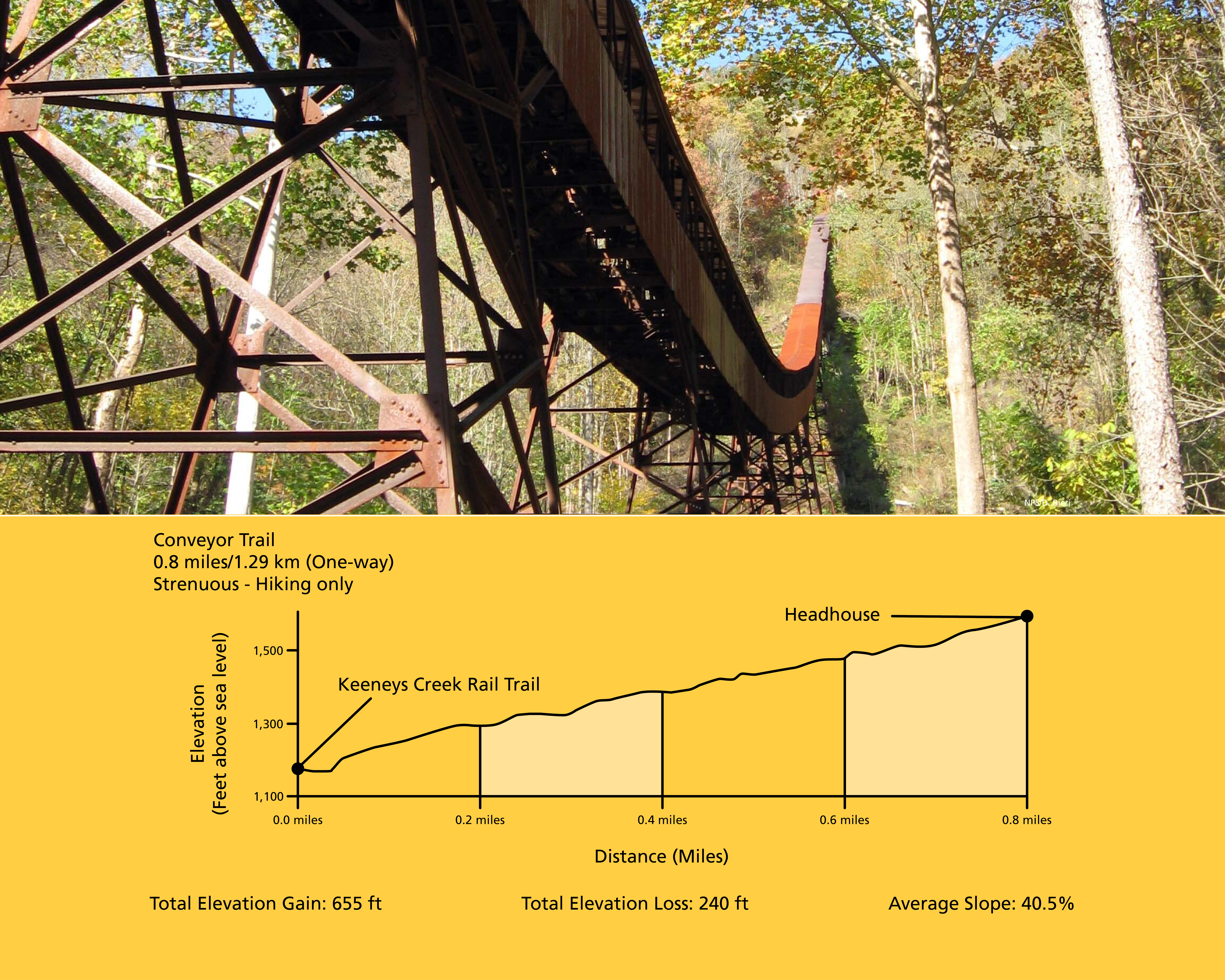
Conveyor Trail
~1 min drive
<p><em>Labeled (2) on the Nuttallburg Area Trails map</em></p> <h4>Length</h4> <p>0.8 miles/1.29 km (One-way)</p> <h4>Difficulty</h4> <p>Strenuous</p> <h4>Trail type</h4> <p>Hiking only</p> <h4>Total Elevation Gain</h4> <p>655 ft</p> <h4>Total Elevation Loss</h4> <p>240 ft</p>…
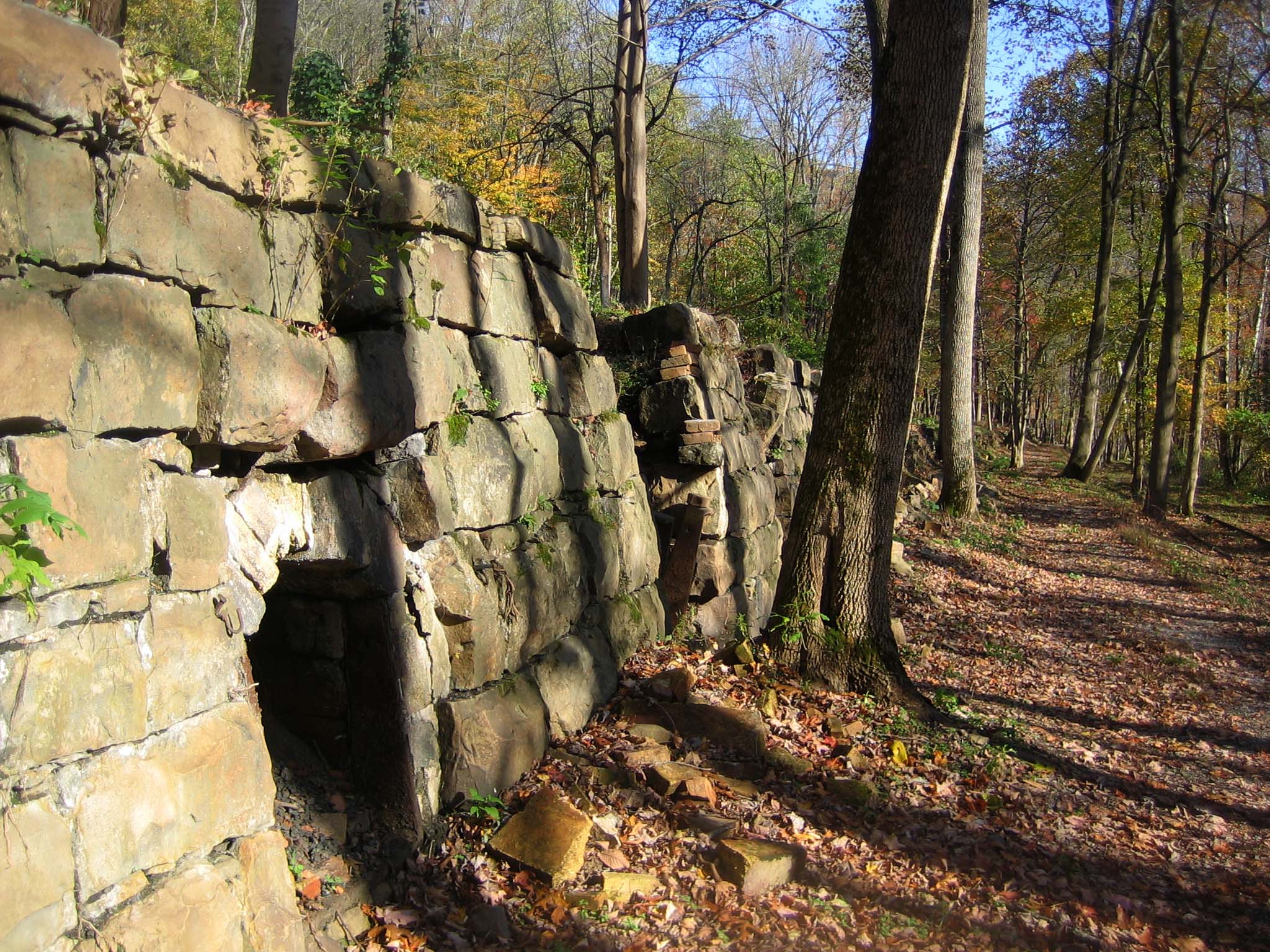
Tipple Trail
~1 min drive
<p><em>Labeled (6) on the Nuttallburg Area Trails map</em></p> <h4>Length</h4> <p>0.6 miles/0.96 km (One-way)</p> <h4>Difficulty</h4> <p>Easy</p> <h4>Trail type</h4> <p>Hiking and biking</p> <h4>Trail Description</h4> <p>This trail reveals both the industrial and community sid…

Headhouse Trail
~1 min drive
<p><em>Labeled (1) on the Nuttallburg Area Trails map</em></p> <h4>Length</h4> <p>0.7 miles/1.13 km (One-way)</p> <h4>Difficulty</h4> <p>Moderate</p> <h4>Trail type</h4> <p>Hiking and biking</p> <h4>Trail Description</h4> <p>This gravel trail (administrative road) leads to the…
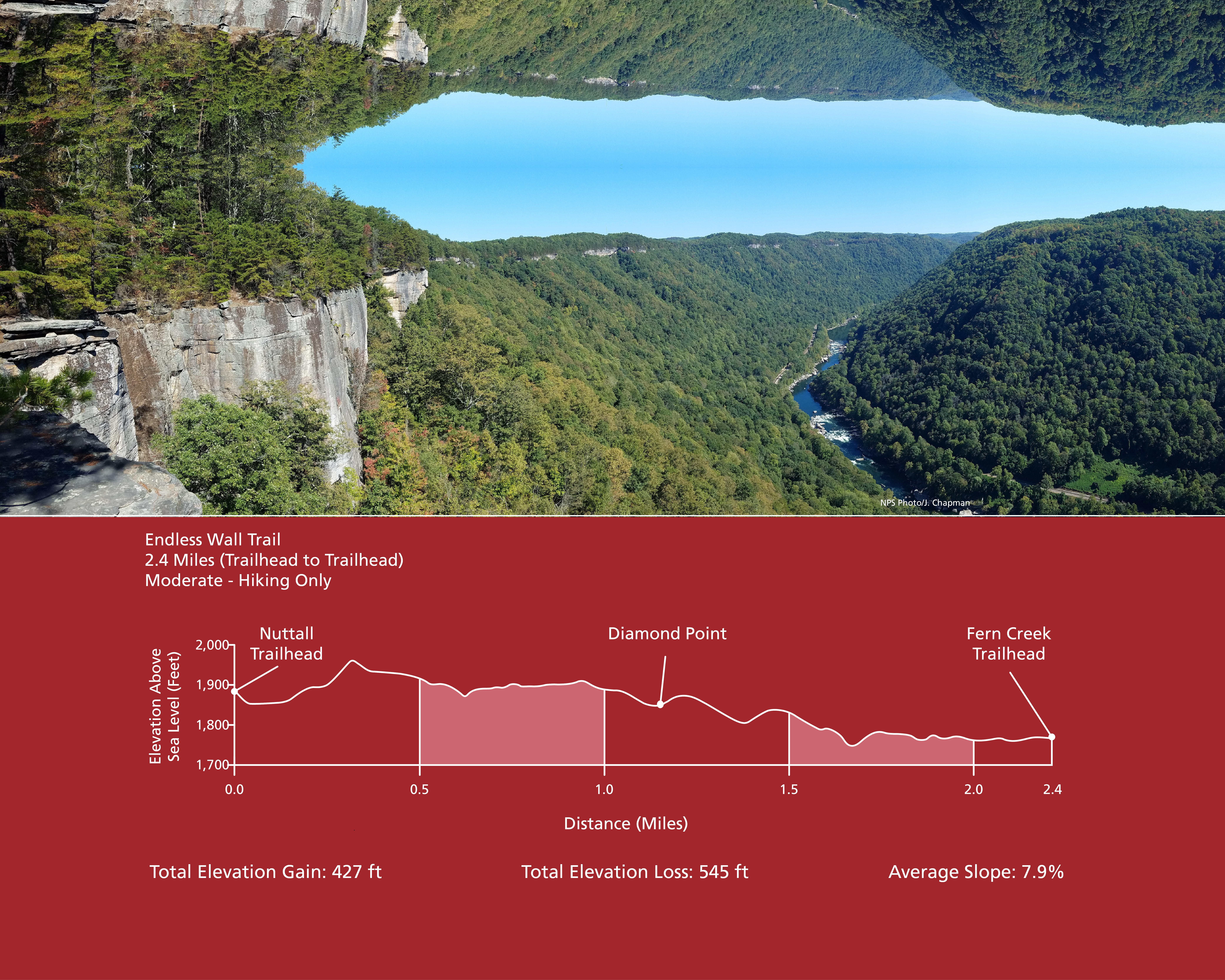
Endless Wall Trail
~3 min drive
<p><em>Labeled (3) on the Fayetteville - Lansing Area Trails map</em></p> <h4><strong>Length</strong></h4> <p>2.4 miles/3.86 km (One-way)</p> <h4><strong>Difficulty</strong></h4> <p>Easy to Moderate</p> <h4><strong>Trail type</strong></h4> <p>Hiking only</p> <h4>Total Elevatio…

Kaymoor Miners Trail
~3 min drive
<p><em>Labeled (9) on the Fayetteville - Lansing Area Trails map</em></p> <h4><span style="color:#e74c3c;"><em>NPS crews are working to improve safety and sustainability of the upper section of the Kaymoor Miner's Trail. The upper portion of the trail will be closed from June…
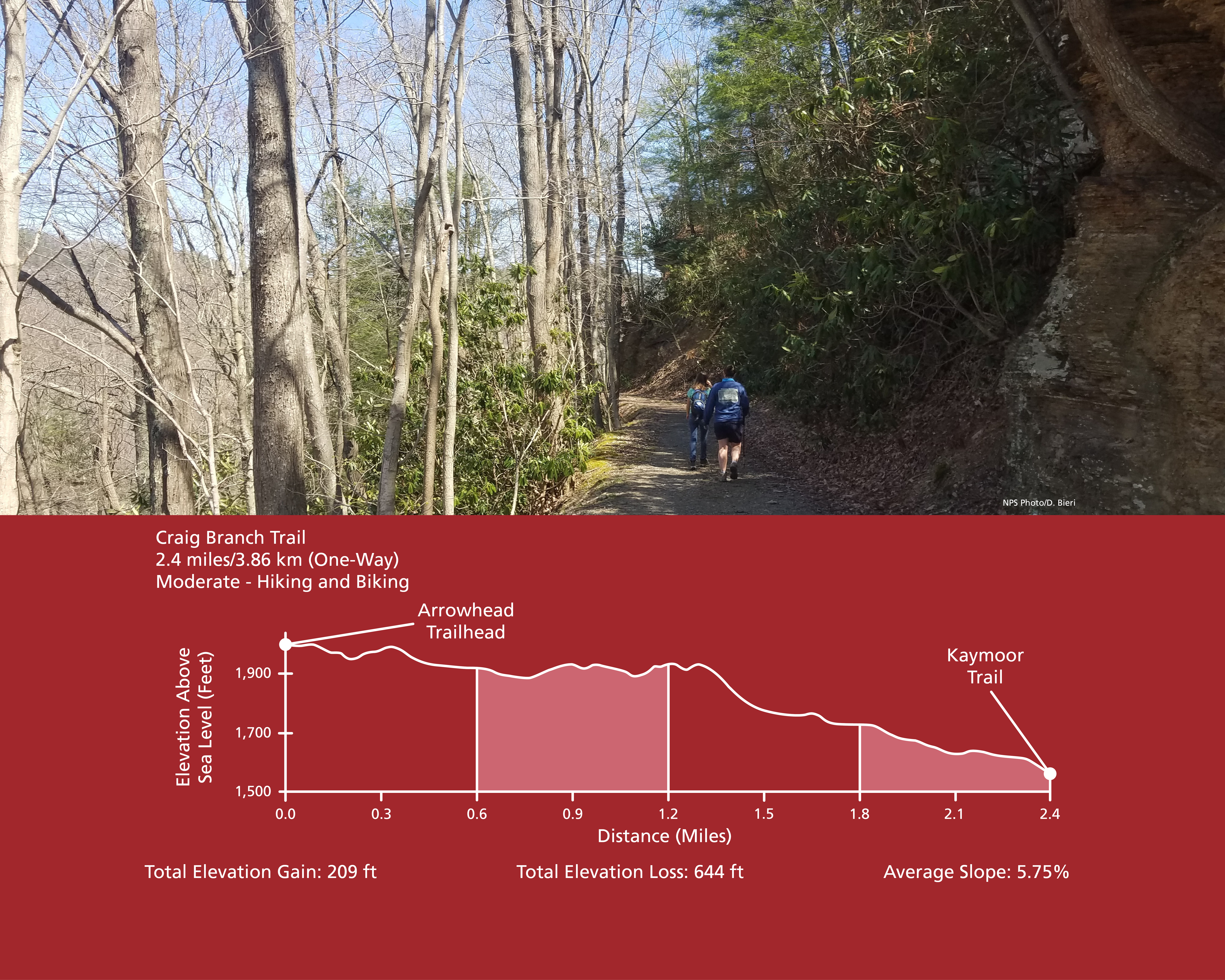
Craig Branch Trail
~3 min drive
<p><em>Labeled (10) on the Fayetteville - Lansing Area Trails map</em><br /> <br /> (Formerly part of the Kaymoor-Cunard Trail)</p> <h4><strong>Length</strong></h4> <p>2.4 miles/3.86 km (One-way)</p> <h4><strong>Difficulty</strong></h4> <p>Moderate</p> <h4><strong>Trail type</…
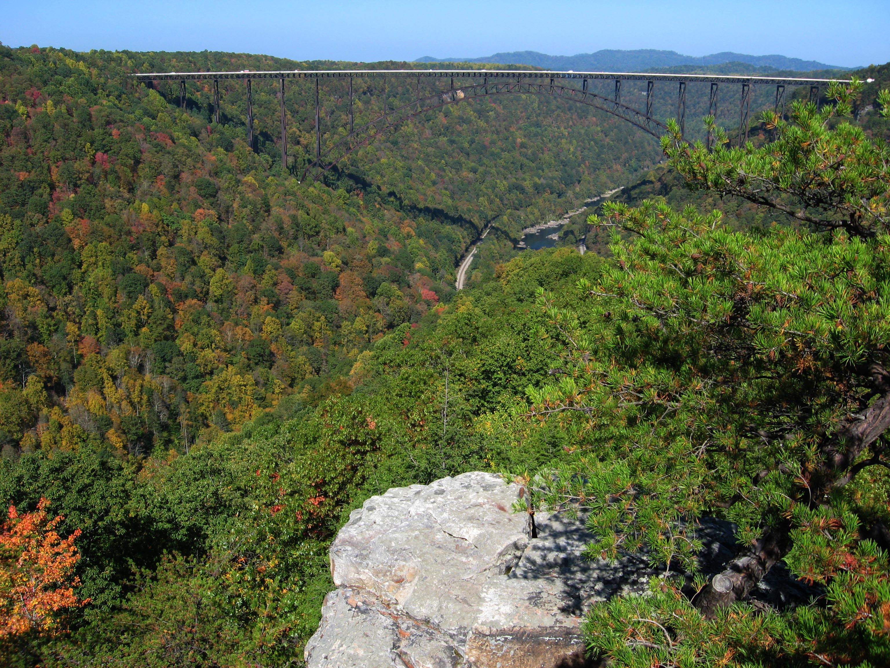
Long Point Trail
~4 min drive
<p><em>Labeled (12) on the Fayetteville - Lansing Area Trails map</em></p> <h4><strong>Length</strong></h4> <p>1.6 miles/1.29 km (One-way)</p> <h4><strong>Difficulty</strong></h4> <p>Moderate</p> <h4><strong>Trail type</strong></h4> <p>Hiking and biking </p> <h4>Trail Descript…

Brooklyn Mine Trail
~5 min drive
<p><em>Labeled (1) on the Cunard, Thurmond and Stone Cliff Area Trails map</em></p> <h4>Length</h4> <p>2.7 miles/4.35 km (One-way)</p> <h4>Difficulty</h4> <p>Moderate</p> <h4><strong>Trail type</strong></h4> <p>Hiking, biking and equestrian</p> <h4>Total Elevation Gain</h4> <p…
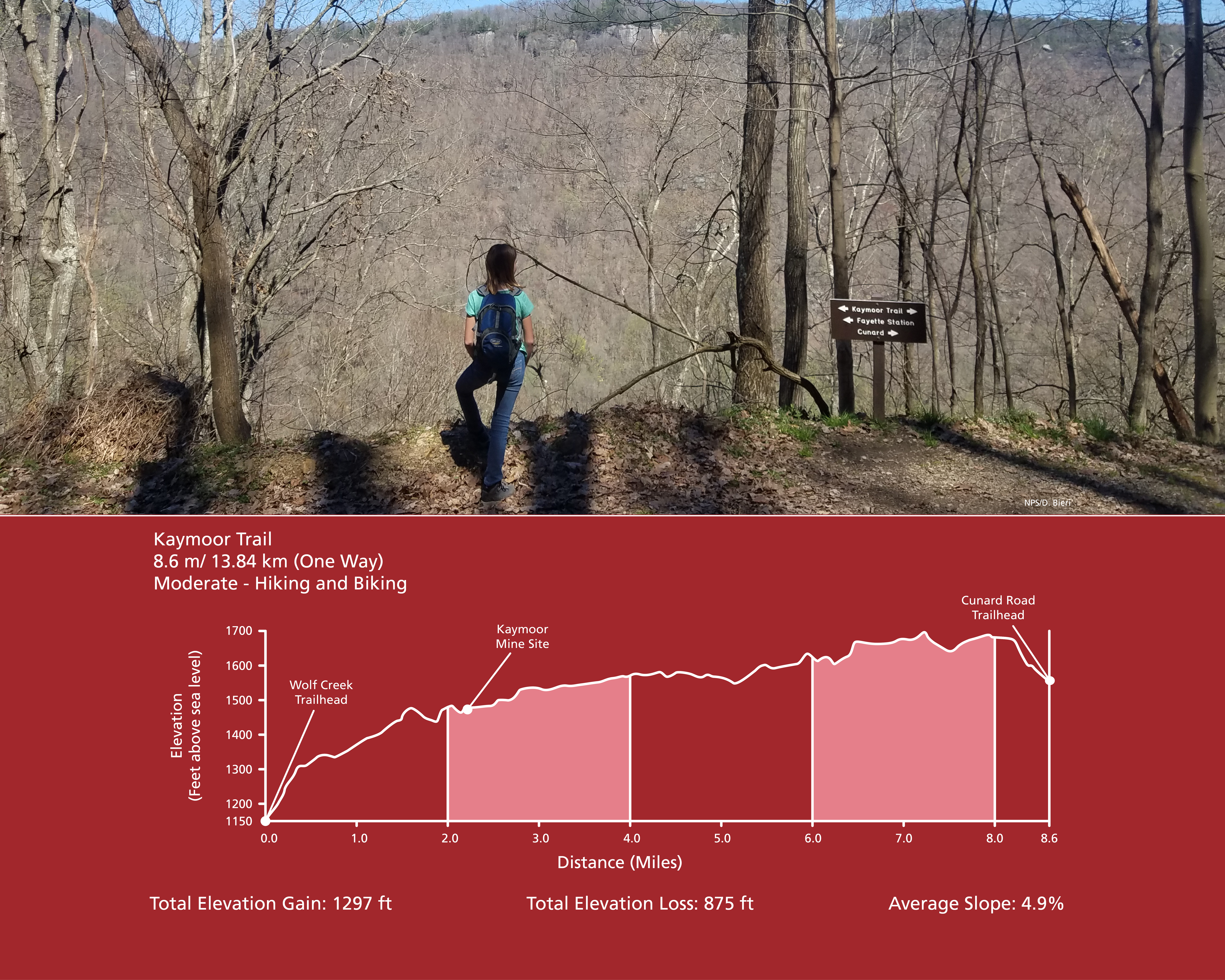
Kaymoor Trail
~5 min drive
<p><em>Labeled (8) on the Fayetteville - Lansing Area Trails map</em><br /> <br /> (Formerly part of the Kaymoor-Cunard Trail)</p> <h4><strong style="color: rgb(34, 34, 34); font-family: inherit; font-size: 1.25rem;">Length</strong></h4> <p>8.6 miles/13.84 km (One-way)</p> <h4…
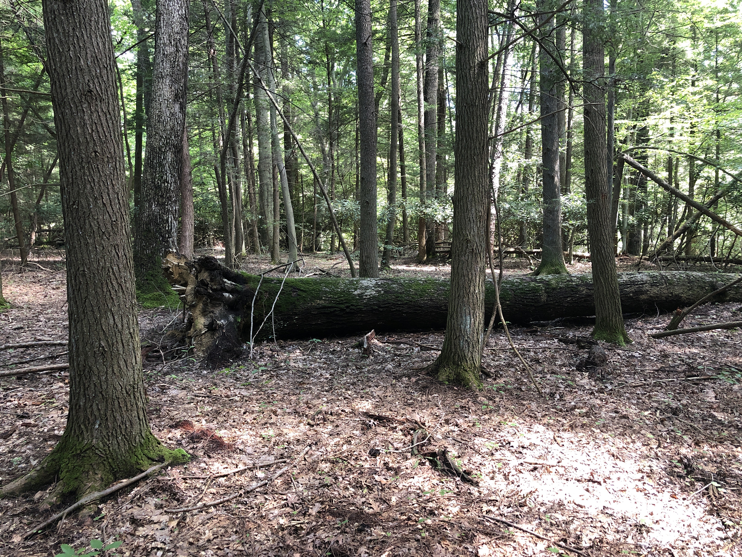
Burnwood Trail Stop 8: Decomposition
~6 min drive
<p><strong>Old-Growth Forest Hike Stop 8 - Decomposition</strong></p> <p>There are many different components other than just big, old trees that make up an old-growth forest. Large fallen trees on the forest floor, also called coarse woody debris, are a key feature researchers…