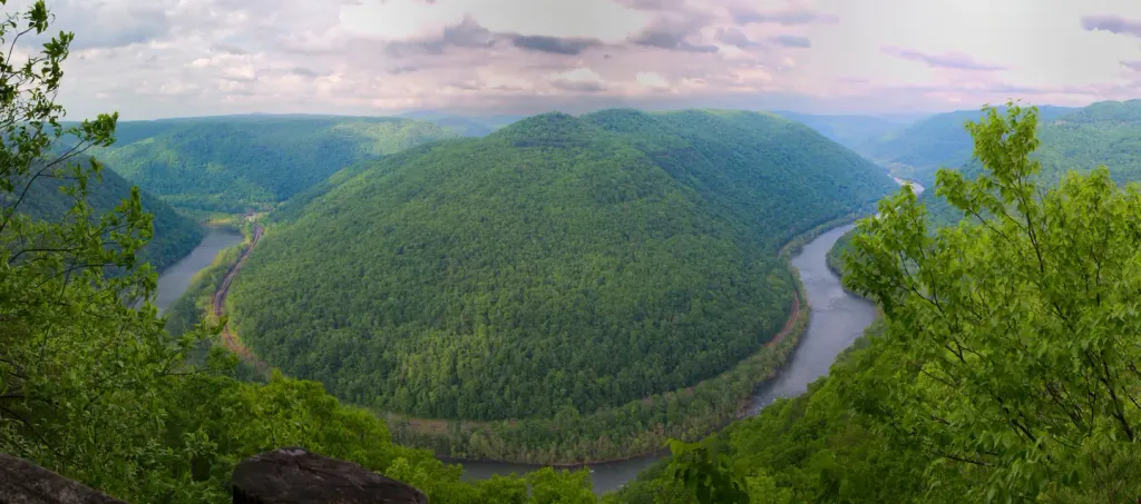
Loading trail…

Free — you'll pick up right here.
Save this plan
Sign up to save your own editable copy — you'll pick up right here.
West Virginia
2.6 mi
Distance
4,654 ft
Gain
2h 27m
Time
No conditions check on file for this trail yet — always verify current conditions before you go.
Why you'll love it
Kaymoor Trail
AI-suggested draft · review before you go
No permit or access details on file for this trail — check with the local land manager before you go.
<p><em>Labeled (8) on the Fayetteville - Lansing Area Trails map</em><br /> <br /> (Formerly part of the Kaymoor-Cunard Trail)</p> <h4><strong style="color: rgb(34, 34, 34); font-family: inherit; font-size: 1.25rem;">Length</strong></h4> <p>8.6 miles/13.84 km (One-way)</p> <h4><strong>Difficulty</strong></h4> <p>Moderate</p> <h4><strong>Trail type</strong></h4> <p>Hiking and biking</p> <h4>Total Elevation Gain </h4> <p>1297 ft</p> <h4>Total Elevation Loss</h4> <p>875 ft</p> <h4>Average Slope</h4> <p>4.9%</p> <h4>Trail Description</h4> <p>The Kaymoor Trail runs parallel with the middle of the gorge, passing the historic coal mine site at Kaymoor. The northern two miles of the trail, from Wolf Creek trailhead to the old mine site, follows an old road. Wayside exhibits interpret the Kaymoor mine operation and community along the way. After passing the mine site the forested trail continues toward Cunard. Connections can be made with the steep <a href="https://www.nps.gov/places/kaymoor-miners-trail.htm">Kaymoor Miner's Trail</a> at the mine site, or the <a href="https://www.nps.gov/places/craig-branch-trail.htm">Craig Branch Trail</a>, 1.74 miles further down the trail from the mine site.</p> <h4><span style="color:#e74c3c;">Note</span></h4> <p><span style="color:#e74c3c;">For your safety, please do not enter any of the abandoned structures in the Kaymoor area.</span></p> <h4><strong>To reach the Wolf Creek Trailhead</strong></h4> <p>Turn off U.S. Route 19 onto Lansing-Edmond Road (Route 5), just north of Canyon Rim Visitor Center. Follow signs for County Route 82, turning right onto Fayette Station Road (a very narrow road with hairpin turns), then fork to the left. Follow the one-way Fayette Station Road to the bottom of the gorge. Cross the New River on the Tunney Hunsaker Bridge and continue for 1.2 miles to the small parking area at the trailhead. There are specific "No Parking" areas near the trailhead, please observe and obey the parking signs.</p> <h4><span style="color:#e74c3c;">NOTE</span></h4> <p><span style="color:#e74c3c;">There is <strong>VERY LIMITED</strong> parking at this trailhead. Please park directly in front of the trailhead or past the trailhead, around the hairpin turn, in the pullouts on the right. <strong>DO NOT PARK</strong> on the left side of the road on the approach to the trailhead. Parking here is not allowed and prevents larger vehicles from making the hairpin turn and can cause traffic jams.</span></p> <h4>To reach the Cunard Road Trailhead</h4> <p>From US 19, follow Route 16 south through the town of Fayetteville. Take a left on Gatewood Road (sign indicates Kaymoor and Cunard). Follow Gatewood Road for 4.6 miles and turn left at the sign for Cunard. Go 1.8 miles and turn left at both of the signs indicating Cunard River Access Road. Parking for the Kaymoor Trail is located 0.5 miles further on the right. The trail begins about 50 yards back on the other side of the road.<br /> <br /> </p>

Brooklyn Mine Trail
~0 min drive
<p><em>Labeled (1) on the Cunard, Thurmond and Stone Cliff Area Trails map</em></p> <h4>Length</h4> <p>2.7 miles/4.35 km (One-way)</p> <h4>Difficulty</h4> <p>Moderate</p> <h4><strong>Trail type</strong></h4> <p>Hiking, biking and equestrian</p> <h4>Total Elevation Gain</h4> <p…
Southside Trail
~2 min drive
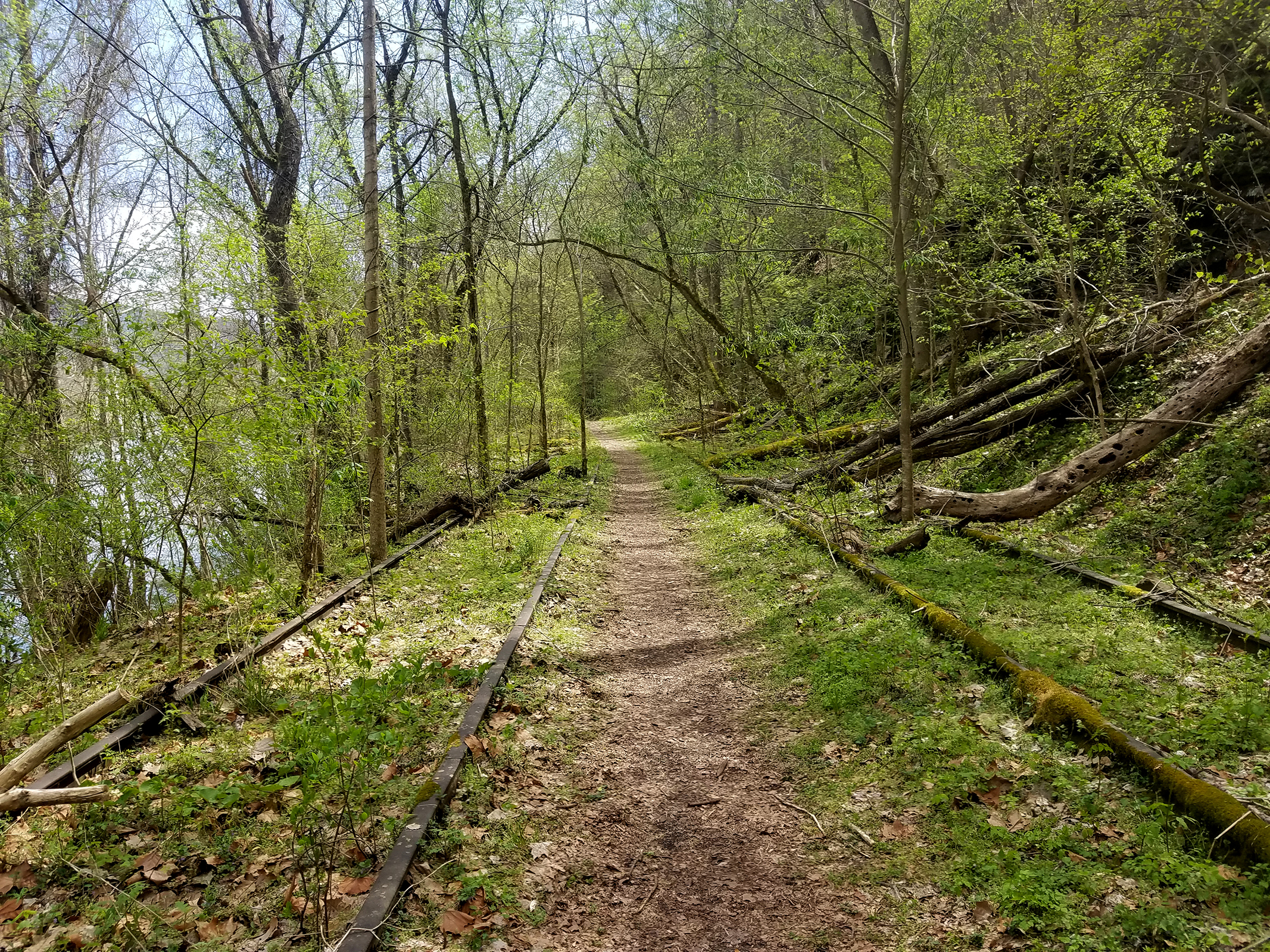
<p><em>Labeled (2) on the Cunard, Thurmond and Stone Cliff Area Trails map</em></p> <h4>Length</h4> <p>7.0 miles/11.27 km (One-way)</p> <h4>Difficulty</h4> <p>Easy</p> <h4>Trail type</h4> <p>Hiking and biking</p> <h4>Trail Description</h4> <p>This easy seven mile riverside tra…
Keeneys Creek Rail Trail
~5 min drive
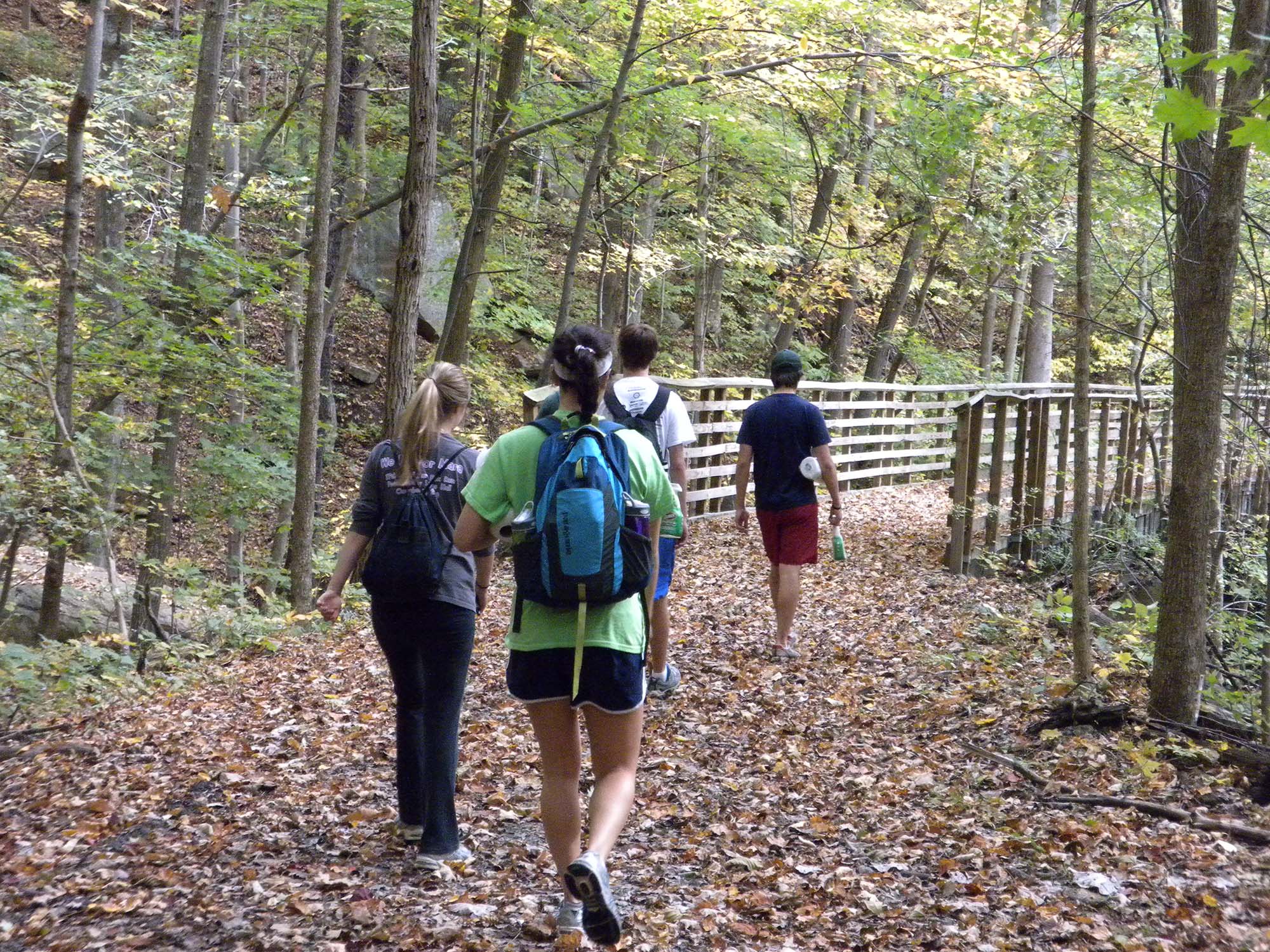
<p><em>Labeled (3) on the Nuttallburg Area Trails map</em></p> <h4><br /> Length</h4> <p>3.3 miles/5.31 km (One-way)</p> <h4>Difficulty</h4> <p>Easy</p> <h4>Trail type</h4> <p>Hiking and biking</p> <h4>Trail Description</h4> <p>This former rail line once connected the mines an…
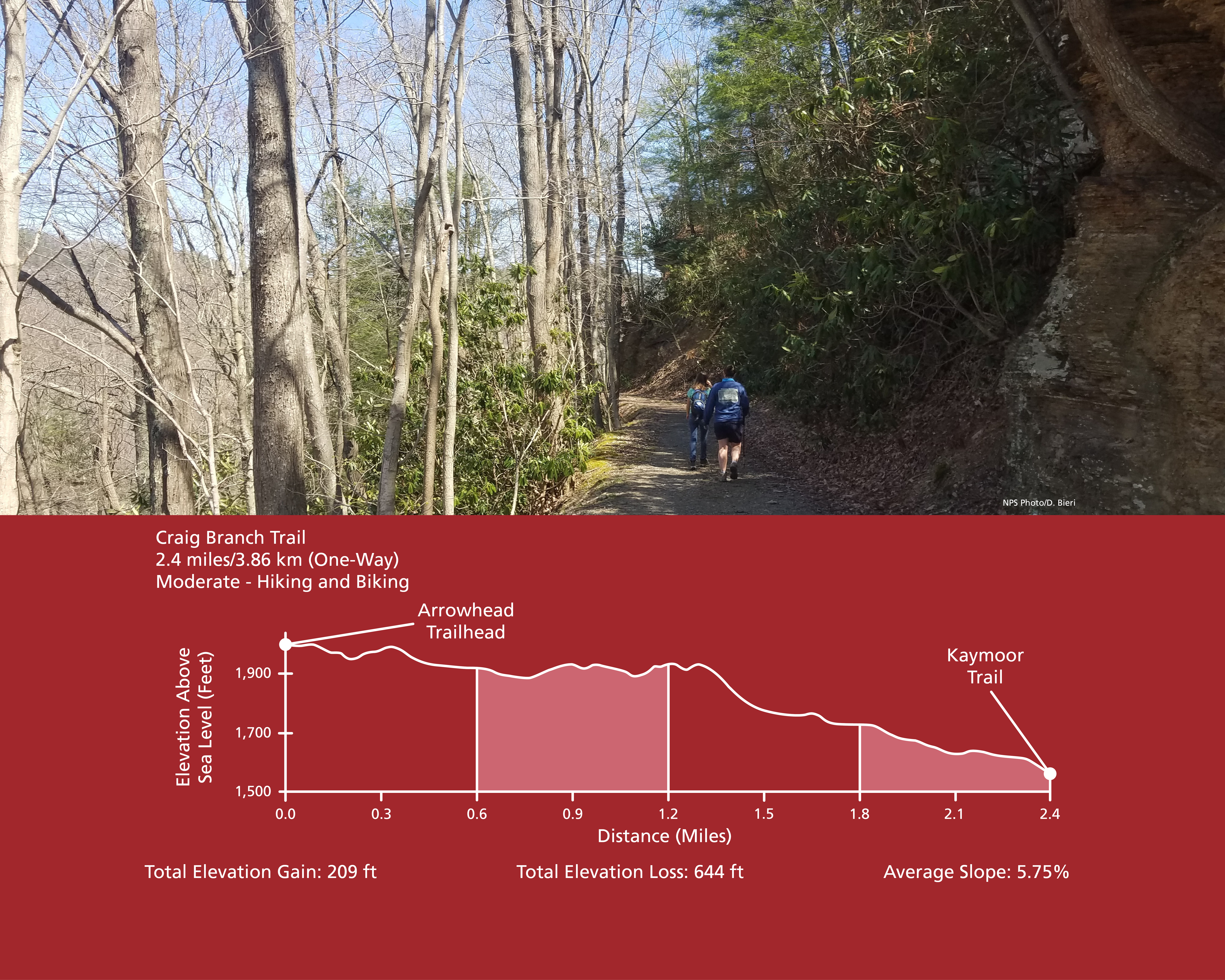
Craig Branch Trail
~6 min drive
<p><em>Labeled (10) on the Fayetteville - Lansing Area Trails map</em><br /> <br /> (Formerly part of the Kaymoor-Cunard Trail)</p> <h4><strong>Length</strong></h4> <p>2.4 miles/3.86 km (One-way)</p> <h4><strong>Difficulty</strong></h4> <p>Moderate</p> <h4><strong>Trail type</…
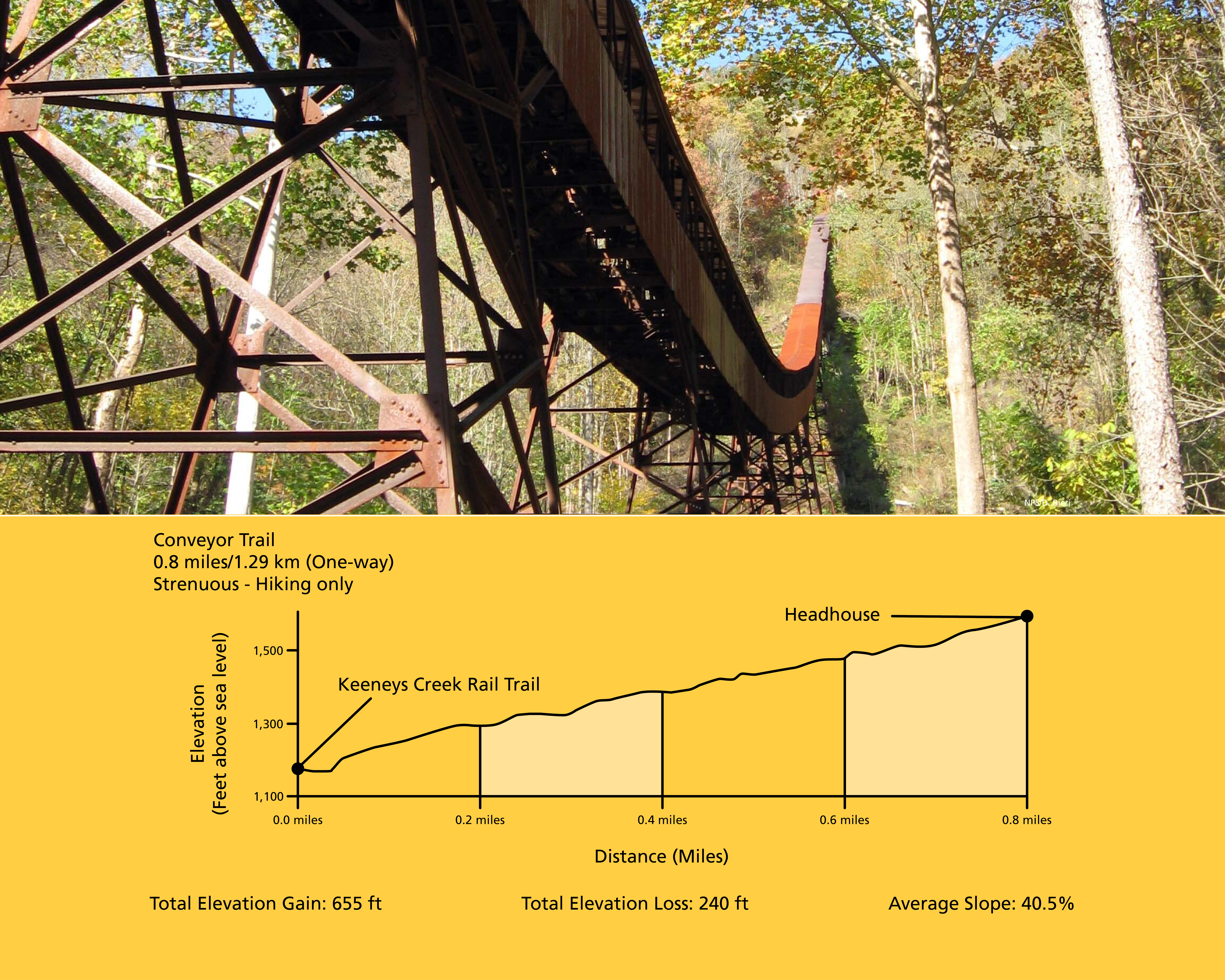
Conveyor Trail
~6 min drive
<p><em>Labeled (2) on the Nuttallburg Area Trails map</em></p> <h4>Length</h4> <p>0.8 miles/1.29 km (One-way)</p> <h4>Difficulty</h4> <p>Strenuous</p> <h4>Trail type</h4> <p>Hiking only</p> <h4>Total Elevation Gain</h4> <p>655 ft</p> <h4>Total Elevation Loss</h4> <p>240 ft</p>…
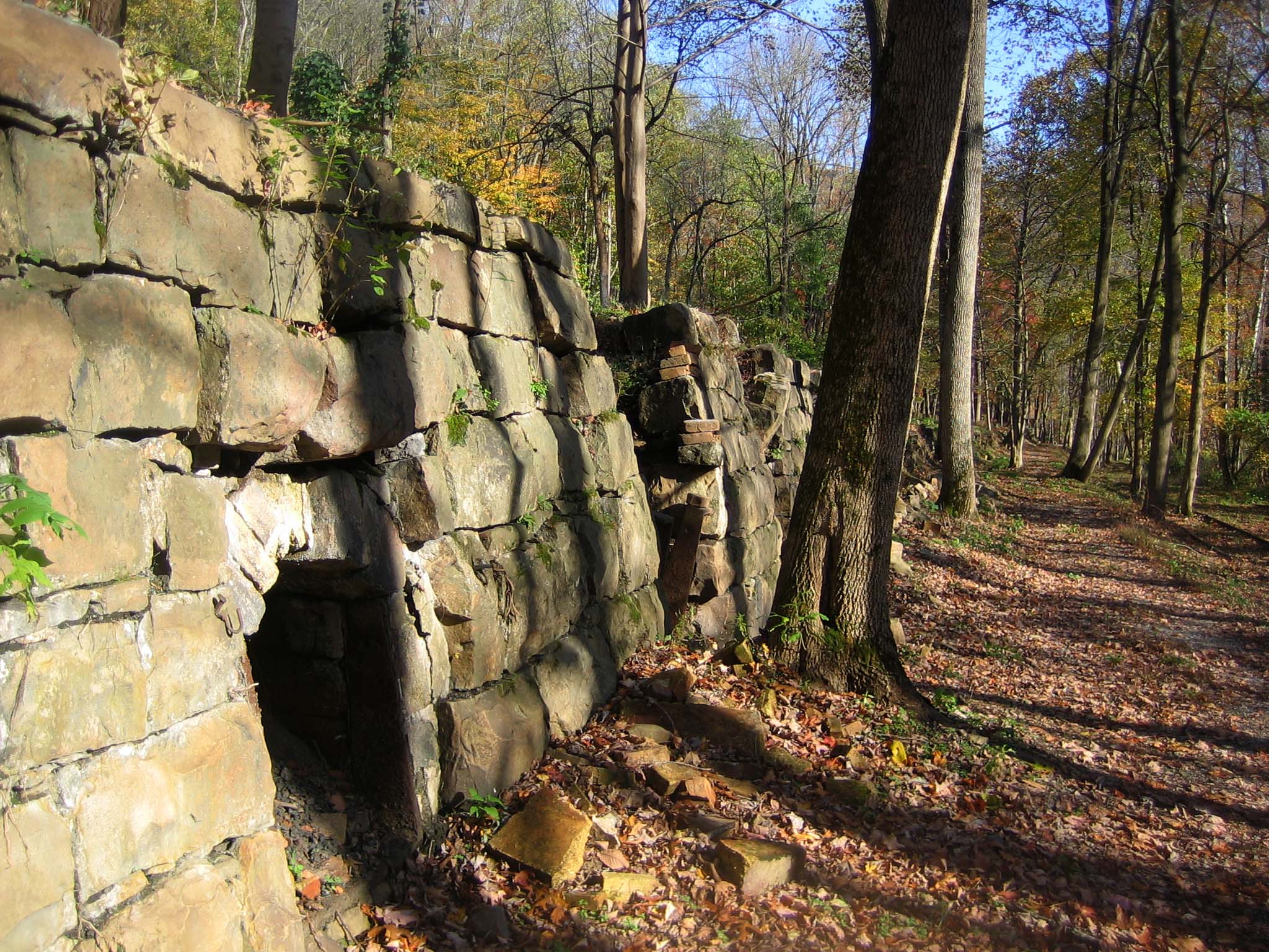
Tipple Trail
~6 min drive
<p><em>Labeled (6) on the Nuttallburg Area Trails map</em></p> <h4>Length</h4> <p>0.6 miles/0.96 km (One-way)</p> <h4>Difficulty</h4> <p>Easy</p> <h4>Trail type</h4> <p>Hiking and biking</p> <h4>Trail Description</h4> <p>This trail reveals both the industrial and community sid…

Kaymoor Miners Trail
~6 min drive
<p><em>Labeled (9) on the Fayetteville - Lansing Area Trails map</em></p> <h4><span style="color:#e74c3c;"><em>NPS crews are working to improve safety and sustainability of the upper section of the Kaymoor Miner's Trail. The upper portion of the trail will be closed from June…
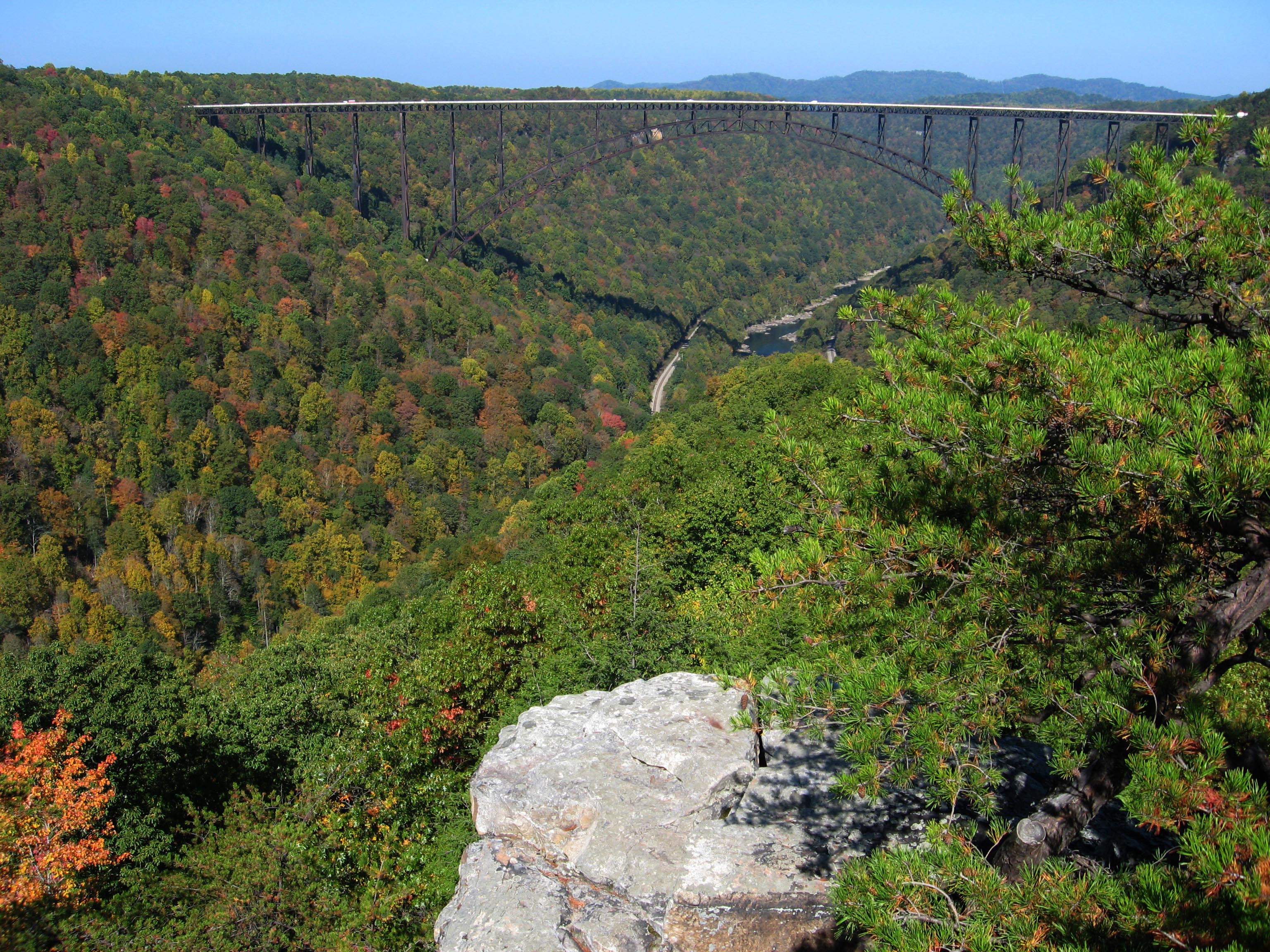
Long Point Trail
~6 min drive
<p><em>Labeled (12) on the Fayetteville - Lansing Area Trails map</em></p> <h4><strong>Length</strong></h4> <p>1.6 miles/1.29 km (One-way)</p> <h4><strong>Difficulty</strong></h4> <p>Moderate</p> <h4><strong>Trail type</strong></h4> <p>Hiking and biking </p> <h4>Trail Descript…

Headhouse Trail
~7 min drive
<p><em>Labeled (1) on the Nuttallburg Area Trails map</em></p> <h4>Length</h4> <p>0.7 miles/1.13 km (One-way)</p> <h4>Difficulty</h4> <p>Moderate</p> <h4>Trail type</h4> <p>Hiking and biking</p> <h4>Trail Description</h4> <p>This gravel trail (administrative road) leads to the…
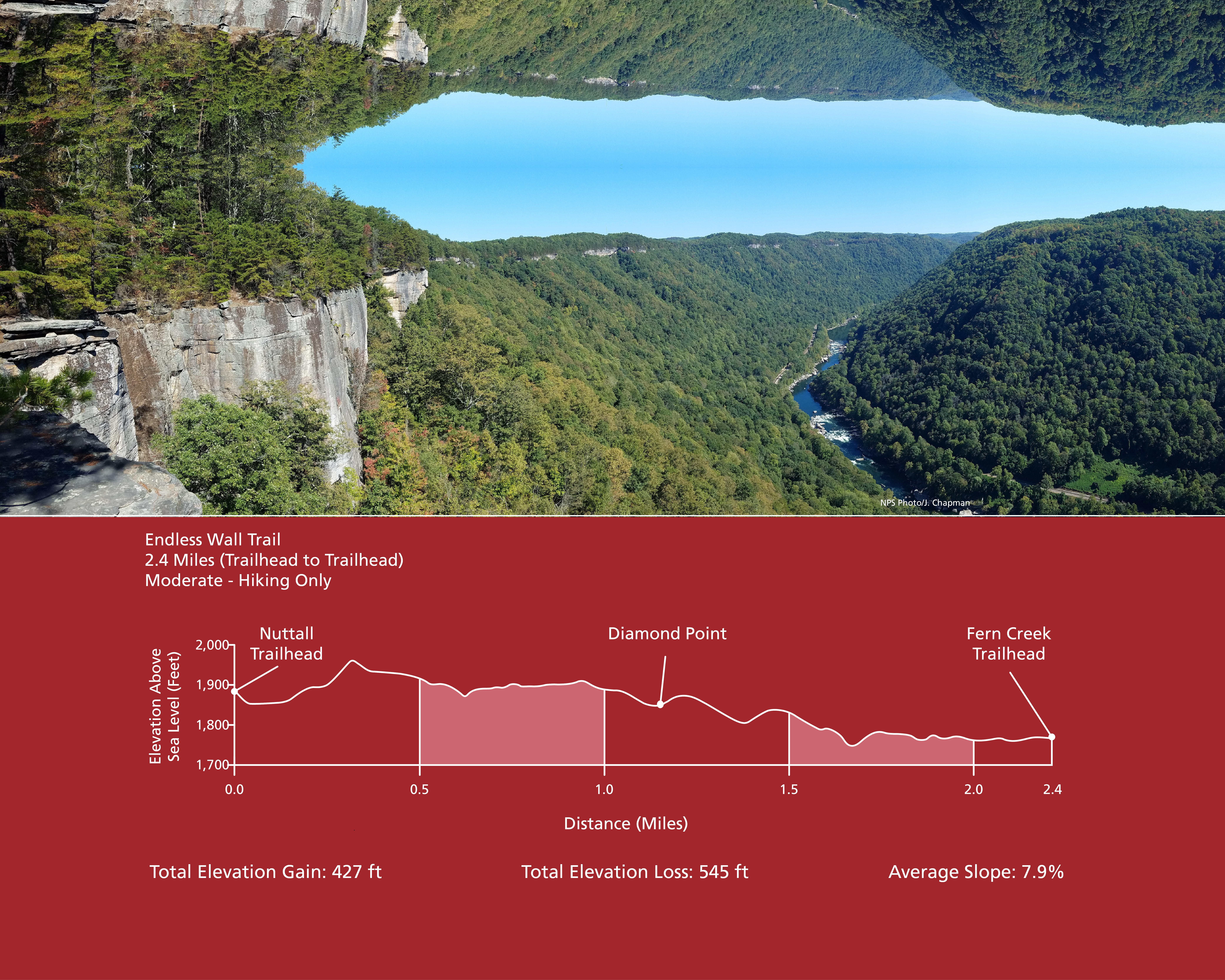
Endless Wall Trail
~8 min drive
<p><em>Labeled (3) on the Fayetteville - Lansing Area Trails map</em></p> <h4><strong>Length</strong></h4> <p>2.4 miles/3.86 km (One-way)</p> <h4><strong>Difficulty</strong></h4> <p>Easy to Moderate</p> <h4><strong>Trail type</strong></h4> <p>Hiking only</p> <h4>Total Elevatio…