Heybrook Lookout
Campground
Campground · 3.8 mi from the trail
 Photo: Ron Clausen, CC BY-SA 4.0 (via Wikimedia Commons)
Closure in the area
There's a closure order in Mt. Baker-Snoqualmie National Forest. It doesn't name Mount Persis, so check the source for the area it covers (2 listed).
Grand Park 2 Fire Closure Update
Agency closure covering Mt. Baker-Snoqualmie National Forest · Order 06-05-26-16 · USFS · Mt. Baker-Snoqualmie National Forest
Bell Creek Bridge Damaged
Agency closure covering Mt. Baker-Snoqualmie National Forest · USFS · Mt. Baker-Snoqualmie National Forest
Rescission of Shooting Restrictions
Agency alert covering Mt. Baker-Snoqualmie National Forest · USFS · Mt. Baker-Snoqualmie National Forest
Electric Fire Closure Order
Agency alert covering Mt. Baker-Snoqualmie National Forest · Order 06-05-26-19 · USFS · Mt. Baker-Snoqualmie National Forest
Mountain Goats Have Been Present on Yellow Aster Butte
Agency alert covering Mt. Baker-Snoqualmie National Forest · USFS · Mt. Baker-Snoqualmie National Forest
As of · Source: USFS · Mt. Baker-Snoqualmie National Forest. Agencies don't list every closure — check before you go.
Mount Persis is a summit in Snohomish County, Washington, within the Skykomish Ranger District of Mt. Baker-Snoqualmie National Forest. The nearest town is Index, about 3.4 miles away, and the Forest Service manages the surrounding land. The peak is a destination in its own right on national forest land, and it sits close to several other ways to spend a day outdoors in the Index area. Planning a visit means looking at forest-wide notices as well as local options, since rules on fires, food storage and road access are set across the national forest. Nearby, Anderson Creek offers canoeing less than a mile away, the Mine boulders climbing area is about 1.5 miles off, and the Lake Serene hike starts within about 2 miles. For camping, Heybrook Lookout is roughly 3.8 miles away.
Heybrook Lookout
Campground
Zeke's Drive-In
Fast food
Camlann Medieval Village
Museum
British living museum in US
Places © OpenStreetMap contributors
More in Gold BarDaily highs and lows, wind and the chance of precipitation at the summit for the next 7 days, from the Open-Meteo model.
Elevation from USGS 3D Elevation Program terrain data (about 10 m resolution).
We don't know of a mapped trail or route to the summit of Mount Persis. Plan the approach with local maps, a guidebook or a local guide, and check conditions before you go.
5,464 ft (1,665 m).
We don't know of a mapped trail or route to the summit. Plan the approach with local maps, a guidebook or a local guide.


 Lake Serene TrailHikingPhoto: striatic — CC BY 2.0 (via Flickr)1.9 mi
Source: Roamze catalog (indexable pages within 10 miles, PostGIS distance)
 Mount IndexSummit · ~3 min drivePhoto: Steven Pavlov, CC BY-SA 4.0 (via Wikimedia Commons)
 Philadelphia MountainSummit · ~6 min drivePhoto: Another Believer, CC BY-SA 4.0 (via Wikimedia Commons)Gunn PeakSummit · ~13 min drivePhoto: Ron Clausen, CC BY-SA 4.0 (via Wikimedia Commons)
 Merchant PeakSummit · ~15 min drivePhoto: Peter Stevens, CC BY 2.0 (via Wikimedia Commons)
 Del Campo PeakSummit · ~26 min drivePhoto: Ron Clausen, CC BY-SA 4.0 (via Wikimedia Commons)
 Beckler PeakSummit · ~26 min drivePhoto: Danust, CC BY-SA 4.0 (via Wikimedia Commons)
 Silvertip PeakSummit · ~27 min drivePhoto: Trailspotter, CC BY 2.0 (via Wikimedia Commons)
 Morning Star PeakSummit · ~27 min drivePhoto: Martin Bravenboer, CC BY 3.0 (via Wikimedia Commons)
 Columbia PeakSummit · ~28 min drivePhoto: CC BY-SA 3.0 us (via Wikimedia Commons)
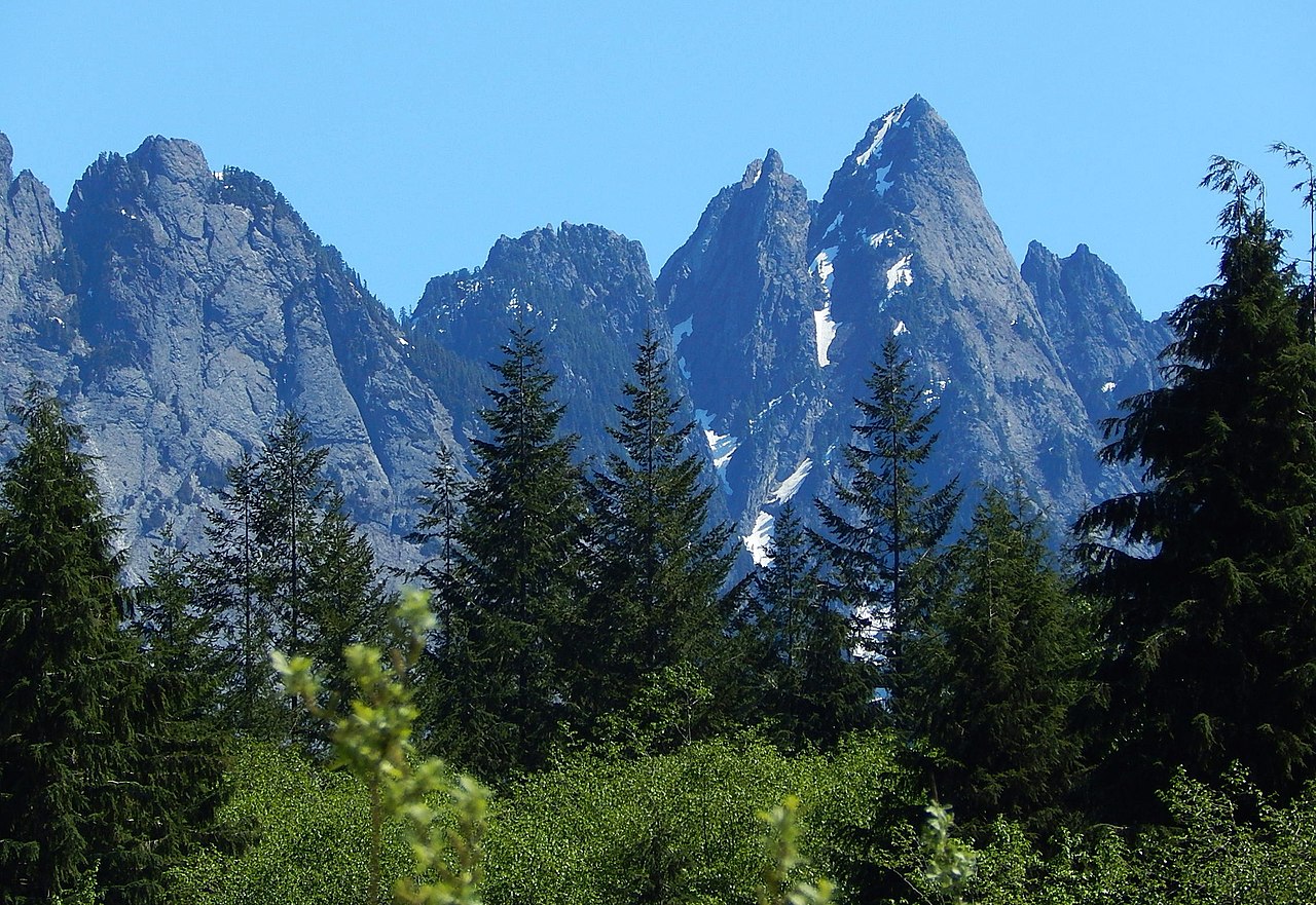 Garfield MountainSummit · ~30 min drivePhoto: Ron Clausen, CC BY-SA 4.0 (via Wikimedia Commons)
Also worth it near here


