Glacier Creek Road
- 1.9 mi
- round trip
- 2,067 ft
- climb
- 3,577 ft
- high point
- Out and back
- route
Is Glacier Creek Road open right now?
Closure in the area
There's a closure order in Mt. Baker-Snoqualmie National Forest. It doesn't name Glacier Creek Road, so check the source for the area it covers (2 listed).
Grand Park 2 Fire Closure Update
Agency closure covering Mt. Baker-Snoqualmie National Forest · Order 06-05-26-16 · USFS · Mt. Baker-Snoqualmie National Forest
Bell Creek Bridge Damaged
Agency closure covering Mt. Baker-Snoqualmie National Forest · USFS · Mt. Baker-Snoqualmie National Forest
Rescission of Shooting Restrictions
Agency alert covering Mt. Baker-Snoqualmie National Forest · USFS · Mt. Baker-Snoqualmie National Forest
Electric Fire Closure Order
Agency alert covering Mt. Baker-Snoqualmie National Forest · Order 06-05-26-19 · USFS · Mt. Baker-Snoqualmie National Forest
Mountain Goats Have Been Present on Yellow Aster Butte
Agency alert covering Mt. Baker-Snoqualmie National Forest · USFS · Mt. Baker-Snoqualmie National Forest
As of · Source: USFS · Mt. Baker-Snoqualmie National Forest. Agencies don't list every closure — check before you go.
Glacier Creek Road is an out-and-back cross-country ski route in Washington's Mt. Baker Ranger District, part of the Mt. Baker-Snoqualmie National Forest. The Forest Service manages the land, and the trip runs about 3.9 miles with a total elevation gain of 2,067 feet, so it's a climb rather than a flat run. The low point is about 2,662 feet, and the high point is about 3,577 feet. The road makes for an easy ski, and the steepest stretch comes early, at about 0.23 miles in with a 15% grade. The route is short enough to fit into a day on the snow, and the forest district's nearby trails and water make it easy to pair with other outings. The Heliotrope Ridge trail is just 0.7 miles away, and the Heliotrope Ridge hike starts 0.2 miles off. For paddling, Glacier Creek is about 3.3 miles away. Douglas Fir Campground, about 6.8 miles out, offers a place to camp.
Local outfitters
- Guided Exposure6 mi away
- WHATCOM MEADOWS22 mi away
Not on Roamze yet. Their page has how to reach them.
- HELIOTROPE RIDGEHiking0.2 mi
- Heliotrope Ridge TrailHiking0.7 mi
- Creek Xing Bypass SpurHiking1.4 mi
- Glacier CreekCanoeing3.3 mi
- Clearwater CreekCanoeing4.2 mi
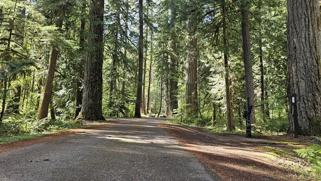 Douglas Fir CampgroundCampingPhoto: Recreation.gov (RIDB) / public domain6.8 mi
- The PumphouseRock climbing7.7 mi
 Excelsior Group CampCampingPhoto: Recreation.gov (RIDB) / public domain8 mi
Source: Roamze catalog (indexable pages within 10 miles, PostGIS distance)
- Heather Meadows X-Country SkiCross-country skiing · ~18 min drive
- Forest Road 3600Cross-country skiing · Next door
- Forest Road 3071Cross-country skiing · ~18 min drive
- Ptarmigan RidgeSki touring · ~15 min drive
- Martin Lake X-Country Ski 1130Cross-country skiing · ~18 min drive
- Glacier Creek RoadCross-country skiing · Next door
- Heather Meadows Day LodgeSki touring · ~18 min drive
- Artist Point X-Country SkiCross-country skiing · ~18 min drive
- Glacier Creek RoadCross-country skiing · Next door
- Glacier Creek RoadCross-country skiing · ~2 min drive

Map and trail data © OpenStreetMap contributors
