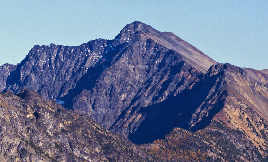
Prospector Crags
Prospector Crags in Washington has 4 sport climbing routes across 3 difficulty grades.
- 4 routes
- 5.10a – 5.11c
- Sport
Is Prospector Crags open right now?
Alert in the area
The Forest Service lists 6 alerts for Methow Valley Ranger District.
Ptarmigan Fire Closure on the Methow Valley Ranger District
Agency alert covering Methow Valley Ranger District · Order 06-17-04-26-39 · USFS · Methow Valley Ranger District
Cle Elum River Restoration Area Closure on the Cle Elum Ranger District
Agency alert covering Okanogan-Wenatchee National Forest · USFS · Okanogan-Wenatchee National Forest
Storm Damaged Roads Closure on Methow Valley District
Agency alert covering Methow Valley Ranger District · Order 06-17-04-26-18 · USFS · Methow Valley Ranger District
Gold Creek Restoration Project Area Closure on Cle Elum Ranger District
Agency alert covering Okanogan-Wenatchee National Forest · USFS · Okanogan-Wenatchee National Forest
Grouse Creek Aquatic Project Road Closure on the Wenatchee River Ranger District
Agency alert covering Okanogan-Wenatchee National Forest · USFS · Okanogan-Wenatchee National Forest
As of · Source: USFS · Methow Valley Ranger District. Agencies don't list every closure — check before you go.
Best time to visit Prospector Crags
Best months: April–October. Best months have typical highs of 55–85 °F, lows of 30 °F or warmer (32 °F where the station doesn't record snow), at most one snowy day and no more than 12 wet days.
Jan
29° / 16°
15 wet
Feb
37° / 19°
12 wet
Mar
46° / 26°
10 wet
Apr
58° / 33°
7 wet
May
68° / 41°
7 wet
Jun
75° / 48°
7 wet
Jul
84° / 55°
5 wet
Aug
84° / 53°
4 wet
Sep
74° / 44°
6 wet
Oct
56° / 34°
10 wet
Nov
39° / 25°
14 wet
Dec
28° / 16°
15 wet
Typical high / low (°F) and days with rain or snow, 1991–2020. Measured at Mazama, WA, 6.3 mi away at 2,141 ft. The station sits about 800 ft lower than this place, so expect it a little cooler here. This station doesn't record snowfall. Source: NOAA NCEI U.S. Climate Normals 1991–2020.
Prospector Crags is a climbing area in the Methow Valley Ranger District of Washington's Okanogan-Wenatchee National Forest, managed by the Forest Service. It sits in the Methow Valley, about 6 miles from the town of Mazama, and the climbing is all sport, with four routes that range from 5.10a to 5.11c. The closest neighbors are Recess Wall and Nugget Wall, both about 0.1 mile away. Summer is the most comfortable time to climb. Typical averages from a nearby weather station in Mazama, which sits about 800 feet lower than the crags, run to highs in the mid-80s and lows around 55 in July and August, with only four or five wet days a month. Winter is cold and wet, with January highs near 29°F. The Robinson Creek Trail is about half a mile away for a walk, and Ballard Campground is about 0.6 mile off for an overnight stay. Paddlers can reach the Methow River about 4.4 miles away.
Routes (4)
Keep exploring — more climbs worth the drive
 Photo: eliduke, CC BY-SA 2.0 (via Flickr)
Ripple Rock
~10 min drive
Ripple Rock in Washington has 6 sport climbing routes across 5 grades.
 Photo: daveynin, CC BY 2.0 (via Flickr)
Washington Pass
~18 min drive
Washington Pass in Washington has 12 climbing routes with alpine no fixed protection.
 Photo: Buidhe, CC BY-SA 4.0 (via Wikimedia Commons)
Spire Gully
~20 min drive
Alpine gully climbing in Washington's dramatic vertical terrain.
 Photo: Rainhead, CC BY-SA 2.0 (via Flickr)
Liberty Bell
~20 min drive
Liberty Bell in Washington has 18 climbing routes across 13 grades.
 Photo: U.S. Forest Service- Pacific Northwest Region, Public domain (via Wikimedia Commons)
Concord Tower
~20 min drive
Concord Tower in Washington has 5 climbing routes with alpine no fixed protection.
 Photo: Buidhe, CC BY-SA 4.0 (via Wikimedia Commons)
The Gunsight Range
~21 min drive
Gunsight Range, The in Washington has 6 climbing routes across 5 grades.
 Photo: caffeinated_zeitgeist, CC BY 2.0 (via Flickr)
Amphitheatre Mountain
~46 min drive
Amphitheatre Mountain in Washington has 5 climbing routes with 4 difficulty grades.
Photo: eliduke, CC BY-SA 2.0 (via Flickr)Rhinozone
~10 min drive
Rhinozone in Washington offers 13 climbing routes across 9 grades, with sport and trad options.
Photo: eliduke, CC BY-SA 2.0 (via Flickr)Sun Rock
~10 min drive
Sun Rock in Washington has 9 sport climbing routes across 7 difficulty grades.
 Photo: mjhbower, CC BY-SA 2.0 (via Flickr)
Summertime Crag
~19 min drive
Summertime Crag in Washington has 6 routes with 5 difficulty grades.