Mosquito Creek
 Photo: U.S. Forest Service, Public domain (via Wikimedia Commons)
- 9.5 mi
- distance
- 715 ft
- high point
- Jul–Sep
- best months
Mosquito Creek is a canoeing spot in Washington, about 3 miles from the town of Oil City. It sits among a cluster of paddling and hiking destinations along the coast, with Minter Creek just 1.6 miles away and Goodman Creek about 3.7 miles off. Summer is the most comfortable time to paddle here. Typical averages from a nearby weather station in Forks show July and August highs in the low 70s, with fewer wet days than the rest of the year. That station sits a few hundred feet lower than the creek, so temperatures on the water may run slightly cooler. The Hoh Head Way Trail and Hoh Head Trail are both within 3 miles, and the South Coast Beach Travelway is about 3.3 miles away. Climbers can find the Ruby Beach boulder stacks roughly 5.7 miles from the creek.
Local outfitters
- Crescent Beach41 mi away
Not on Roamze yet. Their page has how to reach them.
- Minter CreekCanoeing1.6 mi
- Hoh Head Way TrailHiking2.7 mi
 Hoh Head TrailHikingPhoto: pfly, CC BY-SA 2.0 (via Wikimedia Commons)2.9 mi
 South Coast Beach TravelwayHikingPhoto: Sam Beebe/Ecotrust, CC BY-SA 3.0 (via Wikimedia Commons)3.3 mi
- Goodman CreekCanoeing3.7 mi
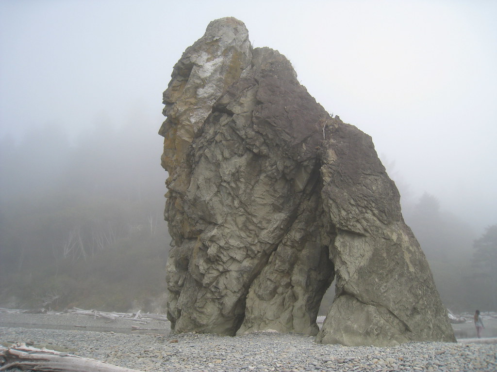 Ruby beach boulder stacksRock climbingPhoto: GSEC, CC BY 2.0 (via Flickr)5.7 mi
- Cedar CreekCanoeing6.6 mi
- Big Fat Beach boulderRock climbing9.6 mi
Source: Roamze catalog (indexable pages within 10 miles, PostGIS distance)
- Minter CreekCanoeing · ~3 min drive
- Three Rivers Boat LaunchBoat launch · ~17 min drive
- Goodman CreekCanoeing · ~6 min drive
- Dickey Boat RampBoat launch · ~22 min drive
- Cedar CreekCanoeing · ~11 min drive
- Hoh BoundaryBoat launch · ~32 min drive
- Murphy CreekCanoeing · ~12 min drive
- Hartzell Creek Boat LaunchBoat launch · ~34 min drive
- Maxfield CreekCanoeing · ~13 min drive
- Morgan's Crossing Boating SiteBoat launch · ~24 min drive
Also worth it near here
Best time to visit Mosquito Creek
Best months: July–September. Best months have typical highs of 55–85 °F, lows of 30 °F or warmer (32 °F where the station doesn't record snow), at most one snowy day and no more than 12 wet days.
Jan
47° / 35°
23 wet
Feb
50° / 34°
20 wet
Mar
53° / 36°
23 wet
Apr
59° / 38°
20 wet
May
64° / 43°
17 wet
Jun
68° / 47°
15 wet
Jul
73° / 50°
11 wet
Aug
74° / 51°
9 wet
Sep
70° / 47°
12 wet
Oct
60° / 42°
19 wet
Nov
51° / 37°
22 wet
Dec
46° / 34°
24 wet
Typical high / low (°F) and days with rain or snow, 1991–2020. Measured at Forks 1 E, WA, 11.4 mi away at 350 ft. This station doesn't record snowfall. Source: NOAA NCEI U.S. Climate Normals 1991–2020.
