Upper Meadow
Campground
Campground · 1.6 mi from the trail
 Photo: Steven Pavlov, CC BY-SA 3.0 (via Wikimedia Commons)
Twin Falls Trail is a 1.6-mile out-and-back hike in Washington's Olallie State Park, managed by State Park and Recreation. The trail gains about 926 feet over its length, with a high point of 1,365 feet, and the route is rated moderate. It starts at roughly 985 feet. Summer is the most comfortable time to go. Typical averages from a nearby weather station at Cedar Lake show July and August highs around 70°F, with only eight or nine wet days a month. Winters are cold and wet, with highs near 39°F and snow on about five days a month from December through February. The trail takes about an hour to complete. The Valley View West and Valley View East climbing areas sit about 0.8 miles away, and the Mount Washington Trail is about 0.9 miles off. For an overnight stay, Tinkham Campground is about 6.8 miles away.
Upper Meadow
Campground
 If it rainsShakespeare at English Wikipedia, CC BY-SA 3.0 · Wikimedia Commons
Railway station in Snoqualmie, the United States of America
Places © OpenStreetMap contributors, Places © Overture Maps Foundation · Photos: Shakespeare at English Wikipedia, CC BY-SA 3.0 (commons)
More in GreenwaterNot on Roamze yet. Their page has how to reach them.
Mount Washington TrailHikingPhoto: Steven Pavlov, CC BY-SA 3.0 (via Wikimedia Commons)0.9 miGreat Wall TrailHikingPhoto: Steven Pavlov, CC BY-SA 3.0 (via Wikimedia Commons)1 mi Cedar RiverCanoeingPhoto: Joe Mabel, CC BY-SA 3.0 (via Wikimedia Commons)6.4 mi
 Tinkham CampgroundCampingPhoto: Recreation.gov (RIDB) / public domain6.8 mi
Source: Roamze catalog (indexable pages within 10 miles, PostGIS distance)
Mount Washington TrailHiking · ~2 min drivePhoto: Steven Pavlov, CC BY-SA 3.0 (via Wikimedia Commons)Great Wall TrailHiking · ~2 min drivePhoto: Steven Pavlov, CC BY-SA 3.0 (via Wikimedia Commons) Dirty Harry's Peak TrailHiking · ~5 min drivePhoto: Gene Bisbee, CC BY 2.0 (via Wikimedia Commons)Neverland Climbing Area TrailHiking · ~5 min drivePhoto: Gene Bisbee, CC BY 2.0 (via Wikimedia Commons)
 Rattlesnake Ledge TrailHiking · ~6 min drivePhoto: Onur Karaagaoglu, CC BY 3.0 (via Wikimedia Commons)
 Mount Teneriffe TrailHiking · ~5 min drivePhoto: Krystof Hoder, CC BY 3.0 (via Wikimedia Commons)
 Mount Teneriffe TrailHiking · ~6 min drivePhoto: Krystof Hoder, CC BY 3.0 (via Wikimedia Commons)Climbing Access Loop TrailHiking · ~6 min drivePhoto: Gene Bisbee, CC BY 2.0 (via Wikimedia Commons)
 Mount Si TrailHiking · ~6 min drivePhoto: Krystof Hoder, CC BY 3.0 (via Wikimedia Commons)
Also worth it near here
 Twin FallsWaterfall · Next doorPhoto: KimonBerlin, CC BY-SA 2.0 (via Wikimedia Commons)
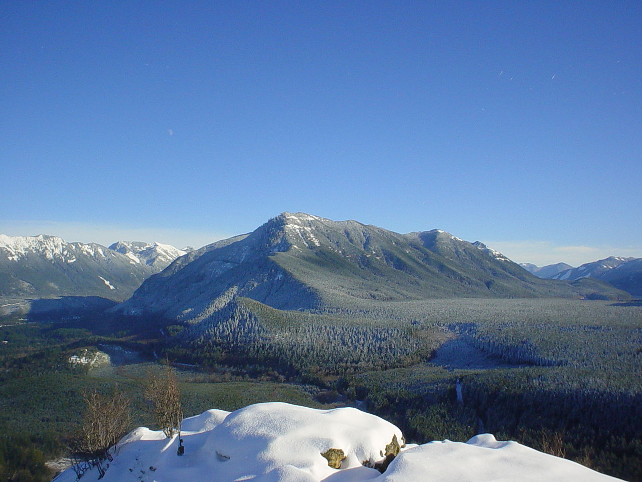 Mount WashingtonSummit · ~2 min drivePhoto: Konrad Roeder (CC) 2006, CC BY 2.5 (via Wikimedia Commons)
 Deception CragsRock climbing · ~3 min drivePhoto: bgreenlee, CC BY 2.0 (via Flickr)
Best months: July–September. Best months have typical highs of 55–85 °F, lows of 30 °F or warmer (32 °F where the station doesn't record snow), at most one snowy day and no more than 12 wet days.
Jan
39° / 32°
19 wet · 5 snow
Feb
42° / 32°
17 wet · 4 snow
Mar
46° / 33°
20 wet · 4 snow
Apr
51° / 36°
19 wet · 1 snow
May
59° / 42°
17 wet
Jun
63° / 46°
15 wet
Jul
70° / 51°
9 wet
Aug
71° / 52°
8 wet
Sep
64° / 47°
12 wet
Oct
54° / 41°
17 wet
Nov
44° / 36°
20 wet · 2 snow
Dec
39° / 31°
20 wet · 5 snow
Typical high / low (°F) and days with rain or snow, 1991–2020. Measured at Cedar Lake, WA, 3.5 mi away at 1,560 ft. Source: NOAA NCEI U.S. Climate Normals 1991–2020.
Map and trail data © OpenStreetMap contributors
