Rica Canyon Trail
- 0.6 mi
- round trip
- 622 ft
- climb
- 1,240 ft
- high point
- Out and back
- route
- May–Sep
- best months
Is Rica Canyon Trail open right now?
Closure in the area
There's a closure order in Olympic National Park. It doesn't name Rica Canyon Trail, so check the source for the area it covers.
Hurricane Ridge Road Closed, Tuesday 11/17, 8:45am
Park closure covering Olympic National Park · NPS · Olympic National Park
Visitors to Rialto, Ruby Beach & Coastal Areas Cautioned Due to High Tides
Park alert covering Olympic National Park · NPS · Olympic National Park
Bat Tests Positive for Rabies, Visitors Urged to Report Potential Contact
Park alert covering Olympic National Park · NPS · Olympic National Park
Full Burn Ban Begins August 7
Park alert covering Olympic National Park · NPS · Olympic National Park
Staircase Developed Area is Open, Use Caution in Burned Areas
Park alert covering Olympic National Park · NPS · Olympic National Park
As of · Source: NPS · Olympic National Park. Agencies don't list every closure — check before you go.
Rica Canyon Trail is a short, easy hike in Olympic National Park, within the Daniel J. Evans Wilderness on land managed by the National Park Service. The trail is about half a mile long, and the round trip adds up to roughly 1.1 miles with a total elevation gain of about 622 feet. The climb is rolling, and the steepest stretch comes at about 0.47 miles in, with a grade of nearly 58 percent. Summer is the most comfortable time to go. Typical averages from a nearby weather station show July and August highs around 74 to 75°F with only about five wet days a month, while winter months bring highs in the low 40s and rain on most days. A fee is charged for the visit. The trail sits close to several other routes, including Geyser Valley Trail about 0.7 miles away and Humes Ranch Loop Trail about 1.1 miles away. Upper Lake Mills Trail is about 1.5 miles off, and the Sol Duc River, a paddling route, lies about 9 miles away.
Local outfitters
- Elwha RV Park10 mi away
- Olympic Hiking Co.13 mi away
Not on Roamze yet. Their page has how to reach them.
 Geyser Valley TrailHikingPhoto: Bala from Seattle, USA, CC BY-SA 2.0 (via Wikimedia Commons)0.7 mi
- Humes Ranch Loop TrailHikingPhoto: Bala from Seattle, USA, CC BY-SA 2.0 (via Wikimedia Commons)1.1 mi
- Upper Lake Mills TrailHiking1.5 mi
 Sol Duc RiverCanoeingPhoto: Kimon Berlin, CC BY-SA 2.0 (via Wikimedia Commons)9.2 mi
- Elwha RiverRock climbing9.7 mi
- The ElwhallRock climbing9.8 mi
- Waka BeachRock climbing9.8 mi
 Morse CreekCanoeingPhoto: Evvekk, CC0 (via Wikimedia Commons)10 mi
Source: Roamze catalog (indexable pages within 10 miles, PostGIS distance)
- Geyser Valley TrailHiking · ~1 min drivePhoto: Bala from Seattle, USA, CC BY-SA 2.0 (via Wikimedia Commons)
- Humes Ranch Loop TrailHiking · ~2 min drivePhoto: Bala from Seattle, USA, CC BY-SA 2.0 (via Wikimedia Commons)
 Cox Valley Primitive TrailHiking · ~7 min drivePhoto: Gabriele Giuseppini, CC BY 3.0 (via Wikimedia Commons)
 Appleton Pass TrailHiking · ~11 min drivePhoto: McKay Savage from London, UK, CC BY 2.0 (via Wikimedia Commons)
 Cirque Rim Nature TrailHiking · ~7 min drivePhoto: Gabriele Giuseppini, CC BY 3.0 (via Wikimedia Commons)
 Hurricane Ridge to Klahhane Ridge TraiHiking · ~9 min drivePhoto: Scott Thompson, CC BY 3.0 (via Wikimedia Commons)
 Lake Angeles TrailHiking · ~12 min drivePhoto: Robert Ashworth from Bellingham, WA., USA, CC BY 2.0 (via Wikimedia Commons)
 Heather Park TrailHiking · ~13 min drivePhoto: sf-dvs, CC BY 2.0 (via Wikimedia Commons)
- High Ridge Nature TrailHiking · ~7 min drivePhoto: Gabriele Giuseppini, CC BY 3.0 (via Wikimedia Commons)
 Boulder Hot Springs TrailHiking · ~9 min drivePhoto: McKay Savage from London, UK, CC BY 2.0 (via Wikimedia Commons)
Also worth it near here
- Geyser Valley Trail Backcountry CampingCamping · Next door
 Mount FitzhenrySummit · ~6 min drivePhoto: Martin Bravenboer, CC BY 3.0 (via Wikimedia Commons)
- Hurricane Ridge Ski AreaDownhill skiing · ~6 min drive
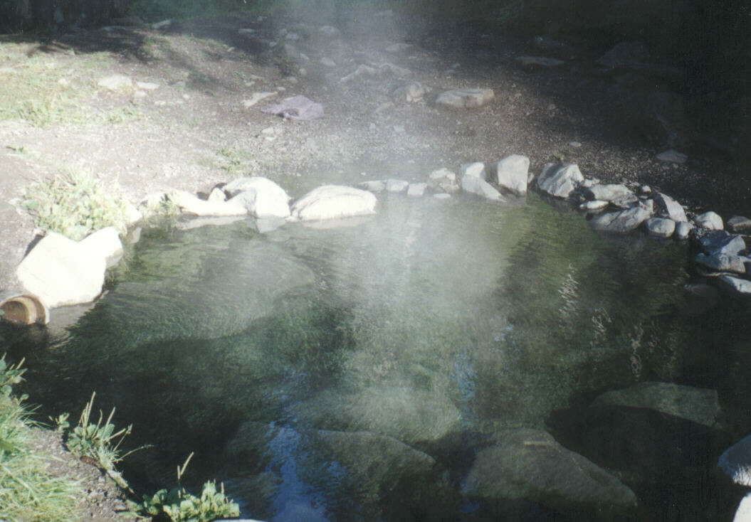 Olympic Hot SpringsHot spring · ~10 min drivePhoto: Robert Ashworth from Bellingham, WA., USA, CC BY 2.0 (via Wikimedia Commons)
Best time to visit Rica Canyon Trail
Best months: May–September. Best months have typical highs of 55–85 °F, lows of 30 °F or warmer (32 °F where the station doesn't record snow), at most one snowy day and no more than 12 wet days.
Jan
41° / 33°
18 wet
Feb
44° / 33°
16 wet
Mar
50° / 35°
17 wet
Apr
56° / 38°
14 wet
May
63° / 43°
12 wet
Jun
67° / 47°
9 wet
Jul
74° / 51°
5 wet
Aug
75° / 52°
5 wet
Sep
68° / 48°
8 wet
Oct
56° / 42°
15 wet
Nov
46° / 36°
18 wet
Dec
41° / 33°
19 wet
Typical high / low (°F) and days with rain or snow, 1991–2020. Measured at Elwha Rs, WA, 4.3 mi away at 360 ft. The station sits about 900 ft lower than this place, so expect it a little cooler here. Source: NOAA NCEI U.S. Climate Normals 1991–2020.
