Damfino Lakes
- 0.6 mi
- round trip
- 442 ft
- climb
- 4,657 ft
- high point
- Out and back
- route
Is DAMFINO LAKES open right now?
Closure in the area
There's a closure order in Mt. Baker-Snoqualmie National Forest. It doesn't name DAMFINO LAKES, so check the source for the area it covers (2 listed).
Grand Park 2 Fire Closure Update
Agency closure covering Mt. Baker-Snoqualmie National Forest · Order 06-05-26-16 · USFS · Mt. Baker-Snoqualmie National Forest
Bell Creek Bridge Damaged
Agency closure covering Mt. Baker-Snoqualmie National Forest · USFS · Mt. Baker-Snoqualmie National Forest
Rescission of Shooting Restrictions
Agency alert covering Mt. Baker-Snoqualmie National Forest · USFS · Mt. Baker-Snoqualmie National Forest
Electric Fire Closure Order
Agency alert covering Mt. Baker-Snoqualmie National Forest · Order 06-05-26-19 · USFS · Mt. Baker-Snoqualmie National Forest
Mountain Goats Have Been Present on Yellow Aster Butte
Agency alert covering Mt. Baker-Snoqualmie National Forest · USFS · Mt. Baker-Snoqualmie National Forest
As of · Source: USFS · Mt. Baker-Snoqualmie National Forest. Agencies don't list every closure — check before you go.
Damfino Lakes is a short, easy out-and-back hike in the Mt. Baker Ranger District of Mt. Baker-Snoqualmie National Forest in Washington, managed by the Forest Service. The trail starts at the Damfino Lakes Trailhead and covers about a mile, with a total elevation gain of 442 feet. The climb is front-loaded, with the steepest stretch at about 0.12 miles from the start, where the grade reaches 27 percent. The high point is 4,657 feet, and the route returns to the trailhead's starting elevation of 4,302 feet. The trip takes about half an hour, so it works well as a quick outing. The trailhead sits about half a mile from the Canyon Ridge hike and the Boundary Way Trail, both of which make easy additions to the day. For an overnight stay, Excelsior Group Camp is about 3.5 miles away, and Damfino Creek offers canoeing roughly 3.3 miles off.
Local outfitters
- WHATCOM MEADOWS31 mi away
- Lutherwood Camp & Retreat Center35 mi away
Not on Roamze yet. Their page has how to reach them.
- CANYON RIDGEHiking0.3 mi
- Boundary Way TrailHiking0.4 mi
- Damfino CreekCanoeing3.3 mi
 Excelsior Group CampCampingPhoto: Recreation.gov (RIDB) / public domain3.5 mi
- The PumphouseRock climbing3.8 mi
- Canyon CreekCanoeing4.1 mi
- Cobblestone WallRock climbing5.3 mi
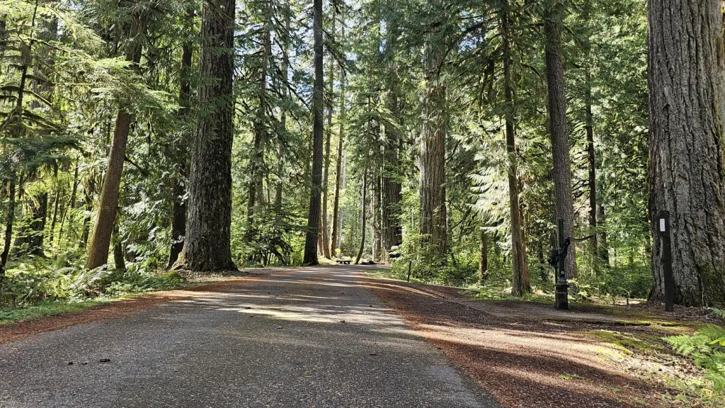 Douglas Fir CampgroundCampingPhoto: Recreation.gov (RIDB) / public domain6.2 mi
Source: Roamze catalog (indexable pages within 10 miles, PostGIS distance)
 Yellow Aster Butte TrailHiking · ~11 min drivePhoto: Nwcamera1, CC BY-SA 3.0 (via Wikimedia Commons)
- Tomyhoi Lake TrailHiking · ~11 min drivePhoto: Nwcamera1, CC BY-SA 3.0 (via Wikimedia Commons)
 Gargett Mine TrailHiking · ~12 min drivePhoto: U.S. Forest Service- Pacific Northwest Region, Public domain (via Wikimedia Commons)
 Deadhorse Camp TrailHiking · ~13 min drivePhoto: Walter Siegmund, CC BY 2.5 (via Wikimedia Commons)
- Excelsior PeakHiking · ~3 min drive
- TOMYHOI LAKEHiking · ~11 min drivePhoto: Nwcamera1, CC BY-SA 3.0 (via Wikimedia Commons)
 SILESIA CREEKHiking · ~14 min drivePhoto: U.S. Forest Service- Pacific Northwest Region, Public domain (via Wikimedia Commons)
 Hayes Lake TrailHiking · ~14 min drivePhoto: Melissa Wright, CC BY-SA 3.0 (via Wikimedia Commons)
- Lone Jack TrailHiking · ~15 min drivePhoto: U.S. Forest Service- Pacific Northwest Region, Public domain (via Wikimedia Commons)
- High Pass TrailHiking · ~13 min drivePhoto: U.S. Forest Service- Pacific Northwest Region, Public domain (via Wikimedia Commons)
Also worth it near here


