Chelan Bob Trail
- 0.4 mi
- round trip
- 1,005 ft
- climb
- 1,167 ft
- high point
- Out and back
- route
- Apr–Jun, Sep–Oct
- best months
The Chelan Bob Trail is a short, moderate out-and-back hike in Washington's BeeBe Wildlife Area Complex, managed by State Fish and Wildlife. The trail is about 0.4 miles long, and the round trip covers roughly 0.8 miles with a total elevation gain of about 1,000 feet. The high point is about 1,167 feet, and the steepest stretch comes early on, with a grade of about 28% at around 0.2 miles. The most comfortable months for a visit are typically late spring and early fall. Typical averages from a nearby weather station in Chelan show May highs around 72°F and September highs around 77°F, while July and August average highs near 87°F. The trail makes an easy pairing with other short routes in the area. The Cultus Jim Trail is about 0.2 miles away and the Toad Creek Trail about 0.3 miles. The Chelan Butte Trail and Reach 1 Trail are each about 1.5 miles off.
Local outfitters
- Icicle River RV Resort38 mi away
- Crescent Bar Recreation Area42 mi away
Not on Roamze yet. Their page has how to reach them.
- Cultus Jim TrailHiking0.2 mi
- Toad Creek TrailHiking0.3 mi
 Reach 1 TrailHikingPhoto: Robert Ashworth from Bellingham, WA., USA, CC BY 2.0 (via Wikimedia Commons)1.5 mi
- Chelan Butte TrailHikingPhoto: Robert Ashworth from Bellingham, WA., USA, CC BY 2.0 (via Wikimedia Commons)1.5 mi
- Foot TrailHiking7 mi
- BOBS TRAIL SNOWSHOEHiking7.7 mi
- Lower Ridge ViewHiking8 mi
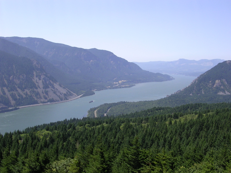 Columbia RiverCanoeingPhoto: The original uploader was Cacophony at English Wikipedia., CC BY-SA 3.0 (via Wikimedia Commons)9.9 mi
Source: Roamze catalog (indexable pages within 10 miles, PostGIS distance)
- Reach 1 TrailHiking · ~3 min drivePhoto: Robert Ashworth from Bellingham, WA., USA, CC BY 2.0 (via Wikimedia Commons)
- Chelan Butte TrailHiking · ~3 min drivePhoto: Robert Ashworth from Bellingham, WA., USA, CC BY 2.0 (via Wikimedia Commons)
 COOPER MOUNTAIN SNOMOHiking · ~20 min drivePhoto: brewbooks from near Seattle, USA, CC BY-SA 2.0 (via Wikimedia Commons)
- BOBS TRAIL SNOWSHOEHiking · ~13 min drive
- Chelan Riverwalk LoopHiking · ~4 min drivePhoto: Robert Ashworth from Bellingham, WA., USA, CC BY 2.0 (via Wikimedia Commons)
- Fourth of July MountainHiking · ~21 min drive
- GRADE CREEK SNOMOHiking · ~20 min drive
- Bergman Gulch TrailHiking · ~14 min drive
- Cultus Jim TrailHiking · Next door
- Keystone Ridge TrailHiking · ~29 min drive
Also worth it near here
Best time to visit Chelan Bob Trail
Best months: April–June and September–October. Best months have typical highs of 55–85 °F, lows of 30 °F or warmer (32 °F where the station doesn't record snow), at most one snowy day and no more than 12 wet days.
Jan
34° / 22°
9 wet
Feb
42° / 24°
7 wet
Mar
52° / 30°
7 wet
Apr
62° / 38°
5 wet
May
72° / 46°
6 wet
Jun
78° / 53°
5 wet
Jul
87° / 59°
3 wet
Aug
87° / 58°
2 wet
Sep
77° / 49°
3 wet
Oct
62° / 39°
6 wet
Nov
46° / 29°
8 wet
Dec
35° / 23°
10 wet
Typical high / low (°F) and days with rain or snow, 1991–2020. Measured at Chelan, WA, 1.2 mi away at 1,194 ft. This station doesn't record snowfall. Source: NOAA NCEI U.S. Climate Normals 1991–2020.
Map and trail data © OpenStreetMap contributors
