Rolston Rest Shelter
Campground
Campground · 6.8 mi from the trail
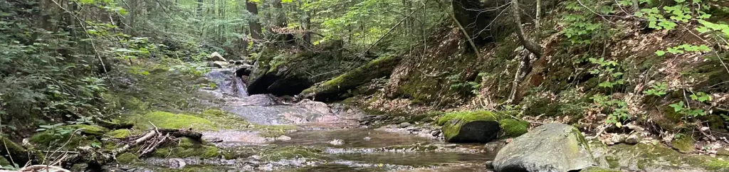
Furnace Brook is a paddling spot in Vermont, about a mile from the town of Grangerville. The nearest town makes it an easy destination to reach, and the paddling puts the water at the center of the outing. Summer is the most comfortable time to go. Typical averages from a nearby weather station in Rutland show July highs around 80°F with lows near 56°F, and the station sits roughly 700 feet lower than the brook, so temperatures up here run cooler. Winters are cold and snowy, with January highs near 29°F and snow on about nine days that month. Paddlers can pair the trip with other outings close by. Stone Soup and Holey Land are climbing areas within half a mile, and the Cave Trail hike is about 0.6 miles away. East Creek, another paddling route, is about 4 miles off.
Rolston Rest Shelter
Campground
Pittsford Pub & Grill
Pub
Places © OpenStreetMap contributors
More in RandolphNot on Roamze yet. Their page has how to reach them.
 Cave TrailHikingPhoto: U. S. Fish and Wildlife Service - Northeast Region, Public domain (via Wikimedia Commons)0.6 miPittsford TrailsHikingPhoto: U. S. Fish and Wildlife Service - Northeast Region, Public domain (via Wikimedia Commons)0.8 mi
 Chittenden Brook CampgroundCampingPhoto: Recreation.gov (RIDB) / public domain8.1 mi
Source: Roamze catalog (indexable pages within 10 miles, PostGIS distance)
 La ChuteCanoeing · ~39 min drivePhoto: Katie Armstrong, Public domain (via Wikimedia Commons)
 Mad RiverCanoeing · ~42 min drivePhoto: USEPA Environmental-Protection-Agency, Public domain (via Wikimedia Commons)
 Otter CreekCanoeing · ~49 min drivePhoto: Ahale at English Wikipedia, Public domain (via Wikimedia Commons)
Best months: June–October. Best months have typical highs of 55–85 °F, lows of 30 °F or warmer (32 °F where the station doesn't record snow), at most one snowy day and no more than 12 wet days.
Jan
29° / 8°
13 wet · 9 snow
Feb
32° / 9°
10 wet · 8 snow
Mar
41° / 18°
12 wet · 6 snow
Apr
55° / 31°
12 wet · 2 snow
May
68° / 42°
13 wet
Jun
76° / 52°
12 wet
Jul
80° / 56°
12 wet
Aug
78° / 54°
11 wet
Sep
71° / 46°
10 wet
Oct
58° / 35°
12 wet
Nov
46° / 26°
12 wet · 3 snow
Dec
35° / 16°
14 wet · 8 snow
Typical high / low (°F) and days with rain or snow, 1991–2020. Measured at Rutland, VT, 6.9 mi away at 620 ft. The station sits about 700 ft lower than this place, so expect it a little cooler here. Source: NOAA NCEI U.S. Climate Normals 1991–2020.
