Moosalamoo Campground
Campground
Campground · < 0.1 mi from the trail
Closure in the area
There's a closure order in Green Mountain and Finger Lakes National Forests. It doesn't name North Branch, so check the source for the area it covers (3 listed).
Klondike Fire Incident Report
Agency closure covering Green Mountain and Finger Lakes National Forests · USFS · Green Mountain and Finger Lakes National Forests
Heavily damaged or closed trails
Agency closure covering Green Mountain and Finger Lakes National Forests · USFS · Green Mountain and Finger Lakes National Forests
Glastenbury fire tower is closed to public use
Agency closure covering Green Mountain and Finger Lakes National Forests · USFS · Green Mountain and Finger Lakes National Forests
Moosalamoo Campground Water System
Agency alert covering Green Mountain and Finger Lakes National Forests · USFS · Green Mountain and Finger Lakes National Forests
As of · Source: USFS · Green Mountain and Finger Lakes National Forests. Agencies don't list every closure — check before you go.
North Branch is a 5.2-mile out-and-back trail in the Middlebury Ranger District of the Green Mountain and Finger Lakes National Forests in Vermont, managed by the Forest Service. The route is rated moderate, with an elevation gain of 582 feet one way and a total round-trip climb of 1,467 feet. The steepest section comes at about 1.9 miles, with a grade of 16 percent. The trail is on natural surface, and bikes are allowed. Moosalamoo Campground sits just 0.1 mile away, with the Moosalamoo Campground Loop and Moosalamoo National Recreation Area both about 0.2 mile off. For a change of pace, Sucker Brook offers canoeing roughly 0.9 mile from the trail.
Moosalamoo Campground
Campground
 If it rainsSMHCNorwich, CC BY-SA 4.0 · Wikimedia Commons
Places © OpenStreetMap contributors · Photos: SMHCNorwich, CC BY-SA 4.0 (commons)
More in Randolph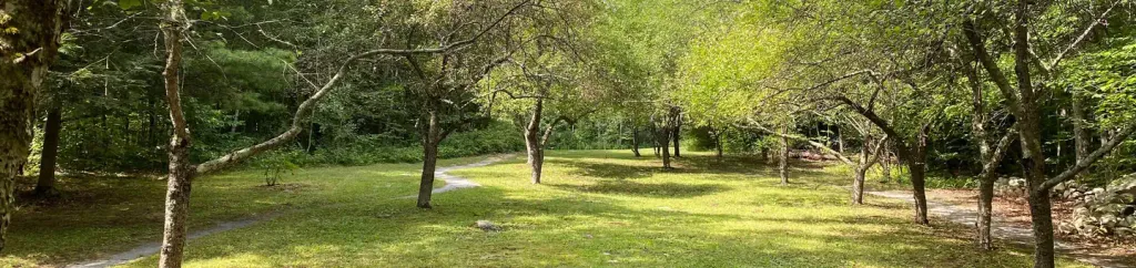 Moosalamoo CampgroundCampingPhoto: Recreation.gov (RIDB) / public domain0.1 mi
 Main CragRock climbingPhoto: Boston Public Library, CC BY 2.0 (via Wikimedia Commons)2 miLake Dunmore/Falls of LanaRock climbingPhoto: Boston Public Library, CC BY 2.0 (via Wikimedia Commons)2 mi
Source: Roamze catalog (indexable pages within 10 miles, PostGIS distance)
Keewaydin EastHiking · Next doorPhoto: Boston Public Library, CC BY 2.0 (via Wikimedia Commons)Best months: August–September. Best months have typical highs of 55–85 °F, lows of 30 °F or warmer (32 °F where the station doesn't record snow), at most one snowy day and no more than 12 wet days.
Jan
25° / 6°
16 wet
Feb
28° / 6°
13 wet
Mar
37° / 15°
14 wet
Apr
50° / 29°
13 wet
May
63° / 40°
14 wet
Jun
71° / 49°
14 wet
Jul
76° / 54°
14 wet
Aug
74° / 51°
12 wet
Sep
67° / 44°
11 wet
Oct
54° / 34°
14 wet
Nov
43° / 25°
15 wet
Dec
32° / 14°
17 wet
Typical high / low (°F) and days with rain or snow, 1991–2020. Measured at S Lincoln, VT, 11 mi away at 1,341 ft. This station doesn't record snowfall. Source: NOAA NCEI U.S. Climate Normals 1991–2020.
