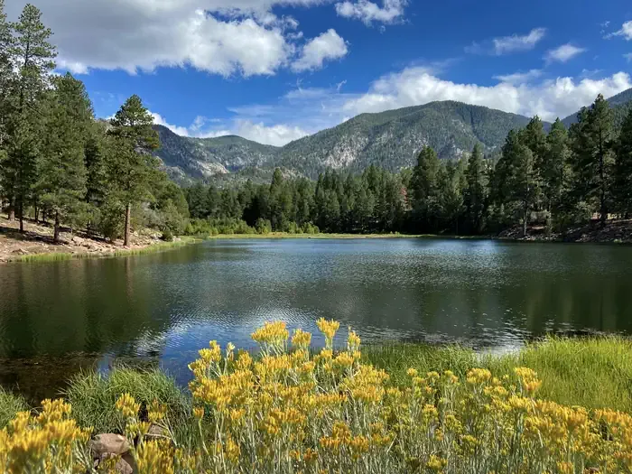
Oak Grove Campground
Campground
Campground · 2.7 mi from the trail
 Photo: Zettabyte, CC BY 3.0 (via Wikimedia Commons)
Alert in the area
The Forest Service lists 3 alerts for Dixie National Forest.
Duck Creek OHV Trail Closure
Agency alert covering Dixie National Forest · Order 0407-26-11 · USFS · Dixie National Forest
Pine Valley Ranger District Area and Trail and Road Closure
Agency alert covering Dixie National Forest · Order 0407-26-01 · USFS · Dixie National Forest
Cedar City Temporary Road Closure Webster Flat Road (Order 0407-25-02)
Agency alert covering Dixie National Forest · Order 0407-25-02 · USFS · Dixie National Forest
As of · Source: USFS · Dixie National Forest. Agencies don't list every closure — check before you go.
Signal Peak is a summit of about 10,369 feet in Washington County, Utah, inside the Pine Valley Mountain Wilderness. The peak lies within the Pine Valley Ranger District of Dixie National Forest, which the Forest Service manages, and the nearest town is Pine Valley, about 5 miles away. The closest trails are the Blake-Gubler Trail, about 1.2 miles away, and the Brown's Point Trail, about 1.6 miles away. Climbers can head to Cottonwood Springs Bouldering, about 2.1 miles off, and Pine Valley Guard Station offers camping about 4.3 miles away.
Oak Grove Campground
Campground
 If it rainsBeneathtimp, CC0 · Wikimedia Commons
Places © OpenStreetMap contributors, Places © Overture Maps Foundation · Photos: Beneathtimp, CC0 (commons)
More in HurricaneDaily highs and lows, wind and the chance of precipitation at the summit for the next 7 days, from the Open-Meteo model.
Elevation from USGS 3D Elevation Program terrain data (about 10 m resolution).
We don't know of a mapped trail or route to the summit of Signal Peak. Plan the approach with local maps, a guidebook or a local guide, and check conditions before you go.
10,369 ft (3,160 m).
We don't know of a mapped trail or route to the summit. Plan the approach with local maps, a guidebook or a local guide.

 Pine Valley Guard StationCampingPhoto: Recreation.gov (RIDB) / public domain4.3 mi
Source: Roamze catalog (indexable pages within 10 miles, PostGIS distance)
North Black RocksSummit · ~22 min drivePhoto: Masohpotato, CC BY-SA 3.0 (via Wikimedia Commons) Red ButteSummit · ~33 min drivePhoto: John Dahlstet, CC BY 2.0 (via Wikimedia Commons)
 Paria PointSummit · ~34 min drivePhoto: Doug Knuth, CC BY-SA 2.0 (via Wikimedia Commons)
 Beatty PointSummit · ~34 min drivePhoto: Ken Lund, CC BY-SA 2.5 (via Wikimedia Commons)
 Tucupit PointSummit · ~35 min drivePhoto: Aaron Zhu, CC BY-SA 3.0 (via Wikimedia Commons)
 Horse Ranch MountainSummit · ~37 min drivePhoto: Daniel Mayer (talk · contribs), CC BY-SA 1.0 (via Wikimedia Commons)
 Cave KnollSummit · ~37 min drivePhoto: Stefan Serena, CC0 (via Wikimedia Commons)
 Tabernacle DomeSummit · ~38 min drivePhoto: Stefan Serena, CC0 (via Wikimedia Commons)
 Pine Valley PeakSummit · ~39 min drivePhoto: Dave Bezaire, CC BY-SA 2.0 (via Wikimedia Commons)
 Iron MountainSummit · ~40 min drivePhoto: Bob Palin, CC BY-SA 3.0 (via Wikimedia Commons)
