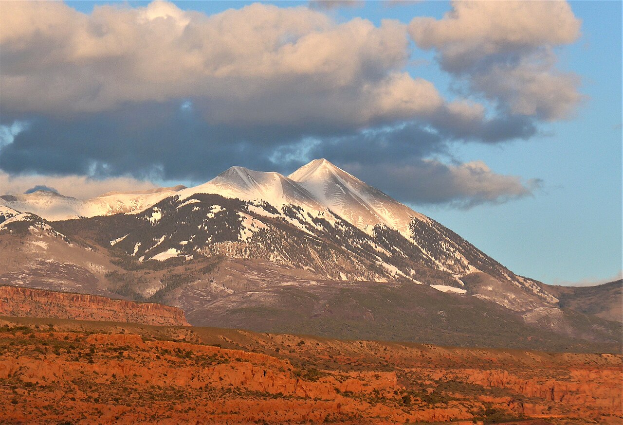
La Sal Mountains
La Sal Mountains is a climbing crag in Utah with 1 route.
- 1 route
- 5.11+
- Trad
Is La Sal Mountains open right now?
Closure in the area
There's a closure order in Manti-La Sal National Forest. It doesn't name La Sal Mountains, so check the source for the area it covers (2 listed).
Order Mountain Prescribed Fire Closure Order 10.6.2026
Agency closure covering Manti-La Sal National Forest · Order 04-10-26-01-03 · USFS · Manti-La Sal National Forest
Spring City Road Temporary Closure Order
Agency closure covering Manti-La Sal National Forest · Order 04-10-26-01-02 · USFS · Manti-La Sal National Forest
As of · Source: USFS · Manti-La Sal National Forest. Agencies don't list every closure — check before you go.
Best time to visit La Sal Mountains
Best months: April–June and August–October. Best months have typical highs of 55–85 °F, lows of 30 °F or warmer (32 °F where the station doesn't record snow), at most one snowy day and no more than 12 wet days.
Jan
37° / 17°
6 wet
Feb
41° / 21°
6 wet
Mar
51° / 28°
6 wet
Apr
59° / 32°
6 wet
May
69° / 40°
5 wet
Jun
81° / 50°
4 wet
Jul
86° / 57°
7 wet
Aug
84° / 55°
7 wet
Sep
75° / 48°
6 wet
Oct
62° / 36°
5 wet
Nov
48° / 26°
5 wet
Dec
37° / 17°
5 wet
Typical high / low (°F) and days with rain or snow, 1991–2020. Measured at La Sal 1sw, UT, 12.3 mi away at 6,787 ft. The station sits about 700 ft lower than this place, so expect it a little cooler here. This station doesn't record snowfall. Source: NOAA NCEI U.S. Climate Normals 1991–2020.
The La Sal Mountains are a climbing area in Utah's Manti-La Sal National Forest, within the Moab Ranger District. The Forest Service manages the land, and the area sits among a cluster of trails and other climbing spots, making it a natural base for a day of hiking and rock. For comfortable weather, aim for late spring or early fall. Typical averages from a nearby weather station show May highs around 69°F and September highs around 75°F, with July the warmest month at about 86°F. That station sits roughly 750 feet lower than the mountains, so temperatures up high run cooler. The closest route is Bumpin' Uglies, a trad climb rated 5.11+. The Sunny Side and The Wicked Crag climbing areas are both within about 2 miles. For an overnight stay, Oowah Campground is about 3.5 miles away.
Routes (1)
Brumley Canyon(1)
Keep exploring — more climbs worth the drive
 Photo: Carter Pape, CC BY-SA 4.0 (via Wikimedia Commons)
Mill Creek
~3 min drive
Mill Creek in Utah has 8 climbing routes with 7 difficulty grades, offering mixed and sport styles.
Photo: Carter Pape, CC BY-SA 4.0 (via Wikimedia Commons)Lower Mill Creek
~5 min drive
Lower Mill Creek in Utah has 14 climbing routes across 9 grades, offering sport and trad styles.
Photo: Carter Pape, CC BY-SA 4.0 (via Wikimedia Commons)50 Ways to Leave Your Lover
~8 min drive
50 Ways to Leave Your Lover is a Utah climbing area with 5 routes.
Photo: Carter Pape, CC BY-SA 4.0 (via Wikimedia Commons)Ken's Lake
~8 min drive
Ken's Lake in Utah has 3 climbing routes with sport and trad options.
 Photo: Ken Lund, CC BY-SA 2.0 (via Flickr)
Sunvana Wall
~17 min drive
Sunvana Wall in Utah offers 6 mixed and sport climbing routes across 4 difficulty grades.
 Photo: Jacob Montgomery, CC BY-SA 3.0 (via Wikimedia Commons)
Sand Flats
~17 min drive
Sand Flats in Utah offers 9 traditional climbing routes across 8 difficulty grades.
 Photo: Ken Lund, CC BY-SA 2.0 (via Flickr)
North Fork
~23 min drive
North Fork in Utah has 3 trad climbing routes.
Photo: Ken Lund, CC BY-SA 2.0 (via Flickr)Gauntlet Wall
~23 min drive
Gauntlet Wall in Utah has 6 routes across 6 grades, offering sport and trad climbing.
 Photo: dconvertini, CC BY-SA 2.0 (via Wikimedia Commons)
Sister Superior Group
~24 min drive
Sister Superior Group in Utah has 8 climbing routes ranging from 5.10 to 5.12c.
 Photo: Ben B, CC BY-SA 4.0 (via Wikimedia Commons)
Joe Wilson Canyon
~25 min drive
Joe Wilson Canyon in Utah has 6 trad routes spanning 3 difficulty grades.