
Pine Valley Guard Station
Campground
The next 6 weekends are full on Recreation.gov
The Santa Clara River Loop is a 3.9-mile mountain biking route in Utah's Dixie National Forest, within the Pine Valley Ranger District. The trail rises from 6,629 feet to 6,934 feet, a total gain of 304 feet, and lies about a tenth of a mile from Pine Valley Guard Station and the Crackfoot Loop. Spring and fall are the most comfortable times to ride. Typical averages from the nearby Enterprise weather station, which sits well below the route, show May highs around 73°F and October highs around 67°F. July is the warmest month, with highs near 90°F, while winter brings highs in the low 40s and a few snowy days each month. The Lions Club (Equestrian) and Brown's Point Trail are both within half a mile. Climbers can head to Hero Wall, about 4.3 miles away, and Baker Dam Campground is roughly 9.5 miles off.
Where it is: Pine Valley Ranger District · Dixie National Forest
Best months: April–June and September–October. Best months have typical highs of 55–85 °F, lows of 30 °F or warmer (32 °F where the station doesn't record snow), at most one snowy day and no more than 12 wet days.
Jan
42°
19°
4 wet · 2 snow
Feb
47°
20°
5 wet · 2 snow
Mar
57°
26°
5 wet · 1 snow
Apr
64°
30°
4 wet
May
73°
39°
4 wet
Jun
83°
48°
2 wet
Jul
90°
56°
4 wet
Aug
87°
55°
4 wet
Sep
81°
45°
3 wet
Oct
67°
32°
3 wet
Nov
54°
23°
3 wet · 1 snow
Dec
42°
17°
4 wet · 2 snow
Typical high / low (°F) and days with rain or snow, 1991–2020. Measured at Enterprise, UT, 19.2 mi away at 5,320 ft. The station sits about 1,600 ft lower than this place, so expect it a little cooler here. Source: NOAA NCEI U.S. Climate Normals 1991–2020.
Been here? Tell people how it was.
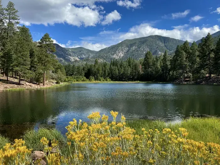 Pine Valley Guard StationCampingPhoto: Recreation.gov (RIDB) / public domain0.1 mi
 Cholla TrailMountain bikingPhoto: The Dye Clan, CC BY-SA 3.0 (via Wikimedia Commons)~34 min drive
 Lower Graveyard TrailMountain bikingPhoto: The Dye Clan, CC BY-SA 3.0 (via Wikimedia Commons)~34 min drive
 Tava'atsi TrailMountain bikingPhoto: The Dye Clan, CC BY-SA 3.0 (via Wikimedia Commons)~34 min drive
 Tempi'po'op TrailMountain bikingPhoto: The Dye Clan, CC BY-SA 3.0 (via Wikimedia Commons)~35 min drive
Daily highs and lows, wind and the chance of precipitation at Santa Clara River Loop for the next 7 days, from the Open-Meteo model.
Questions about Santa Clara River Loop: conditions, access, timing. Answers say when something isn't known.
Pine Valley Guard Station
Campground
 If it rainsBeneathtimp, CC0 · Wikimedia Commons
Places © OpenStreetMap contributors · Photos: Beneathtimp, CC0 (commons)
More in HurricaneNot on Roamze yet. Their page has how to reach them.
Map and trail data © OpenStreetMap contributors
