Redman Cg
Campground
Campground · 0.7 mi from the trail
No closures listed
The Forest Service lists no closures for Uinta-Wasatch-Cache National Forest.
As of · Source: USFS · Uinta-Wasatch-Cache National Forest. Agencies don't list every closure — check before you go.
Forest Glen Trail is a short mountain biking route in Utah's Uinta-Wasatch-Cache National Forest, within the Salt Lake Ranger District. It covers about a quarter mile, with a high point of 8,875 feet and a low of 8,661 feet, and it sits at roughly 8,857 feet at the start. The climb is brief but has a steep stretch. The steepest part comes at about 0.08 miles, with a grade of 13 percent, and the total gain is 189 feet. The trail also has a small loss of 115 feet, so it's a short, low-elevation ride. Summer is the most comfortable time to go. Typical averages from a nearby weather station at Silver Lake run to highs around 72°F in July and 71°F in August, with lows in the mid-40s. Winters are cold, with January highs near 31°F and lows around 11°F. The Gwt Guardsman to Sunset Pass route lies just 0.1 mile away, and Big Cottonwood Canyon Road is 0.2 mile off. Redman Campground and Silver Lake are both about 0.7 mile away.
Redman Cg
Campground
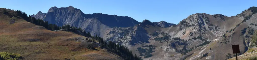
 If it rainsSaalebaer, CC0 · Wikimedia Commons
Park City Museum
Museum
Places © OpenStreetMap contributors · Photos: Saalebaer, CC0 (commons)
More in HeberNot on Roamze yet. Their page has how to reach them.
 Albion BasinCampingPhoto: Recreation.gov (RIDB) / public domain2.9 mi
Source: Roamze catalog (indexable pages within 10 miles, PostGIS distance)
 Rogue Rider TrailMountain biking · ~1 min drivePhoto: Terry Ott, CC BY 2.0 (via Wikimedia Commons)
 Mill F East Fork TrailMountain biking · ~2 min drivePhoto: Buidhe, CC BY-SA 4.0 (via Wikimedia Commons)
 Scott's BypassMountain biking · ~2 min drivePhoto: Buidhe, CC BY-SA 4.0 (via Wikimedia Commons)Wasatch Crest ConnectMountain biking · ~2 min drivePhoto: Terry Ott, CC BY 2.0 (via Wikimedia Commons)
 Blazing SaddleMountain biking · ~2 min drivePhoto: The Dye Clan, CC BY-SA 3.0 (via Wikimedia Commons)
 Shadow LakeMountain biking · ~3 min drivePhoto: Greg Rakozy grakozy, CC0 (via Wikimedia Commons)
 Jupiter PeakMountain biking · ~3 min drivePhoto: Buidhe, CC BY-SA 4.0 (via Wikimedia Commons)Dead Tree TrailMountain biking · ~3 min drivePhoto: The Dye Clan, CC BY-SA 3.0 (via Wikimedia Commons)
 Comstock Mine TrailMountain biking · ~3 min drivePhoto: Buidhe, CC BY-SA 4.0 (via Wikimedia Commons)
 Jupiter RidgeMountain biking · ~4 min drivePhoto: FormalDude, CC BY-SA 4.0 (via Wikimedia Commons)
Best months: June–September. Best months have typical highs of 55–85 °F, lows of 30 °F or warmer (32 °F where the station doesn't record snow), at most one snowy day and no more than 12 wet days.
Jan
31° / 11°
Feb
31° / 12°
Mar
37° / 17°
Apr
43° / 22°
May
52° / 30°
Jun
64° / 39°
Jul
72° / 47°
Aug
71° / 46°
Sep
62° / 38°
Oct
49° / 28°
Nov
37° / 18°
Dec
30° / 11°
Typical high / low (°F) and days with rain or snow, 1991–2020. Measured at Silver Lake Brighton, UT, 0.8 mi away at 8,740 ft. This station doesn't record snowfall. Source: NOAA NCEI U.S. Climate Normals 1991–2020.
Map and trail data © OpenStreetMap contributors
