BLM Dispersed Camping
Campground
Campground · 2.2 mi from the trail
Guacamole West Link Trail is a short, out-and-back mountain biking route on Bureau of Land Management land in the St. George Field Office in southern Utah, about 0.3 miles long with a 24-foot elevation gain. The trail links the Guacamole Trail to the Lime With A Twist Trail and is rated hard, so riders should plan for it as a connection rather than a standalone ride. Spring and fall are the most comfortable times to go. Typical averages from a nearby weather station run from highs around 73°F in April to 78°F in October, while July averages 100°F. That station sits about 570 feet below the trail, so temperatures on the route run a bit cooler. Guacamole Trail is half a mile away, and Lime With A Twist and Margarita Trail are each within about a mile. Climbers can reach Shady Corridor and Ewe Wall, about 6.6 miles off.
BLM Dispersed Camping
Campground
Black Sage
Restaurant
 If it rainsDon Graham from Redlands, CA, USA - God bless it!, CC BY-SA 2.0 · Wikimedia Commons
Places © OpenStreetMap contributors · Photos: Don Graham from Redlands, CA, USA - God bless it!, CC BY-SA 2.0 (commons)
More in HurricaneNot on Roamze yet. Their page has how to reach them.
 Shady CorridorRock climbingPhoto: Steve Montgomery, CC BY-SA 3.0 (via Wikimedia Commons)6.6 miEwe WallRock climbingPhoto: Steve Montgomery, CC BY-SA 3.0 (via Wikimedia Commons)6.6 miLambs KnollRock climbingPhoto: Steve Montgomery, CC BY-SA 3.0 (via Wikimedia Commons)6.6 mi
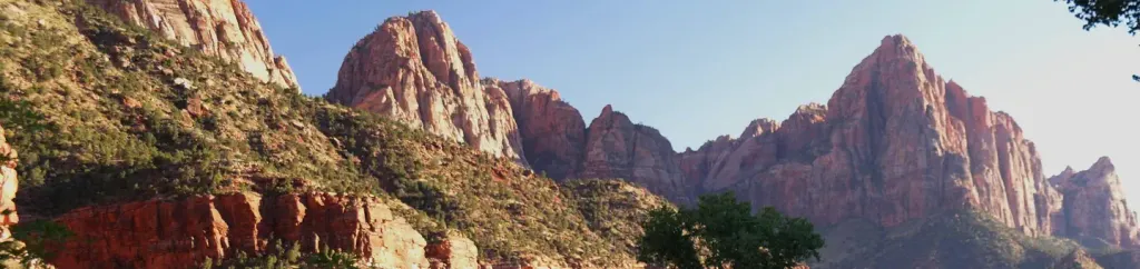 Watchman CampgroundCampingPhoto: Recreation.gov (RIDB) / public domain7.7 mi
Source: Roamze catalog (indexable pages within 10 miles, PostGIS distance)
 Gander TrailMountain biking · ~8 min drivePhoto: Don Graham from Redlands, CA, USA - God bless it!, CC BY-SA 2.0 (via Wikimedia Commons)
 WindmillMountain biking · ~8 min drivePhoto: Outdoor Craziness, CC BY-SA 3.0 (via Wikimedia Commons)Bowls and LedgesMountain biking · ~10 min drivePhoto: Outdoor Craziness, CC BY-SA 3.0 (via Wikimedia Commons)
 Secret TrailMountain biking · ~11 min drivePhoto: Outdoor Craziness, CC BY-SA 3.0 (via Wikimedia Commons)
Also worth it near here
 Coalpits Wash TrailHiking · ~4 min drivePhoto: Fredlyfish4, CC BY-SA 4.0 (via Wikimedia Commons)
 The West TempleSummit · ~10 min drivePhoto: Don Graham from Redlands, CA, USA - God bless it!, CC BY-SA 2.0 (via Wikimedia Commons)Shady CorridorRock climbing · ~11 min drivePhoto: Steve Montgomery, CC BY-SA 3.0 (via Wikimedia Commons)
Best months: February–May and October–November. Best months have typical highs of 55–85 °F, lows of 30 °F or warmer (32 °F where the station doesn't record snow), at most one snowy day and no more than 12 wet days.
Jan
54° / 30°
7 wet
Feb
58° / 34°
8 wet
Mar
66° / 39°
8 wet
Apr
73° / 44°
6 wet
May
83° / 53°
4 wet
Jun
95° / 62°
3 wet
Jul
100° / 70°
5 wet
Aug
98° / 69°
6 wet
Sep
91° / 61°
5 wet
Oct
78° / 49°
5 wet
Nov
64° / 37°
5 wet
Dec
53° / 29°
6 wet · 1 snow
Typical high / low (°F) and days with rain or snow, 1991–2020. Measured at Zion Np, UT, 7.9 mi away at 4,038 ft. The station sits about 600 ft lower than this place, so expect it a little cooler here. Source: NOAA NCEI U.S. Climate Normals 1991–2020.
Map and trail data © OpenStreetMap contributors
