Whittwer Hill
- 2.6 mi
- round trip
- 762 ft
- climb
- 8,118 ft
- high point
- Out and back
- route
- Jun–Oct
- best months
Is Whittwer Hill open right now?
Alert in the area
The Forest Service lists 2 alerts for Fishlake National Forest.
PST 66 Rock Canyon Trail Temporarily Closed
Agency alert covering Fishlake National Forest · USFS · Fishlake National Forest
TERMINATION OF STAGE 1 FIRE RESTRICTION ORDER
Agency alert covering Fishlake National Forest · Order 0408-26-10 · USFS · Fishlake National Forest
As of · Source: USFS · Fishlake National Forest. Agencies don't list every closure — check before you go.
Whittwer Hill is an easy out-and-back hike in the Beaver Ranger District of Fishlake National Forest in Utah, managed by the Forest Service. The trail is about 2.6 miles long, with a one-way climb of 762 feet from a low point of 7,342 feet to a high of 8,118 feet. Summer is the most comfortable time to go. Typical averages from a nearby weather station show July highs around 80°F with lows near 52°F, while winter brings highs in the mid-30s and regular snow days from December through February. The trail is natural-surface and allows bikes, so it works for hikers and mountain bikers alike. South Fork of Pine Creek is about a mile away, and Wildcat Pass - Shingle Creek is about 2 miles off. For an overnight stay, Indian Creek Dispersed Camping is roughly 6 miles away, and the Sevier River offers paddling about 8 miles out.
Local outfitters
- Big Rock Candy Mountain17 mi away
- Cedar Mountain RV Resort38 mi away
Not on Roamze yet. Their page has how to reach them.
Best time to go · Jun–Oct
Best time to visit Whittwer Hill
Best months: June–October. Best months have typical highs of 55–85 °F, lows of 30 °F or warmer (32 °F where the station doesn't record snow), at most one snowy day and no more than 12 wet days.
Jan
37° / 16°
7 wet · 7 snow
Feb
40° / 17°
7 wet · 6 snow
Mar
47° / 23°
7 wet · 6 snow
Apr
53° / 28°
7 wet · 4 snow
May
63° / 36°
6 wet · 2 snow
Jun
75° / 45°
4 wet
Jul
80° / 52°
7 wet
Aug
78° / 51°
9 wet
Sep
71° / 43°
6 wet
Oct
58° / 33°
5 wet · 1 snow
Nov
45° / 24°
5 wet · 3 snow
Dec
36° / 16°
7 wet · 6 snow
Typical high / low (°F) and days with rain or snow, 1991–2020. Measured at Beaver Canyon Pwr House, UT, 14.9 mi away at 7,275 ft. The station sits about 800 ft lower than this place, so expect it a little cooler here. Source: NOAA NCEI U.S. Climate Normals 1991–2020.
Keep exploring — more trails worth the drive
 Photo: Andrey Zharkikh, CC BY 2.0 (via Wikimedia Commons)
South Fork of North Creek
~17 min drive
3.87-mile out-and-back trail in Utah with 661 ft elevation gain.
HIKE
SOUTH FORK OF PINE CREEK
~2 min drive
1.92-mile out-and-back trail in Utah with 736 ft elevation gain
HIKE
South Fork of Pine Creek
~3 min drive
9.56-mile out-and-back trail in Utah with 2,121 ft elevation gain.
HIKE
Cove Creek - Indian Creek
~7 min drive
28.98-mile out-and-back trail in Utah with 4,170 ft elevation gain.
HIKE
Pine Creek
~4 min drive
Pine Creek is a 4-mile out-and-back trail in Utah with 2,386 ft of elevation gain.
HIKE
WILDCAT PASS - SHINGLE CREEK
~4 min drive
1.38-mile out-and-back trail in Utah with 375 ft gain and 7,962 ft max elevation.
HIKE
Little North Cr.-Wittwer Hill
~5 min drive
8.68-mile out-and-back trail in Utah with 1,914 ft elevation gain.
HIKE
CLEAR CREEK-MILL CREEK
~17 min drive
15.52-mile out-and-back trail in Utah with 2,601 ft elevation gain and loss.
HIKE
Wildcat Pass - Shingle Creek
~6 min drive
3.60-mile out-and-back trail in Utah with 133 ft gain.
HIKE
Little North Cr.-Wittwer Hill
~6 min drive
2.00-mile out-and-back trail in Utah with 606 ft elevation gain.
Also worth it near here
BED
Indian Creek Dispersed Camping
~10 min drive
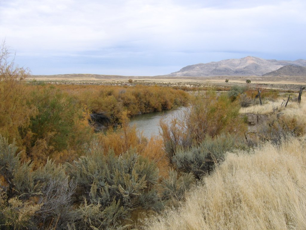 Photo: w:Flickr user rcstanley, CC BY 2.0 (via Wikimedia Commons)
Sevier River
~14 min drive
 Photo: Intermountain Forest Service, USDA Region 4 Photography, Public domain (via Wikimedia Commons)
Mount Belknap
~16 min drive
 Photo: Andrey Zharkikh, CC BY 2.0 (via Wikimedia Commons)
Tanner Hollow - Big John
~16 min drive
