Campsite 2
Campground
Campground · 2.1 mi from the trail
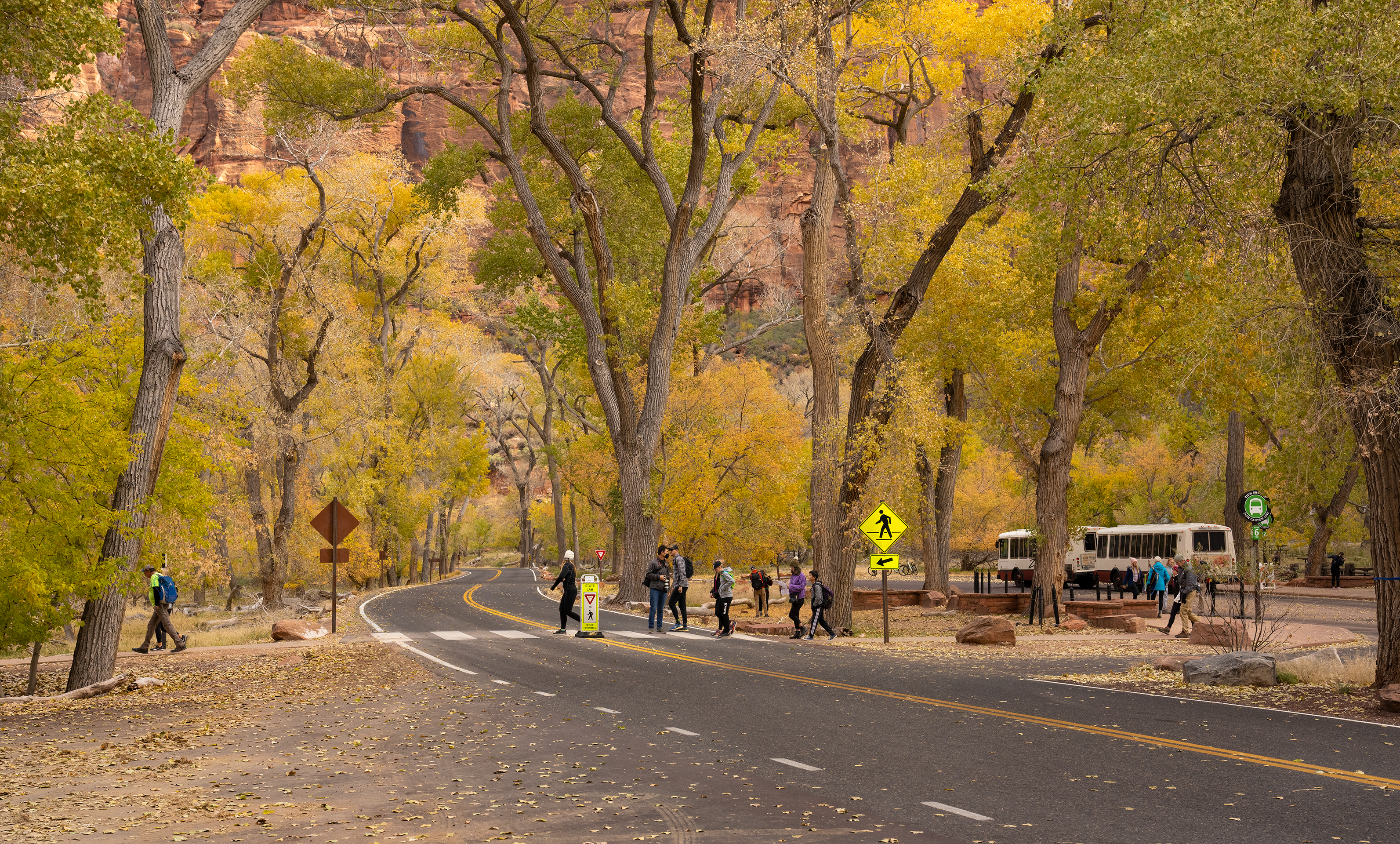 Photo: NPS/Abi Farish
Closure in the area
There's a closure order in Zion National Park. It doesn't name The Zion Grotto, so check the source for the area it covers (2 listed).
Narrows and All Slot Canyons Leading into them are Closed.
Park closure covering Zion National Park · NPS · Zion National Park
Watchman Trail closed
Park closure covering Zion National Park · NPS · Zion National Park
Toxic cyanobacteria in rivers, streams, and pools
Park alert covering Zion National Park · NPS · Zion National Park
Large vehicle restrictions on Zion-Mt. Carmel Highway
Park alert covering Zion National Park · NPS · Zion National Park
As of · Source: NPS · Zion National Park. Agencies don't list every closure — check before you go.
The Grotto In the early 1920s this area marked the end of the road into Zion Canyon. At that time there was a campground, named Grotto, built by the young men of the Civilian Conservation Corps (CCC) in this location. The CCC was developed by President Franklin D. Roosevelt during the Great Depression as part of his New Deal to employ millions of young men and improve our public lands. Take in beautiful views of the Virgin River and Angels Landing. Enjoy a picnic in the shade of large cottonwood trees. Access the Virgin River using designated points found along the West Rim Trail. Trails accessed from here: • The Grotto Trail • Kayenta Trail • Angels Landing (via West Rim Trail). You may hike the West Rim Trail to Scout Lookout, but everyone who hikes Angels Landing needs to have a permit. Shuttle Service When the Zion Canyon Shuttle Bus is running, the Grotto is shuttle stop #6.
Campsite 2
Campground
Red Rock Grill
Restaurant
 If it rainsDon Graham from Redlands, CA, USA - God bless it!, CC BY-SA 2.0 · Wikimedia Commons
Places © OpenStreetMap contributors · Photos: Don Graham from Redlands, CA, USA - God bless it!, CC BY-SA 2.0 (commons)
More in HurricaneNot on Roamze yet. Their page has how to reach them.
Best months: February–May and October–November. Best months have typical highs of 55–85 °F, lows of 30 °F or warmer (32 °F where the station doesn't record snow), at most one snowy day and no more than 12 wet days.
Jan
54° / 30°
7 wet
Feb
58° / 34°
8 wet
Mar
66° / 39°
8 wet
Apr
73° / 44°
6 wet
May
83° / 53°
4 wet
Jun
95° / 62°
3 wet
Jul
100° / 70°
5 wet
Aug
98° / 69°
6 wet
Sep
91° / 61°
5 wet
Oct
78° / 49°
5 wet
Nov
64° / 37°
5 wet
Dec
53° / 29°
6 wet · 1 snow
Typical high / low (°F) and days with rain or snow, 1991–2020. Measured at Zion Np, UT, 3.8 mi away at 4,038 ft. Source: NOAA NCEI U.S. Climate Normals 1991–2020.
 Photo: Klaus Eltrop, CC BY-SA 3.0 (via Wikimedia Commons)
Hidden Canyon - Closed Indefinitely
~2 min drive
0.99-mile lollipop trail in Utah with 1,525 ft elevation gain.
HIKE
Court of the Patriarchs
~3 min drive
Court of the Patriarchs Enjoy spectacular views of the three patriarchs: Abraham, Isaac, and Jacob. The three peaks were named in 1916 by a Methodist Minister, Dr. Frederick Vining Fischer, and two local boys from Southern Utah. They were so inspired and struck by the…
 Photo: Frans-Banja Mulder, CC BY 3.0 (via Wikimedia Commons)
The Narrows Day Hike Section
~4 min drive
7.08-mile out-and-back in Utah with 4,985 ft gain/loss.
Photo: Frans-Banja Mulder, CC BY 3.0 (via Wikimedia Commons)Riverside Walk
~4 min drive
Riverside Walk is a 0.97-mile out-and-back trail in Utah with 1,485 feet of elevation gain.
HIKE
Sand Bench Trail
~3 min drive
8.26-mile out-and-back hike in Utah with 1,915 ft elevation gain/loss.
Photo: Klaus Eltrop, CC BY-SA 3.0 (via Wikimedia Commons)Hidden Canyon Trail
~2 min drive
0.44-mile lollipop trail in Utah with 868 ft elevation gain.
HIKE
Pa'rus - The Master Sculptor
~6 min drive
The Master Sculptor Learn The power of wind, water, and gravity have shaped Zion Canyon over time. Erosion and weathering also play a role forming natural arches in the park. A natural arch is formed when deep cracks penetrate into a layer of sandstone. Erosion wears away…
 Photo: Ken Lund from Reno, Nevada, USA, CC BY-SA 2.0 (via Wikimedia Commons)
Many Pools Hike
~6 min drive
2.08-mile out-and-back hike in Utah with 858 ft gain and 6,141 ft max elevation.
HIKE
East Rim Trail
~3 min drive
Moderate 10.6-mile rim trail with 2,267 ft gain and scenic overlook views.
 Photo: Greg Willis from Denver, CO, usa, CC BY-SA 2.0 (via Wikimedia Commons)
Angels Landing Trail
~2 min drive
0.43-mile out-and-back trail with 226 ft gain in Utah.

