Pothole Point Trail
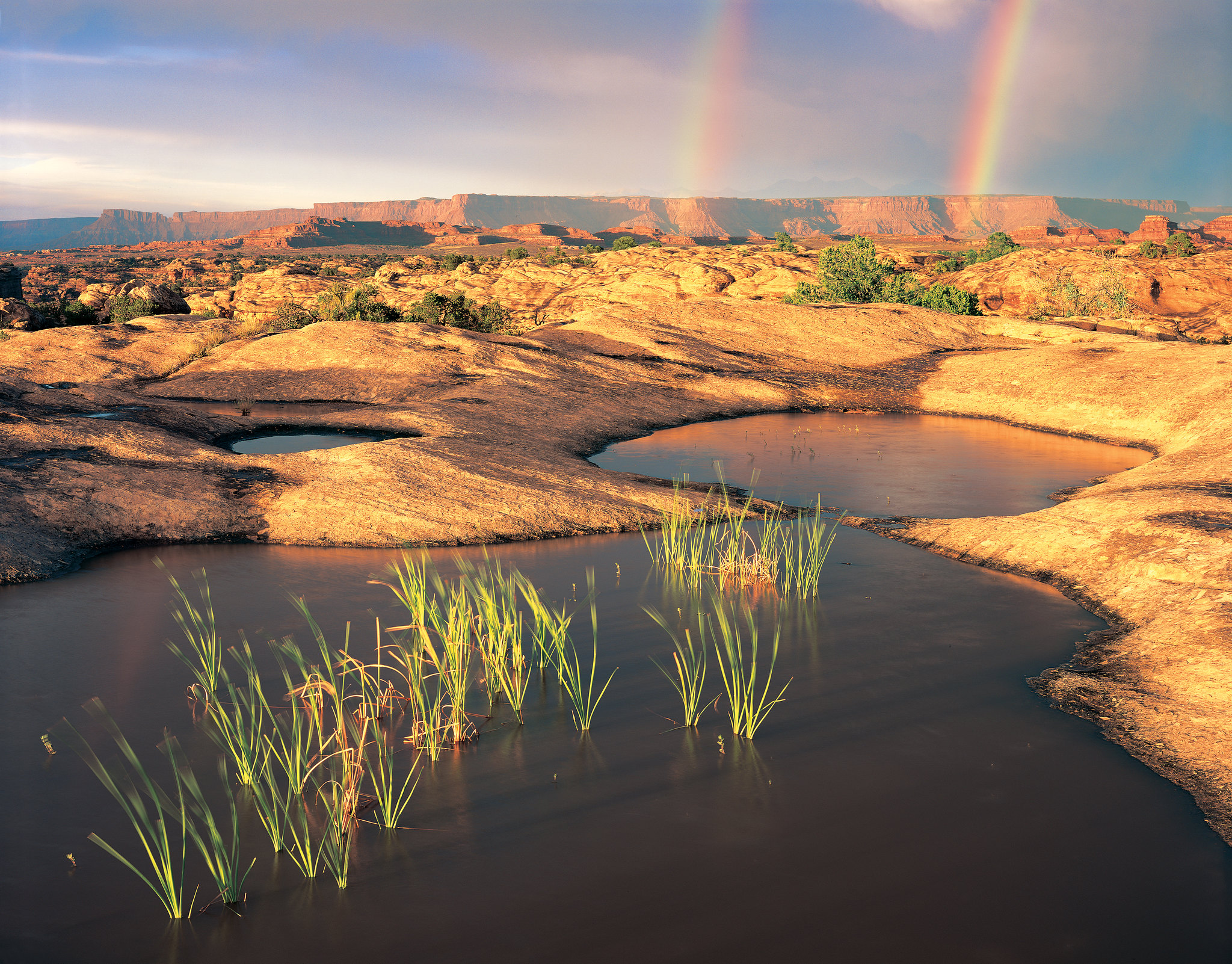 Photo: Neal Herbert
- 0.5 mi
- loop
- 11 ft
- climb
- 5,091 ft
- high point
- Loop
- route
- Mar–May, Sep–Oct
- best months
Is Pothole Point Trail open right now?
Alert in the area
The National Park Service lists an alert for Canyonlands National Park.
Mineral Bottom and White Rim Road are open but not recommended
Park alert covering Canyonlands National Park · NPS · Canyonlands National Park
As of · Source: NPS · Canyonlands National Park. Agencies don't list every closure — check before you go.
This short loop trail (0.6 mi/1 km) crosses sandstone dimpled with pockets called potholes. • Roundtrip Distance: 0.6 mi (1 km) • Time: 45 min • Elevation Change: 36 ft (11 m) • Difficulty: Easy/Short • Hike Description: Uneven slickrock leads to diverse pothole communities and views of The Needles. Trail follows cairns. • Accessibility: This trail can be rough, uneven, and requires walking up and down a rocky hill and stone steps. It is not accessible to wheelchairs. In winter, there may be snow or icy conditions; we recommend traction devices for hikers. • Dogs are not allowed on this trail. Service animals are allowed in national parks. What is a service animal? Help protect fragile desert ecosystems When wet or dry, potholes are tiny—and sensitive—ecosystems. Body oils, soaps, and sunscreen easily pollute the water. Protect these ecosystems by never putting anything (like fingers or feet) into potholes, and by walking around potholes, even when they are dry. The bumpy soil along the trail is also alive. Biological soil crusts are living communities of cyanobacteria, mosses, algae, lichens, and fungi. Soil crust prevents erosion, stores moisture, and provides critical nutrients for plants. Protect this life by staying on trail.
Local outfitters
- Red Desert RV Park29 mi away
- Spanish Trail RV Park30 mi away
Not on Roamze yet. Their page has how to reach them.
Best time to go · Mar–May, Sep–Oct
Best time to visit Pothole Point Trail
Best months: March–May and September–October. Best months have typical highs of 55–85 °F, lows of 30 °F or warmer (32 °F where the station doesn't record snow), at most one snowy day and no more than 12 wet days.
Jan
42° / 17°
4 wet · 2 snow
Feb
49° / 23°
4 wet · 1 snow
Mar
59° / 30°
5 wet · 1 snow
Apr
67° / 36°
5 wet
May
77° / 46°
4 wet
Jun
89° / 56°
3 wet
Jul
95° / 63°
5 wet
Aug
92° / 61°
6 wet
Sep
84° / 51°
5 wet
Oct
70° / 38°
5 wet
Nov
55° / 26°
4 wet · 1 snow
Dec
42° / 18°
4 wet · 2 snow
Typical high / low (°F) and days with rain or snow, 1991–2020. Measured at Canyonlands-The Needles, UT, 2.5 mi away at 4,906 ft. Source: NOAA NCEI U.S. Climate Normals 1991–2020.
Keep exploring — more trails worth the drive
HIKE
Slickrock Trail
~1 min drive
Slickrock, a general term for any bare rock surface, dominates much of the landscape in Canyonlands. For millions of years, natural forces have interacted to create the sweeping vistas and landmarks visible along this trail. Roundtrip Distance: 2.4 mi (3.9 km) Time: 1.5 hrs…
HIKE
Peekaboo Trail
~3 min drive
This trail crosses both Wooden Shoe and Lost Canyons on its way to Salt Creek Canyon, passing along high slickrock benches with spectacular views. Roundtrip Distance: 10.8 mi (17.4 km) Time: 5-6 hrs Overall Elevation Change: 429 ft (131 m) Cumulative elevation gain on this…
HIKE
Druid Arch Trail
~4 min drive
Encounter spectacular rock formations on this unique trail. Roundtrip Distance: 10.8 mi (17.4 km) Time: 5-7 hrs Overall Elevation Change: 503 ft (153 m) Cumulative elevation gain on this route is much greater. Difficulty: Strenuous Hike Description: This trail offers one of…
HIKE
Devils Kitchen
~9 min drive
5.99-mile out-and-back trail in Utah with 1,186 ft elevation gain.
HIKE
Big Spring Canyon Overlook and Trailhead
~1 min drive
Overlook Big Spring rests at the end of the Needles Park Road. From the overlook, unique rock spires and multi-colored sandstone benches line the bend in the canyon. The presence of the spring allows trees and plants to flourish in the spring and summer months. Trailhead…
HIKE
Chesler Park Viewpoint Trail
~4 min drive
Discover stunning views of the sandstone spires that characterize the Needles. Roundtrip Distance: 5.8 mi (9.3 km) Time: 3-4 hrs Overall Elevation Change: 533 ft (162 m) Cumulative elevation gain on this route is much greater. Difficulty: Strenuous Hike Description: This…
HIKE
Chesler Park Loop and Joint Trail
~4 min drive
This trail provides many great panoramas of the Needles formations. The Joint Trail winds through deep, narrow fractures in the rock. Roundtrip Distance: 10.7 mi (17.2 km) Time: 5-7 hrs Overall Elevation Change: 615 ft (187 m) Cumulative elevation gain on this route is much…
HIKE
Big Spring Canyon to Elephant Canyon Loop Trail
~3 min drive
This loop features extended hiking on slickrock benches and mesa tops overlooking canyons. Excellent views of sheer cliff walls and other rock formations. Roundtrip Distance: 10.5 mi (16.9 km) Time: 4-6 hrs Overall Elevation Change: 443ft (135m) Cumulative elevation gain on…
 Photo: BFS Man from Webster, TX, USA, CC BY 2.0 (via Wikimedia Commons)
Lower Lost Hiker
~7 min drive
2.06-mile out-and-back trail in Utah with 659 ft gain.
HIKE
Canyonlands' Cave Spring Trail
~5 min drive
This is the trailhead for a short, 0.6-mile (1 km) loop leading to a historic cowboy camp and prehistoric rock markings. You will climb two ladders to complete the route. Roundtrip Distance: 0.6 mi (1 km) Time: 45 min Elevation Change: 67 ft (20 m) Difficulty: Easy Hike…


