Chesler Park Viewpoint Trail
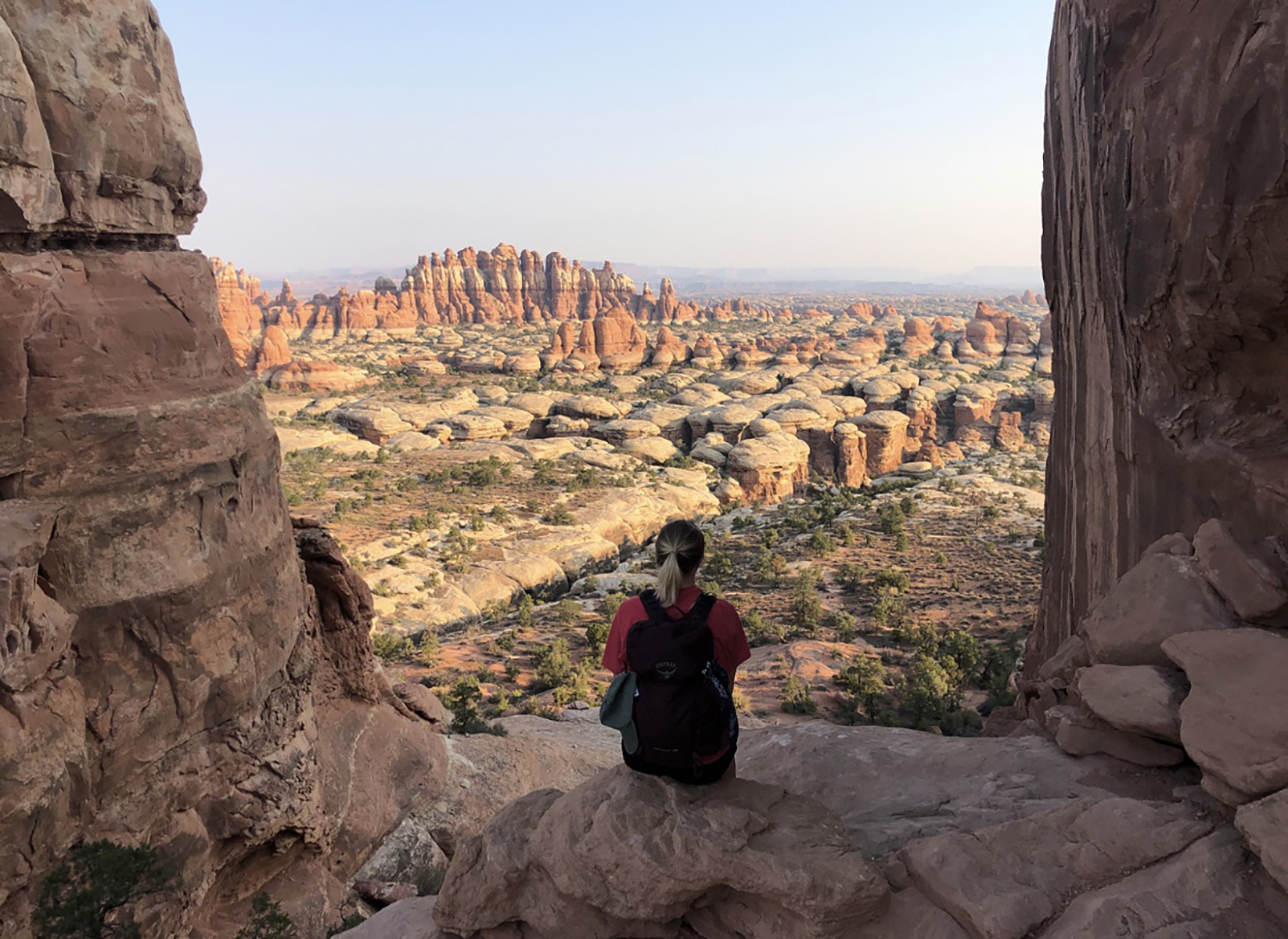 Photo: NPS/C.Gilmore
- 4.6 mi
- round trip
- 769 ft
- climb
- 5,687 ft
- high point
- Out and back
- route
- Mar–May, Sep–Oct
- best months
Is Chesler Park Viewpoint Trail open right now?
Alert in the area
The National Park Service lists 2 alerts for Canyonlands National Park.
White Rim Road Impassable to Vehicles due to Rockfall
Park alert covering Canyonlands National Park · NPS · Canyonlands National Park
Mineral Bottom and White Rim Road are Not Recommended
Park alert covering Canyonlands National Park · NPS · Canyonlands National Park
As of · Source: NPS · Canyonlands National Park. Agencies don't list every closure — check before you go.
Chesler Park Viewpoint Trail is a moderate out-and-back hike in Canyonlands National Park in Utah, managed by the National Park Service. The trail is 9.2 miles long, with a one-way elevation gain of 769 feet, and it rises from about 5,140 feet to a high point of 5,687 feet. The trailhead is at Elephant Hill Trailhead, and the route is part of the park's network of trails around Chesler Park. Spring and fall are the most comfortable times to go. Typical averages from a nearby weather station at Canyonlands-The Needles show May highs around 77°F and October highs around 70°F, while July averages about 95°F and January highs sit near 42°F. The trail starts close to several other routes. The Chesler Park Loop and Joint Trail, Druid Arch Trail and Chesler Park are all about 0.1 mile away. For an overnight stay, Canyonlands National Park Needles District Campground is about 4.1 miles off.
Local outfitters
- Red Desert RV Park31 mi away
- Spanish Trail RV Park32 mi away
Not on Roamze yet. Their page has how to reach them.
Best time to go · Mar–May, Sep–Oct
Best time to visit Chesler Park Viewpoint Trail
Best months: March–May and September–October. Best months have typical highs of 55–85 °F, lows of 30 °F or warmer (32 °F where the station doesn't record snow), at most one snowy day and no more than 12 wet days.
Jan
42° / 17°
4 wet · 2 snow
Feb
49° / 23°
4 wet · 1 snow
Mar
59° / 30°
5 wet · 1 snow
Apr
67° / 36°
5 wet
May
77° / 46°
4 wet
Jun
89° / 56°
3 wet
Jul
95° / 63°
5 wet
Aug
92° / 61°
6 wet
Sep
84° / 51°
5 wet
Oct
70° / 38°
5 wet
Nov
55° / 26°
4 wet · 1 snow
Dec
42° / 18°
4 wet · 2 snow
Typical high / low (°F) and days with rain or snow, 1991–2020. Measured at Canyonlands-The Needles, UT, 4.1 mi away at 4,906 ft. The station sits about 800 ft lower than this place, so expect it a little cooler here. Source: NOAA NCEI U.S. Climate Normals 1991–2020.
Keep exploring — more trails worth the drive
HIKE
Big Spring Canyon to Elephant Canyon Loop Trail
~2 min drive
This loop features extended hiking on slickrock benches and mesa tops overlooking canyons. Excellent views of sheer cliff walls and other rock formations. Roundtrip Distance: 10.5 mi (16.9 km) Time: 4-6 hrs Overall Elevation Change: 443ft (135m) Cumulative elevation gain on…
HIKE
Peekaboo Trail
~2 min drive
This trail crosses both Wooden Shoe and Lost Canyons on its way to Salt Creek Canyon, passing along high slickrock benches with spectacular views. Roundtrip Distance: 10.8 mi (17.4 km) Time: 5-6 hrs Overall Elevation Change: 429 ft (131 m) Cumulative elevation gain on this…
HIKE
Canyonlands' Cave Spring Trail
~7 min drive
This is the trailhead for a short, 0.6-mile (1 km) loop leading to a historic cowboy camp and prehistoric rock markings. You will climb two ladders to complete the route. Roundtrip Distance: 0.6 mi (1 km) Time: 45 min Elevation Change: 67 ft (20 m) Difficulty: Easy Hike…
HIKE
Devils Kitchen
~5 min drive
5.99-mile out-and-back trail in Utah with 1,186 ft elevation gain.
HIKE
Big Spring Canyon to Wooden Shoe Canyon Loop Trail
~2 min drive
A great introduction to the landscape of The Needles, this route connects two canyons for a loop across varied terrain. Roundtrip Distance: 7.5 mi (12 km) Time: 3-4 hrs Overall Elevation Change: 478 ft (146 m) Cumulative elevation gain on this route is much greater.…
 Photo: BFS Man from Webster, TX, USA, CC BY 2.0 (via Wikimedia Commons)
Lower Lost Hiker
~4 min drive
2.06-mile out-and-back trail in Utah with 659 ft gain.
HIKE
Wooden Shoe Canyon to Lost Canyon Loop Trail
~2 min drive
This loop hike is a bit more challenging, with one ladder and some difficult sections of climbing between the two canyons. Roundtrip Distance: 8.7 mi (14 km) Time: 4-6 hrs Overall Elevation Change: 404 ft (123 m) Cumulative elevation gain on this route is much greater.…
 Photo: BFS Man from Webster, TX, USA, CC BY 2.0 (via Wikimedia Commons)
Lost Canyon
~5 min drive
3.15-mile out-and-back trail in Utah with 628 ft elevation gain.
Photo: BFS Man from Webster, TX, USA, CC BY 2.0 (via Wikimedia Commons)Elephant Canyon
~2 min drive
2.82-mile out-and-back trail in Utah with 686 ft elevation gain.
 Photo: InSapphoWeTrust from Los Angeles, California, USA, CC BY-SA 2.0 (via Wikimedia Commons)
Spanish Bottom
~9 min drive
1.90-mile out-and-back trail in Utah with 1,519 ft gain.
Also worth it near here
 Photo: RuggyBearLA, CC BY 2.0 (via Wikimedia Commons)
The Needles District
~4 min drive
 Photo: J. Benjamin Wildeboer (talk · contribs), Ben W on flickr, CC BY-SA 2.0 (via Wikimedia Commons)
Druid Arch
~6 min drive
SEE
Lower Jump
~7 min drive
BED
Canyonlands National Park Needles District Campground
~7 min drive
