Sun Outdoors Arches Gateway
Campground
Campground · 2.1 mi from the trail
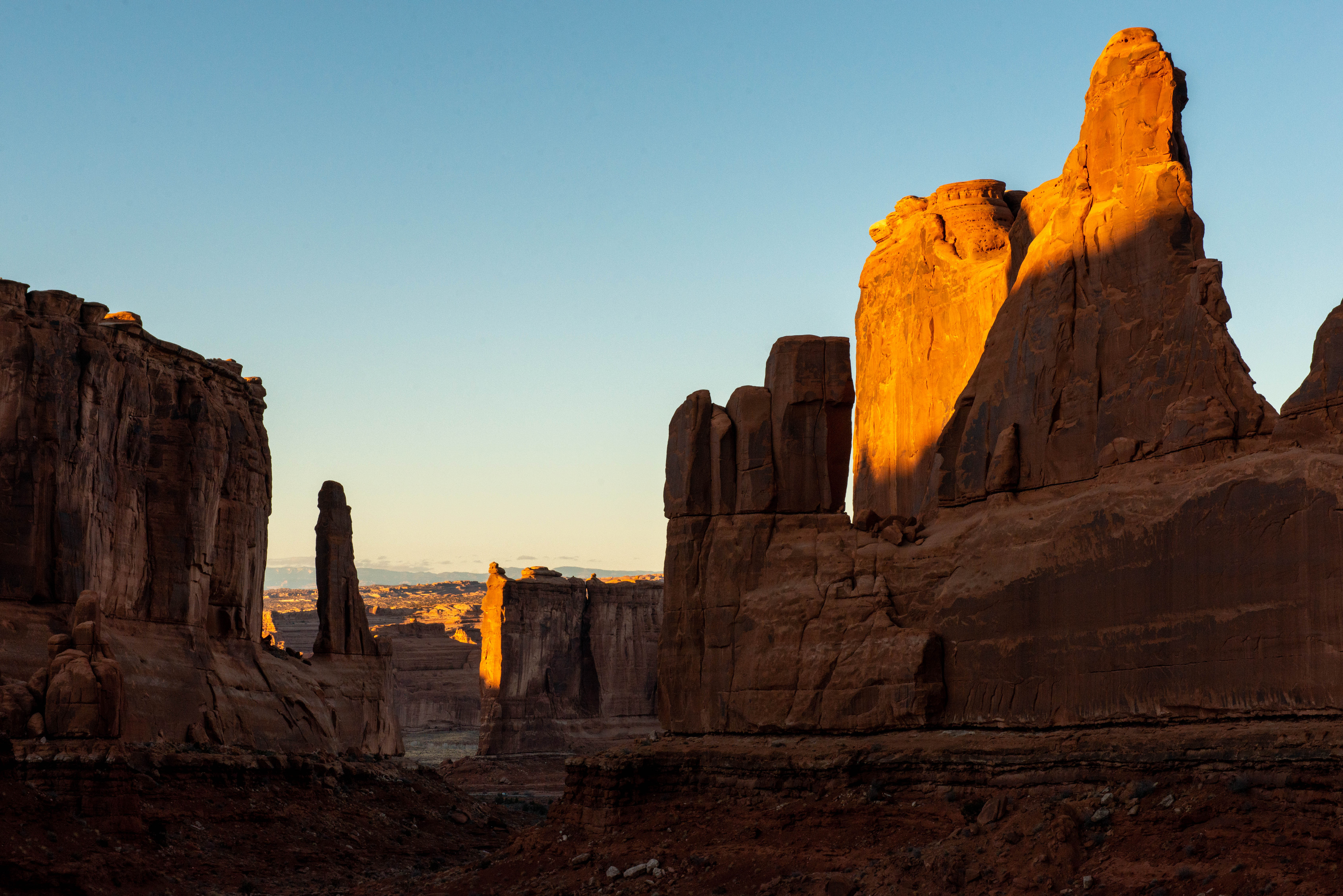 Photo: NPS/Veronica Verdin
No closures listed
The National Park Service lists no closures for Arches National Park.
As of · Source: NPS · Arches National Park. Agencies don't list every closure — check before you go.
A paved sidewalk leads to a viewpoint down a corridor of towering rock walls and curiously carved spires. Descend stairs to walk the trail among massive monoliths toward Courthouse Towers Viewpoint one mile away. • Roundtrip Distance: 1.8 mi (3.2 km) • Time: 1 hour • Elevation Change: 322 ft (98 m) • Difficulty: Moderate • Hike Description: The trail descends steeply into a spectacular canyon and continues to Courthouse Towers. For a roundtrip hike, retrace your steps along the trail rather than walking along the road. • Trail Tip: To avoid the steep stairs, start at the north end. • Accessibility: The paved walkway to the viewpoint is accessible to wheelchairs. Beyond, this trail has a long flight of stairs and requires some walking on sand and uneven surfaces. • Dogs are not allowed on this trail. Service animals are allowed in national parks. What is a service animal? Just 3.6 miles (5.8 km) after Arches National Park Visitor Center, this is many visitors' first scenic stop. At Park Avenue, you can gaze down a grand boulevard of rock and let your imagination loose. Previous visitors named some of the rock features here "Queen Nefertiti," "Queen Victoria," and "Sausage Rock" (also known as "The Corndog"). What names does your imagination suggest? Often overlooked, Park Avenue Arch is visible from the parking lot, suspended high up a rock wall on the right. Light is not visible through the arch from this angle.
Sun Outdoors Arches Gateway
Campground
Panorama Viewpoint
Viewpoint
Places © OpenStreetMap contributors
More in MoabNot on Roamze yet. Their page has how to reach them.
Best months: March–May and October–November. Best months have typical highs of 55–85 °F, lows of 30 °F or warmer (32 °F where the station doesn't record snow), at most one snowy day and no more than 12 wet days.
Jan
42° / 22°
4 wet
Feb
50° / 29°
4 wet
Mar
62° / 37°
5 wet
Apr
70° / 44°
5 wet
May
80° / 53°
5 wet
Jun
93° / 63°
3 wet
Jul
99° / 70°
5 wet
Aug
96° / 68°
6 wet
Sep
87° / 58°
5 wet
Oct
72° / 44°
5 wet
Nov
56° / 33°
4 wet
Dec
42° / 24°
4 wet
Typical high / low (°F) and days with rain or snow, 1991–2020. Measured at Arches Np Hqs, UT, 1.2 mi away at 4,093 ft. This station doesn't record snowfall. Source: NOAA NCEI U.S. Climate Normals 1991–2020.
HIKE
Arches Visitor Center Nature Trail
~2 min drive
Walk a short path behind the visitor center to learn about native desert plants and their traditional uses. Roundtrip Distance: 150 feet (45 m) Time: 10 min Elevation Change: 0 ft (0 m) Difficulty: Easy Hike Description: Learn about native desert plants on this short trail…
 Photo: inkknife_2000 (7.5 million views +), CC BY-SA 2.0 (via Wikimedia Commons)
Ring Arch Trail
~3 min drive
2.88-mile out-and-back hike in Utah with 325 ft elevation gain
Photo: inkknife_2000 (7.5 million views +), CC BY-SA 2.0 (via Wikimedia Commons)Courthouse Wash Trail
~3 min drive
10.48-mile out-and-back trail in Utah with 2,545 ft elevation gain/loss.
HIKE
Gold Bar Rim Bike Trail
~4 min drive
7.1-mile out-and-back bike trail in Utah with 4,800 ft elevation gain and loss.
HIKE
Long Branch Trail
~4 min drive
2.1-mile out-and-back hike in Utah with 902 ft elevation gain
HIKE
Courthouse Wash Panel Trail
~2 min drive
Where Courthouse Wash joins the Colorado River, walk across the small bridge and up a short trail to see a panel of rock markings created by Indigenous travelers. Roundtrip Distance: 0.8 mi (1.4 km) Time: 30-60 min Elevation Change: 60 ft (18 m) Difficulty: Easy Hike…
HIKE
Courthouse Wash Panel
~3 min drive
0.45-mile out-and-back trail in Utah with 127 ft gain.
HIKE
Moab Canyon Bike Path
~3 min drive
Scenic 5.45-mile Moab red rock route with 960 ft elevation gain.
HIKE
Where Eagles Dare Trail
~5 min drive
6.28-mile out-and-back trail in Utah with 1,736 ft gain and loss.
HIKE
Killer B Trail
~3 min drive
1.46-mile out-and-back trail in Utah with 679 ft gain and 4,680 ft max elevation.
Also worth it near here


