Eva Conover Trail
- 12.3 mi
- round trip
- 2,587 ft
- climb
- 6,963 ft
- high point
- Out and back
- route
- Apr–Jun, Sep–Oct
- best months
The Eva Conover Trail is a 24.6-mile out-and-back hike in Utah's Eagle Canyon Wilderness, managed by the Bureau of Land Management's Price Field Office. The route starts at the high point of 6,963 feet and descends to a low of 5,780 feet, with a total elevation gain and loss of 2,587 feet each way. The climb is back-loaded, with the steepest stretch at about 3.8 miles in, where the grade reaches 11 percent. The trail is rated expert, and the round trip takes about 9.5 hours. The most comfortable months for a visit are typically May and September. Typical averages from the nearby Ferron weather station, which sits about 1,000 feet lower, show May highs around 71°F and September highs around 78°F. July is the warmest month, with typical highs near 89°F, and winter brings highs in the upper 30s and a few snowy days each month from December through February. Several other routes lie within a short drive. Eagle Canyon Trail is about 3.2 miles away, and Fix It Pass Trail and Moore-Moore Int. Trail are each about 4.1 miles off. Climbers can find Head of Sinbad North about 6.1 miles away.
Local outfitters
- Muddy Creek Mining Co.38 mi away
Not on Roamze yet. Their page has how to reach them.
 Eagle Canyon TrailHikingPhoto: Scott Thompson, CC BY 3.0 (via Wikimedia Commons)3.2 mi
- Fix It Pass TrailHiking4.1 mi
- Moore-Moore Int. TrailHiking4.1 mi
- Swasey Cabin TrailHiking5.2 mi
 Head of Sinbad NorthRock climbingPhoto: Greg Willis from Denver, CO, usa, CC BY-SA 2.0 (via Wikimedia Commons)6.1 mi
 SwaseylandRock climbingPhoto: hakkun, CC BY-SA 3.0 (via Wikimedia Commons)6.1 mi
 Moore Cutoff RoadRock climbingPhoto: inkknife_2000 (7.5 million views +), CC BY-SA 2.0 (via Wikimedia Commons)7.3 mi
 The Weasel FormationRock climbingPhoto: Famartin, CC BY-SA 4.0 (via Wikimedia Commons)8.5 mi
Source: Roamze catalog (indexable pages within 10 miles, PostGIS distance)
- Swaseys Cabin-Rods Valle TrailHiking · ~10 min drivePhoto: Greg Willis from Denver, CO, usa, CC BY-SA 2.0 (via Wikimedia Commons)
 Coal Wash TrailHiking · ~16 min drivePhoto: inkknife_2000 (7.5 million views +), CC BY-SA 2.0 (via Wikimedia Commons)
 Waterfall TrailHiking · ~28 min drivePhoto: Greg Willis from Denver, CO, usa, CC BY-SA 2.0 (via Wikimedia Commons)
- Eagle Canyon TrailHiking · ~6 min drivePhoto: Scott Thompson, CC BY 3.0 (via Wikimedia Commons)
 Fix It Pass TrailHiking · ~11 min drivePhoto: inkknife_2000 (7.5 million views +), CC BY-SA 2.0 (via Wikimedia Commons)
 Arsens Garden Loop TrailHiking · ~24 min drivePhoto: U.S. Department of the Interior, CC BY-SA 2.0 (via Wikimedia Commons)
 Little Grand Canyon TrailHiking · ~25 min drivePhoto: Greg Willis from Denver, CO, usa, CC BY-SA 2.0 (via Wikimedia Commons)
- Green Trail (BLM 841)Hiking · ~24 min drive
- Red Draw TrailHiking · ~25 min drivePhoto: U.S. Department of the Interior, CC BY-SA 2.0 (via Wikimedia Commons)
 Goodwater RimHiking · ~28 min drivePhoto: Greg Willis from Denver, CO, usa, CC BY-SA 2.0 (via Wikimedia Commons)
Also worth it near here
 Dutchman ArchNatural arch · ~9 min drivePhoto: Greg Willis from Denver, CO, usa, CC BY-SA 2.0 (via Wikimedia Commons)
- Head of Sinbad NorthRock climbing · ~10 min drivePhoto: Greg Willis from Denver, CO, usa, CC BY-SA 2.0 (via Wikimedia Commons)
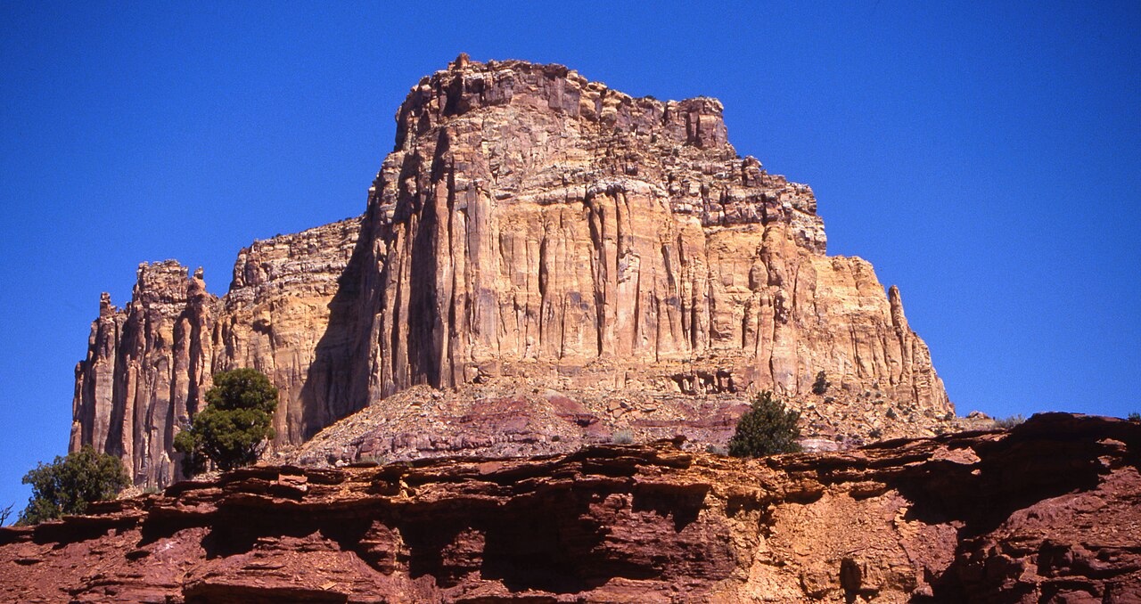 Square TopSummit · ~16 min drivePhoto: Bureau of Land Management - Utah, Public domain (via Wikimedia Commons)
- Sids ReservoirLake fishing · ~20 min drive
Best time to visit Eva Conover Trail
Best months: April–June and September–October. Best months have typical highs of 55–85 °F, lows of 30 °F or warmer (32 °F where the station doesn't record snow), at most one snowy day and no more than 12 wet days.
Jan
37° / 14°
4 wet · 3 snow
Feb
43° / 20°
4 wet · 3 snow
Mar
54° / 29°
4 wet · 2 snow
Apr
62° / 35°
4 wet · 1 snow
May
71° / 45°
5 wet
Jun
83° / 54°
4 wet
Jul
89° / 60°
6 wet
Aug
86° / 58°
7 wet
Sep
78° / 49°
6 wet
Oct
65° / 37°
4 wet
Nov
49° / 25°
3 wet · 1 snow
Dec
37° / 15°
4 wet · 3 snow
Typical high / low (°F) and days with rain or snow, 1991–2020. Measured at Ferron, UT, 18.6 mi away at 5,923 ft. The station sits about 1,000 ft lower than this place, so expect it a little cooler here. Source: NOAA NCEI U.S. Climate Normals 1991–2020.
Map and trail data © OpenStreetMap contributors
