Mill Flat Trail
- 1.5 mi
- round trip
- 448 ft
- climb
- 8,210 ft
- high point
- Out and back
- route
- May–Sep
- best months
Is Mill Flat Trail open right now?
No closures listed
The Forest Service lists no closures for Uinta-Wasatch-Cache National Forest.
As of · Source: USFS · Uinta-Wasatch-Cache National Forest. Agencies don't list every closure — check before you go.
Mill Flat Trail is an easy out-and-back hike of about 2.9 miles in the Heber-Kamas Ranger District of the Uinta-Wasatch-Cache National Forest in Utah. The trail starts at about 7,950 feet and climbs to a high point of about 8,210 feet, with a total gain of roughly 448 feet. The climb is front-loaded, and the steepest stretch comes at about 0.8 miles in, with a 7% grade. The Forest Service manages the land. Summer is the most comfortable time to go. Typical averages from a nearby weather station at Moon Lake, at about 8,125 feet, show July and August highs around 77°F with lows in the upper 40s. Winters there are cold, with January highs near 31°F. The hike takes about an hour. The Duchesne River trail lies about 1.4 miles away and Little Deer Creek SNOMO Marked about 1.8 miles. For an overnight stay, Iron Mine campground is about 3.6 miles off, and the Wall Of Tiers climbing area is about 5.1 miles away.
Local outfitters
- Midway Adventure Company31 mi away
- Rocky Mountain Outfitters33 mi away
Not on Roamze yet. Their page has how to reach them.
- Duchesne RiverHiking1.4 mi
- LITTLE DEER CREEK SNOMO MARKEDHiking1.8 mi
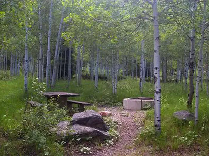 Iron MineCampingPhoto: Recreation.gov (RIDB) / public domain3.6 mi
- Cobblerest CampgroundCamping4.7 mi
 Wall Of TiersRock climbingPhoto: Glennfcowan, CC BY 3.0 (via Wikimedia Commons)5.1 mi
- Lost LakeLake fishing5.5 mi
- Fehr LakeLake fishing5.8 mi
- The Pass CragRock climbing6.1 mi
Source: Roamze catalog (indexable pages within 10 miles, PostGIS distance)
 Teapot LakeHiking · ~10 min drivePhoto: Glennfcowan, CC BY 3.0 (via Wikimedia Commons)
 Mirror LakeHiking · ~11 min drivePhoto: Glennfcowan, CC BY 3.0 (via Wikimedia Commons)
- Notch MountainHiking · ~11 min drivePhoto: Glennfcowan, CC BY 3.0 (via Wikimedia Commons)
- Fehr LakeHiking · ~10 min drivePhoto: Glennfcowan, CC BY 3.0 (via Wikimedia Commons)
- LITTLE DEER CREEK SNOMO MARKEDHiking · ~3 min drive
- Hades-Rocky Sea PassHiking · ~7 min drive
- Mirror Lake ShorelineHiking · ~12 min drivePhoto: Glennfcowan, CC BY 3.0 (via Wikimedia Commons)
- Duchesne RiverHiking · ~5 min drive
- East Fork Duchesne RiverHiking · ~8 min drive
- Mohawk Lake TrailHiking · ~7 min drive
Best time to visit Mill Flat Trail
Best months: May–September. Best months have typical highs of 55–85 °F, lows of 30 °F or warmer (32 °F where the station doesn't record snow), at most one snowy day and no more than 12 wet days.
Jan
31° / 7°
Feb
34° / 12°
Mar
41° / 18°
Apr
49° / 24°
May
59° / 33°
Jun
69° / 40°
Jul
77° / 48°
Aug
77° / 49°
Sep
67° / 41°
Oct
55° / 31°
Nov
40° / 22°
Dec
31° / 11°
Typical high / low (°F) and days with rain or snow, 1991–2020. Measured at Moon Lake, UT, 21 mi away at 8,125 ft. This station doesn't record snowfall. Source: NOAA NCEI U.S. Climate Normals 1991–2020.

Map and trail data © OpenStreetMap contributors
