Shafer
Campground
Campground · 0.9 mi from the trail
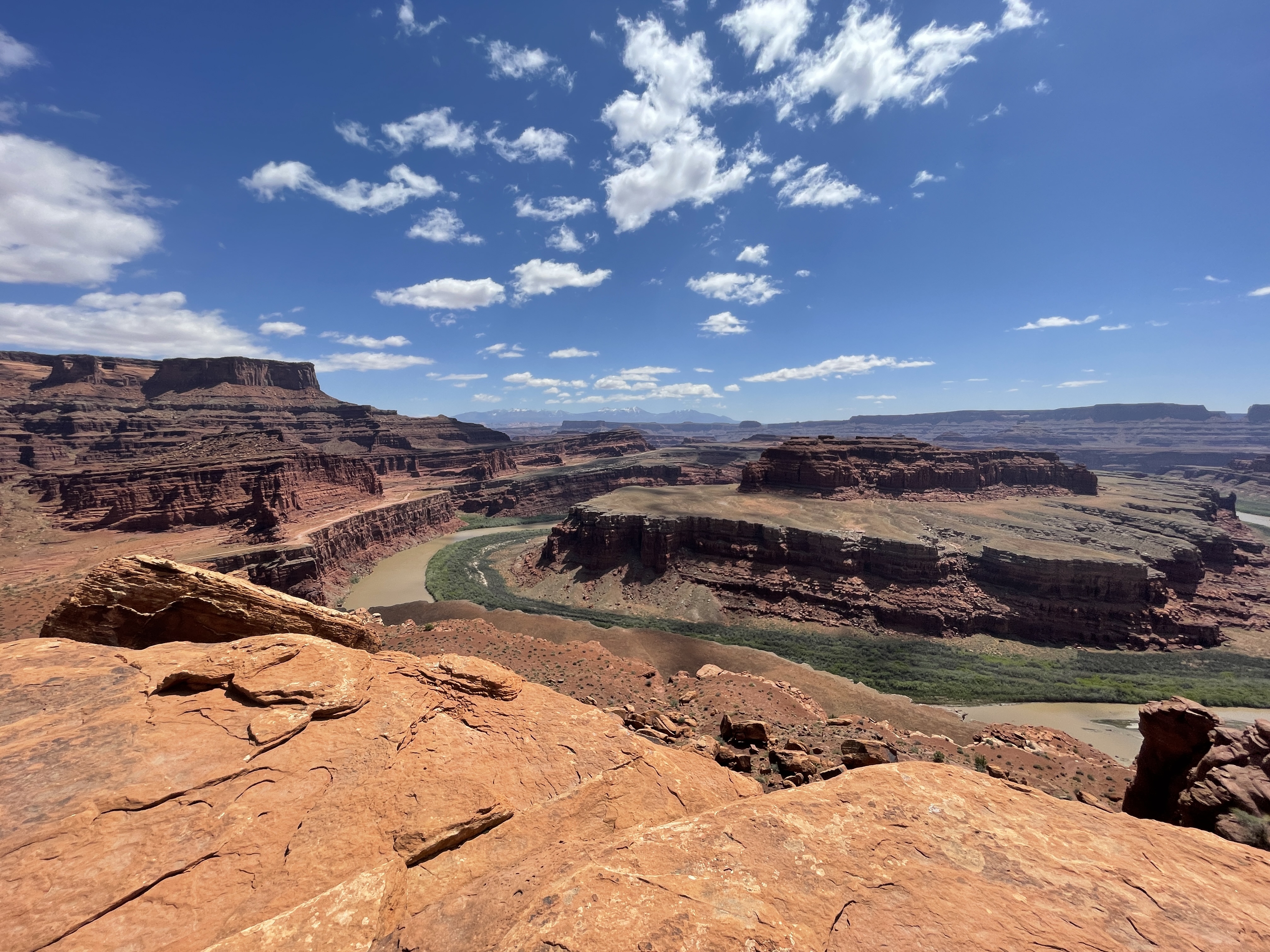 Photo: Veronica Verdin
Alert in the area
The National Park Service lists 2 alerts for Canyonlands National Park.
White Rim Road Impassable to Vehicles due to Rockfall
Park alert covering Canyonlands National Park · NPS · Canyonlands National Park
Mineral Bottom and White Rim Road are Not Recommended
Park alert covering Canyonlands National Park · NPS · Canyonlands National Park
As of · Source: NPS · Canyonlands National Park. Agencies don't list every closure — check before you go.
Gooseneck Overlook Trail is a short, easy hike in Canyonlands National Park in Utah, about 0.28 miles long and 81 feet of elevation gain on an out-and-back route. The trail reaches a high point of 4,844 feet, and the trailhead is named Gooseneck Trail Trailhead. The National Park Service manages the land, and a fee is charged for the visit. Spring and fall are the most comfortable times to go. Typical averages from a nearby weather station at Canyonlands-The Neck put May highs around 72°F and October highs around 65°F, while July averages about 91°F and winter brings frequent snow days. Close by, Shafer Trail lies about 0.6 miles away, and Neck Spring Trail is about 2.5 miles off. Bird's View Butte / Crow's Head Spires offers climbing roughly 2.6 miles away, and Cowboy Camp Campground is about 7.4 miles away.
Shafer
Campground
 If it rainsCarter Pape, CC BY-SA 4.0 · Wikimedia Commons
Hell's Revenge
Attraction
Places © OpenStreetMap contributors · Photos: Carter Pape, CC BY-SA 4.0 (commons)
More in MoabNot on Roamze yet. Their page has how to reach them.
Best months: April–June and September–October. Best months have typical highs of 55–85 °F, lows of 30 °F or warmer (32 °F where the station doesn't record snow), at most one snowy day and no more than 12 wet days.
Jan
37° / 22°
4 wet · 4 snow
Feb
43° / 27°
4 wet · 3 snow
Mar
54° / 35°
5 wet · 2 snow
Apr
62° / 40°
5 wet · 1 snow
May
72° / 50°
5 wet
Jun
85° / 62°
3 wet
Jul
91° / 68°
6 wet
Aug
88° / 66°
7 wet
Sep
79° / 57°
6 wet
Oct
65° / 44°
5 wet
Nov
49° / 33°
4 wet · 2 snow
Dec
37° / 23°
4 wet · 4 snow
Typical high / low (°F) and days with rain or snow, 1991–2020. Measured at Canyonlands-The Neck, UT, 2.6 mi away at 5,871 ft. The station sits about 1,000 ft higher than this place, so expect it a little warmer here. Source: NOAA NCEI U.S. Climate Normals 1991–2020.
 Photo: Greg Willis from Denver, CO, usa, CC BY-SA 2.0 (via Wikimedia Commons)
Shafer Trail
Next door
24.72-mile out-and-back hike in Utah with 2,722 ft elevation gain and loss.
HIKE
Neck Spring Trail
~4 min drive
A walk back in time, this loop trail passes historic ranching features and two springs where cowboys watered cattle. Roundtrip Distance: 5.6 mi (9 km) Time: 3-4 hrs Elevation Change: 418 ft (127 m) Difficulty: Moderate – Mesa Top Hike Description: A walk back in time, this…
 Photo: BFS Man from Webster, TX, USA, CC BY 2.0 (via Wikimedia Commons)
West Rim Trail
~5 min drive
West Rim Trail is a 2.13-mile out-and-back trail in Utah with 774 ft of elevation gain.
 Photo: BFS Man from Webster, TX, USA, CC BY 2.0 (via Wikimedia Commons)
East Rim Trail
~5 min drive
2.76-mile out-and-back trail in Utah with 1,898 ft elevation gain and loss.
 Photo: Greg Willis, CC BY-SA 3.0 (via Wikimedia Commons)
Lathrop Canyon
~6 min drive
5.89-mile out-and-back trail in Utah with 2,794 ft elevation gain
 Photo: swhitfield, CC BY-SA 3.0 (via Wikimedia Commons)
Alcove Spring
~14 min drive
5.63-mile out-and-back trail in Utah with 2,113 ft of elevation gain.
HIKE
Shafer Trail Viewpoint
~4 min drive
A short, 0.9 mi (1.4 km) drive past the Island in the Sky visitor center leads to a breathtaking view of the Shafer Trail. The Shafer Trail at the Island in the Sky district of Canyonlands National Park is an iconic road that descends 1,500 feet (457 m) through a colorful…
Photo: BFS Man from Webster, TX, USA, CC BY 2.0 (via Wikimedia Commons)Intrepid
~5 min drive
0.61-mile out-and-back trail in Utah with 58 feet of elevation gain.
Photo: BFS Man from Webster, TX, USA, CC BY 2.0 (via Wikimedia Commons)Prickly Pair
~6 min drive
Easy 2.94-mile desert hike with 289 ft elevation gain near Prickly Pair.
HIKE
Wilhite Trail
~13 min drive
A primitive trail with steep switchbacks drops 1,600 feet (488 m) into a long, sandy wash. Follow the wash to the White Rim Road. No shade. Roundtrip Distance: 11.4 mi (18.3 km) Time: 6-8 hrs Elevation Change: 1,693 ft (516 m) Difficulty: Strenuous– Mesa Top to White Rim…

