Up The Creek Campground
Hiking business nearby (~21 mi away) — hasn't claimed their Roamze page yet
Free — you'll pick up right here.
Watch this trail
Sign up to watch it — saving subscribes you to gate, closure and report changes.
Utah
5.6 mi
Distance
2,139 ft
Gain
2h 56m
Time
We won't guess. Here is exactly what we do and don't know.
What we do know
Inside Canyonlands National Park
National Park unit boundary is mapped — agency alerts for it feed this page automatically.
Boundary data
What's missing
No access route mapped
We don't yet know which road reaches this trailhead, so we can't tell you if it's gated.
Nobody's filed a report here yet — be the first.
Why you'll love it
Alcove Spring
AI-suggested draft · review before you go
Alcove Spring is a 5.63-mile out-and-back trail in Utah managed by the National Park Service. The trail gains 2,113 feet of elevation.
Moses and Zeus Towers Trail
~0 min drive
Reaching this trail requires a permit to drive the 4WD White Rim Road or hiking down Alcove Spring Trail (11.2 mi/18.3 km roundtrip). Moses and Zeus are two prominent towers overlooking Taylor Canyon. This trail leads to their base. Roundtrip Distance: 1.3 mi (2 km) Time: 1…
 Photo: BFS Man from Webster, TX, USA, CC BY 2.0 (via Wikimedia Commons)
Upheaval Crater Spur
~5 min drive
2.15-mile out-and-back trail at Upheaval Crater in Utah with 124 ft elevation gain.
Whale Rock Trail
~6 min drive
Many features in this region bear imaginative names. Does this long sandstone dome looked like a giant whale to you? This trail walks along its side, then climbs from its "tail" up to its "blowhole." Roundtrip Distance: 0.8 mi (1.3 km) Time: 1 hr Elevation Change: 141 ft (43…
Wilhite Trail
~9 min drive
A primitive trail with steep switchbacks drops 1,600 feet (488 m) into a long, sandy wash. Follow the wash to the White Rim Road. No shade. Roundtrip Distance: 11.4 mi (18.3 km) Time: 6-8 hrs Elevation Change: 1,693 ft (516 m) Difficulty: Strenuous– Mesa Top to White Rim…
 Photo: swhitfield, CC BY-SA 3.0 (via Wikimedia Commons)
Moses & Zeus
~1 min drive
0.85-mile lollipop trail in Utah with 136 ft gain and 540 ft loss.
Syncline Trail
~6 min drive
The Syncline Trail follows canyons around Upheaval Dome and requires navigating steep switchbacks, climbing and scrambling through boulder fields, and a 1,500-foot (460 m) elevation change. This is the most challenging trail in the Island in the Sky district, and most park…
Alcove Spring Trail
~6 min drive
After descending 1,300 feet (396 m) past a large alcove, the trail meanders in a wide canyon to the base of the notable Moses and Zeus towers. Roundtrip Distance: 11.2 mi (18 km) Time: 6-7 hrs Elevation Change: 1,455 ft (444 m) Difficulty: Strenuous – Mesa Top to White Rim…
 Photo: Greg Willis, CC BY-SA 3.0 (via Wikimedia Commons)
Lathrop Canyon
~13 min drive
5.89-mile out-and-back trail in Utah with 2,794 ft elevation gain
Photo: BFS Man from Webster, TX, USA, CC BY 2.0 (via Wikimedia Commons)Upheaval Dome
~6 min drive
0.57-mile out-and-back trail at Upheaval Dome in Utah with 174 ft gain.
 Photo: Greg Willis from Denver, CO, usa, CC BY-SA 2.0 (via Wikimedia Commons)
Wilhite
~9 min drive
5.71-mile out-and-back trail in Utah with 2,269 ft of elevation gain.
Also worth it near here
 Photo: Jim Stuby (user Jstuby), Public domain (via Wikimedia Commons)
Upheaval Dome
~6 min drive
 Photo: au_ears, CC BY-SA 2.0 (via Wikimedia Commons)
Island In The Sky
~9 min drive
Mineral Bottom Recreation Site
~9 min drive
Mineral Bottom Recreation Site
~9 min drive
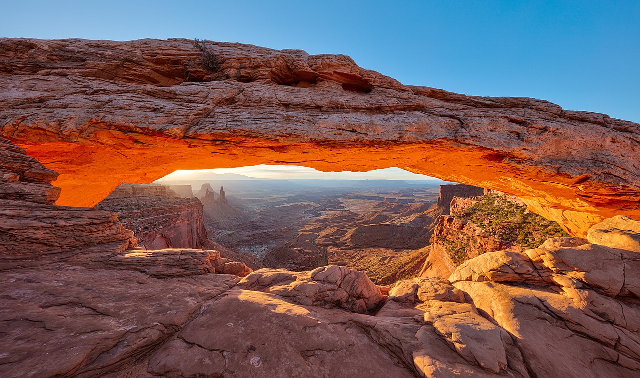 Photo: Thomas Wolf, www.foto-tw.de, CC BY-SA 3.0 (via Wikimedia Commons)
Mesa Arch
~12 min drive
Local operatorsoffering guided trips. You book directly with them — Roamze doesn’t take a cut.
Up The Creek Campground
Hiking business nearby (~21 mi away) — hasn't claimed their Roamze page yet
Moab Rim Campark
Hiking business nearby (~22 mi away) — hasn't claimed their Roamze page yet
Spanish Trail RV Park
Hiking business nearby (~23 mi away) — hasn't claimed their Roamze page yet
