Fish Creek Access
- 0.4 mi
- round trip
- 71 ft
- climb
- 6,193 ft
- high point
- Out and back
- route
- Apr–Jun, Aug–Oct
- best months
Fish Creek Access is a short, easy hike on Bureau of Land Management land in Utah, within the Monticello Field Office. The route is an out-and-back that covers about 0.8 miles, rising roughly 70 feet from a low point of 6,105 feet to a high of 6,193 feet. The trail surface is natural, and the access is rated easy, making it a quick stop rather than a full-day outing. The most comfortable months for a visit are typically May and September. At a nearby weather station, typical averages run to highs around 71°F in May and 77°F in September, while July averages climb to 89°F and winter highs sit near 39°F. Bikes and horses are not allowed on this route. The closest trails are Nevills Arch Trail, about 3 miles away, and Mule Canyon Trail, about 3.5 miles away. Arch Canyon, a climbing area, lies roughly 7 miles off, and Comb Ridge is about 10 miles away.
Local outfitters
- Coral Sands RV Park19 mi away
- Sacred Monument Tours40 mi away
Not on Roamze yet. Their page has how to reach them.
- Nevills Arch TrailHiking2.9 mi
- Mule Canyon TrailHiking3.5 mi
- Mule Canyonn TrailHiking4.4 mi
- Moon House TrailHiking4.5 mi
- Salvation KnollHiking5.2 mi
- Emigrant TrailHiking5.9 mi
 Arch CanyonRock climbingPhoto: BLMUtah, Public domain (via Wikimedia Commons)7.1 mi
- Comb RidgeRock climbing9.8 mi
Source: Roamze catalog (indexable pages within 10 miles, PostGIS distance)
 Salvation Knoll Trail (475)Hiking · ~11 min drivePhoto: Ken Lund from Reno, Nevada, USA, CC BY-SA 2.0 (via Wikimedia Commons)
- West Rim Texas CanyonHiking · ~12 min drivePhoto: Ken Lund from Reno, Nevada, USA, CC BY-SA 2.0 (via Wikimedia Commons)
 Grand Gulch TrailHiking · ~17 min drivePhoto: Greg Willis, CC BY-SA 3.0 (via Wikimedia Commons)
- Nevills Arch TrailHiking · ~5 min drive
 Kane Gulch TrailHiking · ~14 min drivePhoto: Greg Willis, CC BY-SA 3.0 (via Wikimedia Commons)
- Texas TrailHiking · ~13 min drivePhoto: Ken Lund from Reno, Nevada, USA, CC BY-SA 2.0 (via Wikimedia Commons)
 Bullet Canyon TrailHiking · ~18 min drivePhoto: Greg Willis, CC BY-SA 3.0 (via Wikimedia Commons)
- Mule Canyon TrailHiking · ~6 min drive
- Grand Gulch TrailHiking · ~14 min drivePhoto: Greg Willis, CC BY-SA 3.0 (via Wikimedia Commons)
- Emigrant TrailHiking · ~10 min drive
Also worth it near here
- Arch CanyonRock climbing · ~12 min drivePhoto: BLMUtah, Public domain (via Wikimedia Commons)
 Lyman Canyon OverlookMountain biking · ~15 min drivePhoto: brewbooks from near Seattle, USA, CC BY-SA 2.0 (via Wikimedia Commons)
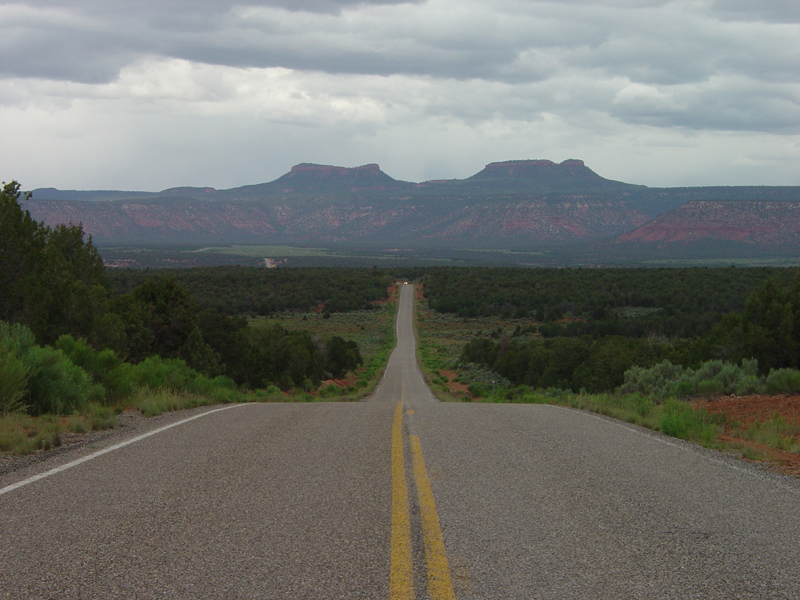 Bears EarsSummit · ~17 min drivePhoto: U.S. Geological Surey, Public domain (via Wikimedia Commons)
- The Thumb Pour OffWaterfall · ~24 min drive
Best time to visit Fish Creek Access
Best months: April–June and August–October. Best months have typical highs of 55–85 °F, lows of 30 °F or warmer (32 °F where the station doesn't record snow), at most one snowy day and no more than 12 wet days.
Jan
39° / 20°
6 wet · 4 snow
Feb
43° / 24°
6 wet · 3 snow
Mar
53° / 30°
5 wet · 2 snow
Apr
60° / 35°
5 wet · 1 snow
May
71° / 44°
5 wet
Jun
83° / 54°
3 wet
Jul
89° / 60°
7 wet
Aug
85° / 58°
8 wet
Sep
77° / 51°
6 wet
Oct
63° / 39°
5 wet
Nov
50° / 29°
4 wet · 2 snow
Dec
39° / 20°
6 wet · 4 snow
Typical high / low (°F) and days with rain or snow, 1991–2020. Measured at Natural Bridges Nm, UT, 13.5 mi away at 6,508 ft. Source: NOAA NCEI U.S. Climate Normals 1991–2020.
