Bristlecone Loop wayside (108)
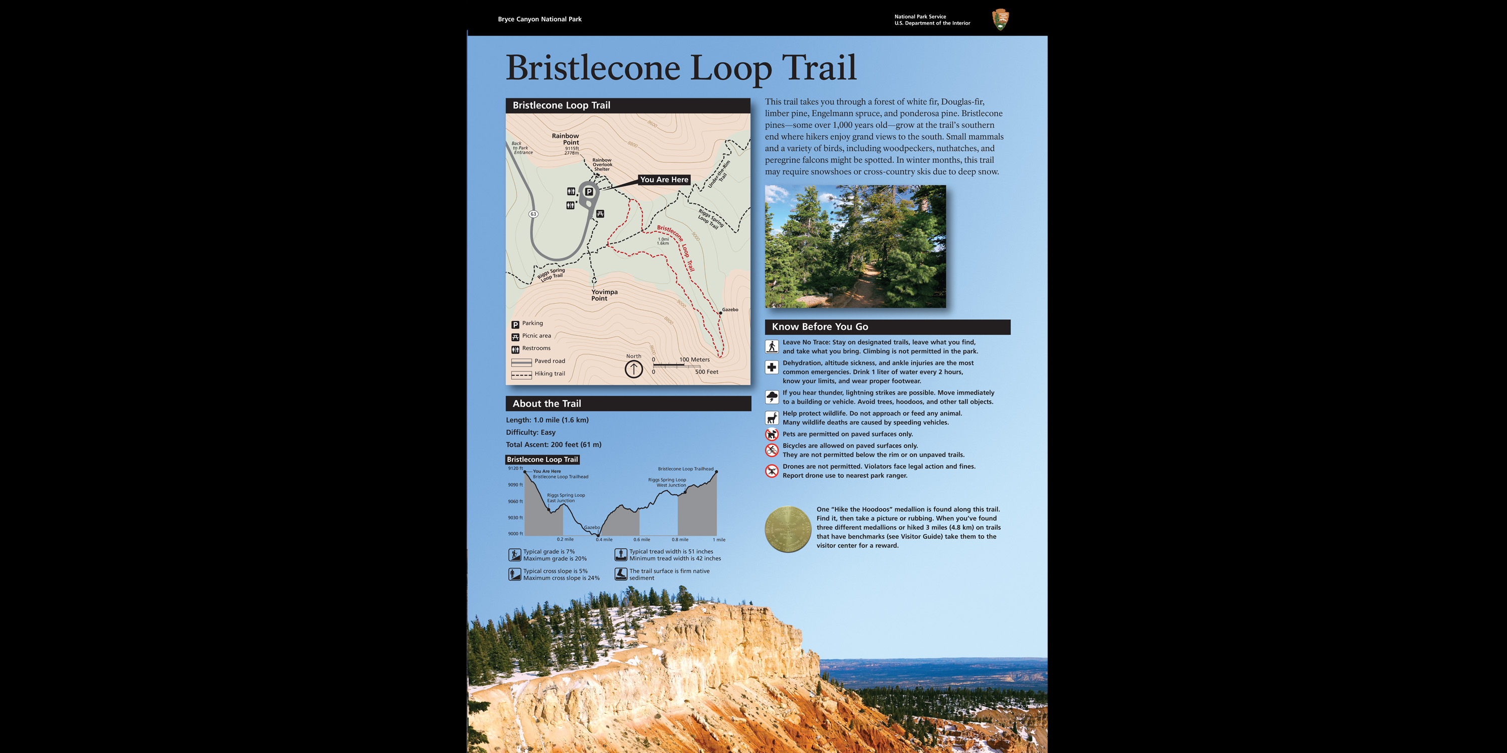 Photo: NPS
- May–Oct
- best months
Is Bristlecone Loop wayside (108) open right now?
Closure in the area
There's a closure order in Bryce Canyon National Park. It doesn't name Bristlecone Loop wayside (108), so check the source for the area it covers.
Trail Closures Due to Recent Weather
Park closure covering Bryce Canyon National Park · NPS · Bryce Canyon National Park
Current Fire Restrictions
Park alert covering Bryce Canyon National Park · NPS · Bryce Canyon National Park
As of · Source: NPS · Bryce Canyon National Park. Agencies don't list every closure — check before you go.
Bristlecone Loop wayside (108) is a trail in Bryce Canyon National Park in Utah, managed by the National Park Service. The nearest town is Georgetown, about 11 miles away. The trail passes through a forest of white fir, Douglas-fir, limber pine and ponderosa pine. At the southern end, bristlecone pines—some over 1,000 years old—stand alongside grand views to the south. Small mammals and birds such as woodpeckers, nuthatches and peregrine falcons may be seen along the way. Winter brings deep snow, and the trail may be impassable in the colder months. Summer is the most comfortable time to visit. Typical averages from a nearby weather station show July highs around 80°F with lows near 52°F, while winter highs stay in the upper 30s. The trail sits close to several other routes, including Bristlecone Loop wayside (107), the Under-The-Rim Trail and the Riggs Spring Loop Trail, all about 0.1 mile away. For an overnight stay, King Creek Campground is roughly 9 miles off.
Local outfitters
- Ruby's Inn Bryce Canyon RV Park & Campground14 mi away
- Bryce Canyon Horseback Tours14 mi away
Not on Roamze yet. Their page has how to reach them.
Best time to go · May–Oct
Best time to visit Bristlecone Loop wayside (108)
Best months: May–October. Best months have typical highs of 55–85 °F, lows of 30 °F or warmer (32 °F where the station doesn't record snow), at most one snowy day and no more than 12 wet days.
Jan
37° / 17°
6 wet
Feb
39° / 18°
7 wet
Mar
46° / 23°
7 wet
Apr
54° / 29°
6 wet
May
63° / 37°
5 wet
Jun
75° / 45°
4 wet
Jul
80° / 52°
8 wet
Aug
77° / 50°
10 wet
Sep
70° / 42°
7 wet
Oct
58° / 32°
5 wet
Nov
46° / 23°
5 wet
Dec
37° / 17°
6 wet
Typical high / low (°F) and days with rain or snow, 1991–2020. Measured at Bryce Canyon Np Hqrs, UT, 12.1 mi away at 7,890 ft. The station sits about 1,200 ft lower than this place, so expect it a little cooler here. This station doesn't record snowfall. Source: NOAA NCEI U.S. Climate Normals 1991–2020.
Keep exploring — more trails worth the drive
HIKE
Bristlecone Loop wayside (107)
Next door
This trail takes you through a forest of white fir, Douglas-fir, limber pine, and ponderosa pine. Bristlecone pines—some over 1,000 years old—grow at the trail's southern end where hikers enjoy grand views to the south. Small mammals and a variety of birds, including woodpecke…
HIKE
Bristlecone Loop Gazebo
Next door
A small octagon shaped log shelter built by the park in the 1980s after the Bristlecone Loop was completed. At this point in the trail you might recognize smaller bristlecone pines nearby. Look for densely bunched needles travelling in a bushy arrangement up the branch.…
 Photo: Greg Willis from Denver, CO, usa, CC BY-SA 2.0 (via Wikimedia Commons)
Agua Canyon Connecting Trail
~4 min drive
1.62-mile out-and-back trail in Utah with 387 ft gain and 1,172 ft loss.
HIKE
Under-The-Rim Trail
Next door
22.06-mile out-and-back trail in Utah with 5,230 ft elevation gain.
HIKE
East Side Road
~6 min drive
7.87-mile out-and-back trail in Utah with 1,206 ft elevation gain.
HIKE
Bristlecone Loop Trailhead at Rainbow Point
Next door
Bristlecone Loop Trail Difficulty: Easy Total Distance: 1.0 miles (1.6 km) Elevation change: 200 feet (61 m) Average time: 1-2 hours This trail may be inaccessible during mid-winter due to snow depths ranging from 2-15 ft (0.7-5 m). The Bristlecone Loop reaches elevations…
HIKE
Whiteman Trail Connections wayside
~11 min drive
Here, the Whiteman Connecting Trail descends to the rugged 22.9-mile (36.9 km) Under-the-Rim backcountry trail, which travels north to Bryce Point and south to Rainbow Point. Day hikers can enjoy an out-and-back hike with views of the Paria Valley and Swamp Canyon.
 Photo: inkknife_2000 (7.5 million views +), CC BY-SA 2.0 (via Wikimedia Commons)
Swamp Canyon Connecting Trail
~14 min drive
1.04-mile out-and-back trail in Utah with 24 ft gain and 566 ft loss.
HIKE
Riggs Spring Loop Trail
Next door
8.27-mile out-and-back trail in Utah with 618 ft elevation gain.
HIKE
Podunk East Road
~7 min drive
6.07-mile out-and-back trail in Utah with 1,202 ft elevation gain.

