Leipers Fork
- 3.3 mi
- distance
- 727 ft
- high point
- Mar–May, Sep–Nov
- best months
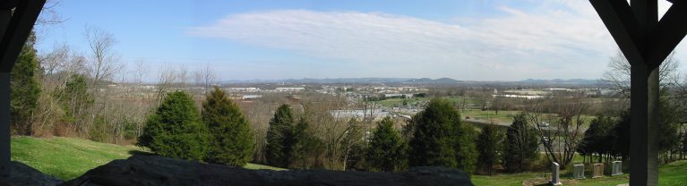
Leipers Fork is a canoeing spot in Tennessee, about 1.5 miles from the town of Boston. It sits close to the NST - Highland Rim Section, a hiking route about half a mile away, which makes it easy to pair a paddle with a walk. Spring and fall are the most comfortable times to visit. Typical averages from a nearby weather station show October highs around 73°F with lows near 49°F, and April highs around 71°F. Midsummer highs typically reach the upper 80s. Several trails lie within a short drive. The NST - Highland Rim Section Grigg Springs Spur Trail is about 4 miles away, and the Ridge Trail and West Slope Trail are each roughly 6.5 miles off.
- NST - Highland Rim SectionHiking0.5 mi
- NST - Highland Rim Section Grigg Springs Spur TrailHiking3.9 mi
- Ridge TrailHiking6.5 mi
- West Slope TrailHiking6.7 mi
- East Slope TrailHiking6.7 mi
- Sun TrailsHiking9.9 mi
- Loblolly LoopHiking9.9 mi
- Redbud TrailHiking9.9 mi
Source: Roamze catalog (indexable pages within 10 miles, PostGIS distance)
- South Harpeth RiverCanoeing · ~22 min drive
- Eastern Flank Canoe RampBoat launch · ~17 min drive
- Rutherford CreekCanoeing · ~23 min drive
- Chickasaw TraceBoat launch · ~25 min drive
- Jones CreekCanoeing · ~40 min drive
- Henry Horton Canoe / Kayak RampBoat launch · ~46 min drive
- Quality CreekCanoeing · ~40 min drive
- Hurricane Creek Boat RampBoat launch · ~50 min drive
- Sugar ForkCanoeing · ~41 min drive
- Peeler Park Boat RampBoat launch · ~53 min drive
Best time to visit Leipers Fork
Best months: March–May and September–November. Best months have typical highs of 55–85 °F, lows of 30 °F or warmer (32 °F where the station doesn't record snow), at most one snowy day and no more than 12 wet days.
Jan
48° / 29°
11 wet
Feb
51° / 31°
11 wet
Mar
61° / 39°
12 wet
Apr
71° / 47°
11 wet
May
79° / 57°
12 wet
Jun
87° / 66°
10 wet
Jul
89° / 69°
10 wet
Aug
89° / 69°
9 wet
Sep
84° / 62°
8 wet
Oct
73° / 49°
9 wet
Nov
61° / 38°
9 wet
Dec
51° / 32°
12 wet
Typical high / low (°F) and days with rain or snow, 1991–2020. Measured at Thompson Stn, TN, 8.8 mi away at 775 ft. This station doesn't record snowfall. Source: NOAA NCEI U.S. Climate Normals 1991–2020.