Morganton Reserve Walking Trail
- 0.3 mi
- round trip
- 48 ft
- climb
- 981 ft
- high point
- Out and back
- route
- Mar–May, Sep–Nov
- best months
Morganton Reserve Walking Trail is a short, flat out-and-back hike in Tennessee, about a mile from Fairway Estates. The trail is easy to fit into a quick stop, with a total round-trip distance of about 0.6 miles and a total elevation gain of about 50 feet. The route stays nearly flat, with the most noticeable grade a slight rise of about 4% at around 0.15 miles from the start. The start and end both sit near 980 feet, with a high point of about 981 feet and a low of about 936 feet along the way. The trip takes roughly half an hour. Fall is the most comfortable time to visit. At a nearby weather station in Knoxville, typical October highs run around 72°F with lows near 49°F, and September and October bring the fewest wet days of the year. The station sits at nearly the same elevation as the trail. Paddlers can head to Pistol Creek, about 3 miles away, or Baker Creek, about 5 miles away. Climbers will find the Fire Tower Area about 8 miles off, and Abram's Creek Campground is about 9.6 miles away.
Local outfitters
- GSM Outfitters21 mi away
- Hurshel's Outfitters25 mi away
Not on Roamze yet. Their page has how to reach them.
- Pistol CreekCanoeing3.1 mi
- Baker CreekCanoeing5 mi
- Ninemile CreekCanoeing7.6 mi
- Crooked CreekCanoeing7.8 mi
- Fire Tower AreaRock climbing8.1 mi
 Look Rock TrailHikingPhoto: Pete Seabolt, CC BY 3.0 (via Wikimedia Commons)8.2 mi
- Little Bottoms TrailHikingPhoto: Pete Seabolt, CC BY 3.0 (via Wikimedia Commons)9.5 mi
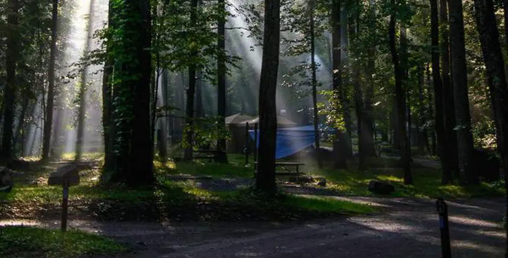 Abram's Creek CampgroundCampingPhoto: Recreation.gov (RIDB) / public domain9.6 mi
Source: Roamze catalog (indexable pages within 10 miles, PostGIS distance)
- Look Rock TrailHiking · ~14 min drivePhoto: Pete Seabolt, CC BY 3.0 (via Wikimedia Commons)
- Little Bottoms TrailHiking · ~16 min drivePhoto: Pete Seabolt, CC BY 3.0 (via Wikimedia Commons)
 Rabbit Creek TrailHiking · ~23 min drivePhoto: Bas van Oorschot, CC BY-SA 3.0 (via Wikimedia Commons)
- Cooper Road TrailHiking · ~18 min drive
 Abrams Falls TrailHiking · ~19 min drivePhoto: Bas van Oorschot, CC BY-SA 3.0 (via Wikimedia Commons)
- Beard Cane TrailHiking · ~18 min drive
- Hannah Mountain TrailHiking · ~19 min drive
- Wet Bottom TrailHiking · ~23 min drivePhoto: Bas van Oorschot, CC BY-SA 3.0 (via Wikimedia Commons)
- Hatcher Mountain TrailHiking · ~19 min drive
- Gregory Ridge TrailHiking · ~26 min drive
Best time to visit Morganton Reserve Walking Trail
Best months: March–May and September–November. Best months have typical highs of 55–85 °F, lows of 30 °F or warmer (32 °F where the station doesn't record snow), at most one snowy day and no more than 12 wet days.
Jan
48° / 30°
12 wet
Feb
53° / 33°
11 wet
Mar
61° / 40°
12 wet
Apr
71° / 48°
11 wet
May
79° / 57°
11 wet
Jun
86° / 65°
12 wet
Jul
88° / 69°
11 wet
Aug
88° / 67°
10 wet
Sep
82° / 61°
8 wet
Oct
72° / 49°
8 wet
Nov
60° / 38°
10 wet
Dec
51° / 33°
12 wet
Typical high / low (°F) and days with rain or snow, 1991–2020. Measured at Knoxville Mcghee Tyson Ap, TN, 6.2 mi away at 962 ft. This station doesn't record snowfall. Source: NOAA NCEI U.S. Climate Normals 1991–2020.
Map and trail data © OpenStreetMap contributors
